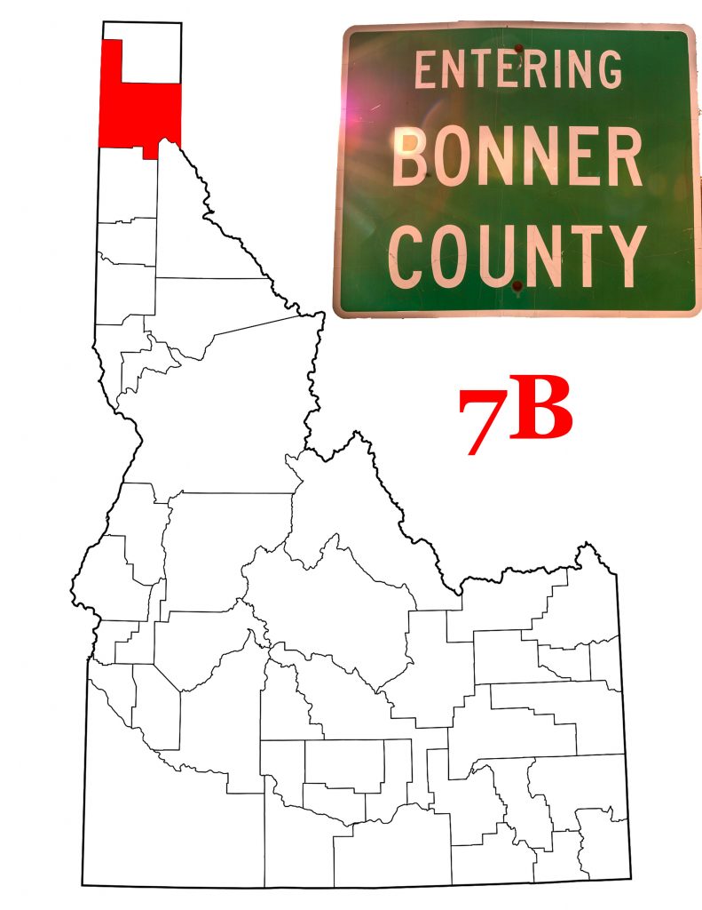
Bonner County Idaho
Introducing Bonner County Idaho
On February 21st, 1907, the Idaho State Legislature took land from Kootenai County to create Bonner County. They named the new county for Edwin Bonner who operated a ferry crossing the Kootenai River. The new county covered the northern end of the Idaho Panhandle. In 1915, it lost the northern end in the formation of Boundary County. Today, the County covers 1,919 square miles, of which 185 square miles are water. Bonner County includes almost all of Idaho’s largest lake, Lake Pend Oreille. It is 19th of Idaho’s 44 counties in area. With an estimated population of 44,727 (2018), it is Idaho’s eighth most populated.
A Brief History of Bonner County
Prior to the creation of Idaho Territory, northern Idaho was in either Spokane County or Shoshone County, Washington. Idaho renamed their portion of Spokane County as Kootenai. No one seemed to notice that there was a small area, south of the 48th parallel but east of Shoshone County. This small bit of land remained outside of any county jurisdiction until the creation of Bonner County.
Lewis and Clark did not travel through today’s Bonner County, but David Thompson did. Thompson, working with Britain’s North West Company, came through the area in 1809 and directed Finan MacDonald to build a trading post near today’s Hope, Idaho. He named the post Kullyspell House. It stood for two years,but the company abandoned it in 1811. More on this below.
Seneaquoteen, Post Offices and Lumber
With the creation of Kootenai County, a former trading post named Seneacquoteen became county seat. The name apparently comes from the Kalispel Salish and means “crossing.” The native people used the location near today’s Laclede as a place to cross the Pend Oreille River. Post Office records show a Seneacquoteen Post Office operating between 1891 and 1902 when the name changed to Valley. Other early Post Offices include Albeni (1891-1893), Clark Fork (1886-Present), Coolin (1893-Present), Halfway/Elmira (1891-1894), Granite (1883-1954), Hope (1887-Present), and many more, especially in the early 20th Century.
As with most of the intermountain West, gold and silver brought the first settlers. But as one site says about Priest River, timber built Bonner County. Lumber mills operated in Clark Fork, Dover, Kootenai, Laclede, and Sandpoint. Writing for Sandpoint Magazine, Billie Jean Plaster relates that “The Kaniksu was one of the greatest areas of unbroken timber on the continent. It covered more than 2,600 square miles.”
Camping Along the Lake
David Thompson built Kullyspell House because he had met with a group of “54 Flat Heads, 23 Pointed Hearts & 4 Kootanees—in all about 80 men.” (Thompson’s journals as reported in Sandpointonline.com) Thompson spoke French with his voyageurs, and in his journals translated their names for the native people. He thus wrote of the Ear Pendant people (Pend Oreille) and the Pointed Heart people (Coeur d’Alene). He figured that every adult male had a family of 6 or 7. so with 80 men, he estimated the total camping on the shores of Lake Pend Oreille at 500. Surely that many people needed a trading post.
The “Flat Heads”, “Pointed Hearts,” and “Ear Pendant” people were all inter-related Salish people. The Kootenai are not Salish, but often traded with the larger tribes. Today, these people have four reservations, none of which are in Bonner County.
Sandpoint, the County Seat
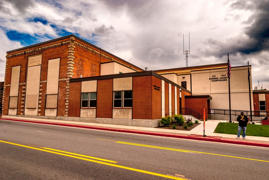
Not much seems to have happened in the Sandpoint area after David Thompson came through. Robert Weeks opened a general store in Pend Oreille in 1880, and the Northern Pacific Railroad started surveying the area that same year. The railroad laid its track west from Montana beginning in 1882. This brought both workers, including many Chinese, and settlers. The Great Northern Railway arrived in 1892. Agents for the Great Northern were Mr. & Mrs. L.D. Farmin. The Farmins obtained a homestead on Sand Creek. In 1898, they platted the town of Sandpoint.
On February 7, 1901, the Kootenai County Commissioners incorporated the village of Sandpoint. Not quite six years later, Sandpoint voters asked that Kootenai County recognize their village as a city. In February 1907, Sandpoint became the Seat of the newly created Bonner County. With a 2018 estimated population of 8,931, Sandpoint is the 25th largest city in Idaho.
Over the past 113 years, the city has grown and diversified. In its early days, the city depended on timber. Today it is home to a snall aircraft manufacturer, Quest Aircraft Company. It is also home to the Litehouse Company which makes and distributes salad dressings and other food stuffs all around the Northwest.
Lost in the ‘50s
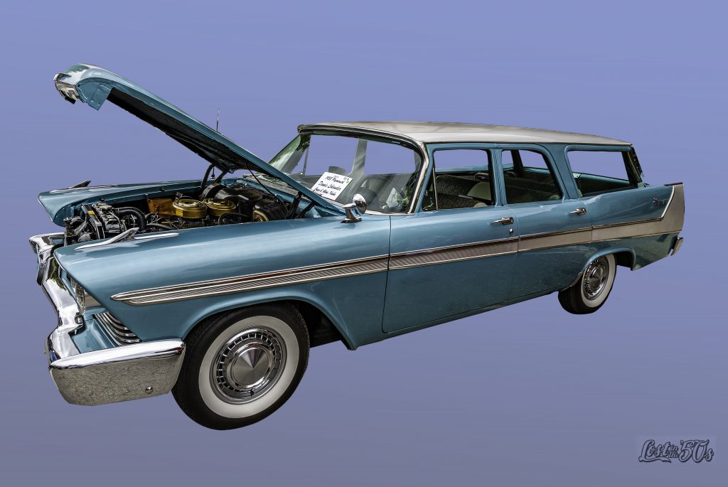
For thirty-five years, May brought classic cars to Sandpoint. Lost in the ‘50s meant beautiful old cars filled most of downtown Sandpoint. 2020 proved to be difficult because of the Covid-19 situation. Event organizer Carolyn Gleason let it be known that the event had reached its end. There would be no 2021 Lost in the ‘50s. I was not able to get to Sandpoint to see if any show happened in 2020. Gleason says as far as the future is concerned, nothing is set in stone, but events are conspiring against another show. I guess we’ll have to wait and see. Videographer 7B Stoke added a youtube video of the 2019 show. The film is almost 45 minutes long, but attempts to show every car entered in the show. That is today’s video of the day. Also I photographed this beautiful 1958 Plymouth Station Wagon at the 2014 show.
Other Bonner County Communities
In addition to Sandpoint, there are eight other incorporated cities in Bonner County, Idaho. Of those eight, three are best considered suburbs of Sandpoint. Dover, with a 2019 estimated population of 874, is just west of the County Seat. Kootenai (978) and Ponderay (1,157) are on Sandpoint’s eastern border. As someone who does not live in the area, I find it hard to tell where one town ends and the next begins.
East of Sandpoint
Clark Fork is the first town you find driving west on Idaho Highway 200. Roughly seven miles west of the Montana State Line, Clark Fork got its start with the Northern Pacific Railroad in the 1880s. The town incorporated in 1911. It’s 2019 estimated population is 579.
Nine miles northwest of Clark Fork, you come to the resort community of East Hope (225 in 2019). East Hope is home to two large vacation condominium complexes on the shore of Lake Pend Oreille. It is also right next door to the city of Hope (102 in 2019). Hope takes its name from a Doctor Hope, a veterinarian for the railroad. I’m sure there’s a story as to why two separate tiny cities should be right next to each other. Unfortunately, I don’t know what it is.
What I do know is that a few miles east of East Hope, you can turn off Highway 200 and stay at the Beyond Hope Resort. An RV park with spaces for camping, a marina and a restaurant, Beyond Hope Resort has received mixed reviews on travel sites. I figure anyone can have a bad day, but I haven’t checked the place out myself. I just love that driving eastward, you come to Hope, then East Hope, and finally Beyond Hope.
Western Bonner County Idaho
In the beginning, there was a Newport, Idaho. The city is right on the Washington State Line, and again, if you don’t live there, it’s hard to know which state you’re in. Folk on the Washington side had their Post Office named Newport. The resulting confusion led to the Idaho community becoming Oldtown in 1947. I know that I am never sure if I’m in Oldtown or Newport. The 2019 estimated population for Oldtown was 201.
Less than seven miles east of Oldtown, the city of Priest River lies at the confluence of the Priest and Pend Oreille Rivers. With a 2019 estimated population of 1,893, Priest River is the second largest community in Bonner County. The City’s website calls the town a “town that logs built.” It goes on to talk about the Italians who came to the area starting in 1892. So many came over the next thirty years, that people called the town “Little Italy.” On the last Saturday of July, town folk celebrate Priest River Timber Days.
Bonner County Idaho’s Topography
Lakes
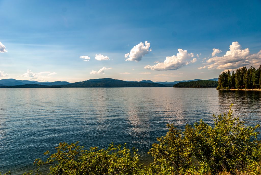
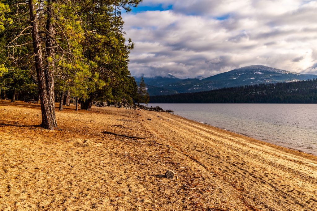
Bonner County is home to Idaho’s largest lake, Lake Pend Oreille. The lake stretches forty-three miles long with a shoreline of 111 miles of shoreline. It is the fourth deepest lake in the United States, 1,158 feet deep at its deepest.
Thirty miles north of Priest River, Priest Lake is Bonner County’s second largest body of water. Priest Lake, so named because of a Jesuit priest who drowned in the lake, today is a resort area. Many marinas line the 19 mile length of the lake. New condominium units are currently under construction. There are so many homesites along the western side of the lake, it’s hard to find a good vantage point. Two weeks ago, I wrote about a day trip that Kevin and I took to Priest Lake, and I’ll refer you to that post.
Mountains and Rivers
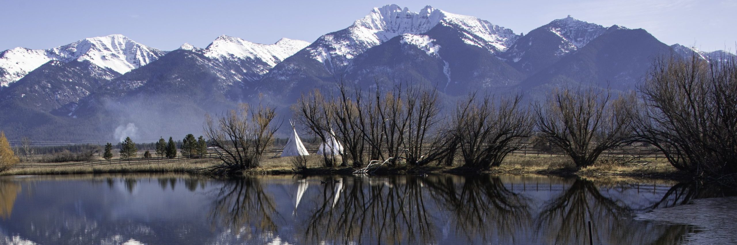
The reason for the depth of the lakes is, of course, the mountains that fill Bonner County. The Selkirk Mountains cross western Bonner County, as well as Pend Oreille County, Washington and southern British Columbia, Canada. The Cabinet Mountains fill eastern Bonner County and western Sanders and Lincoln Counties in Montana. Finally, the Bitterroot Range is the mountain range dividing Idaho and Montana for most of their shared border.
The Clark Fork River enters Idaho from Montana at Cabinet Gorge. It is the principal tributary of Lake Pend Oreille. Flowing out of the Lake on the western side, the Pend Oreille River continues on to Washington where it turns north towards its confluence with the Columbia in British Columbia. Connecting Priest Lake with the Pend Oreille is Priest River. 68 miles long, Priest River originates in Upper Priest Lake, flows through Lower Priest Lake, then continues on to its confluence with the Pend Oreille.
Recreation
With all this water and mountainside, Bonner County Idaho is a sportsman’s paradise. Fishing, boating, floating are all popular activities. In the winter, people ice skate on Lake Pend Oreille alongside one of Sandpoint’s beaches. Schweizer Basin, just northwest of Sandpoint, is Idaho’s largest ski resort and attracts skiers from all over the Northwest.
| <Previous Idaho County: Boise County | All Idaho Counties | Next Idaho County: Boundary County> |
![]()