Boundary County Idaho
Introducing Boundary County Idaho
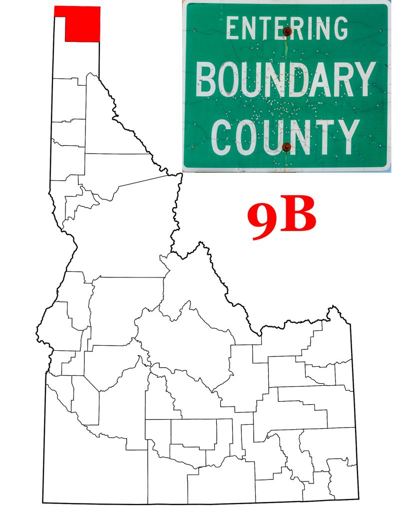
Boundary County got its name because it borders Washington’s Pend Oreille County to the west, Montana’s Lincoln County to the east, and the Canadian province of British Columbia to the north. On January 23rd, 1915, the Idaho Legislature took the northern part of Bonner County to create the new Boundary County Idaho. The County has retained its original size, 1,278 square miles, of which 9.3 are water. The 1920 U.S. Census, Boundary County’s first, found 4,474 people living in the County. The 2018 estimate suggests 11,948 live there now.
A Brief History of Boundary County
Edward L. Bonner built a trading post on the Kootenai River in 1864. He also built a trading post at that location. Ten years later, he sold his operations to Richard Fry. Fry and his family lived in the area for another ten years as the only white folk in the Kootenai Valley. Settlers began arriving in the 1890s, and in 1893, Bonners Ferry was born. Vast stands of timber brought logging operations into the area, and the population began to grow.
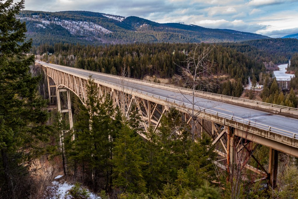
The Great Northern Railway came through in the 1880s. By the late 1890s, rumors surfaced that a new railroad was in the works. Indeed it was, and construction of the Kootenai Valley Railroad began in 1898. The new railroad was a subsidiary of the Great Northern, and James J. Hill was behind it. It connected the Great Northern with Kootenay Lake in British Columbia. Hill ran steamships across the lake, but in 1913 he sold off his Canadian holdings. Passenger service between Bonners Ferry and Porthill at the border continued for another year. Freight service until the 1970s. A fascinating article on the Boundary County Museum’s website indicates that travelers could expect the trip to take four hours. They cite “frequent stops and regular derailments.” I should hope so. We’re talking a distance of 27 miles.
The Boundary County Museum Writes
Another captivating article, written by Howard Kent, looks at Boundary County in 1916. One year after the County’s creation, brought Prohibition to all of Idaho. Kent writes that 1916 was a flood year. The road connecting Bonners Ferry with Eastport on the Canadian border was closed for three months. Kent doesn’t just write about 1916. He goes both back in time, and forward. He connects the activities and buildings of a former age with what you’d see and do in Boundary County today. I recommend his short article.
In fact, I recommend visiting the Boundary County Museum’s website. They’ve done a good job of writing up and sharing the County’s history. And if you’re in Bonners Ferry, by all means pay them a visit. They are located at 7229 Main Street, Bonners Ferry, ID 83805 and their website is https://boundarycountymuseum.org
The Kootenai Tribe of Idaho
The Kutenai (Ktunaxa,Kútonâqa, Kootenai) gave their name to the river that flows through Boundary County. A smaller group than most of their neighbors, the Kutanai today are broken into six separate bands. Four are in Canada, one in Montana and one in Boundary County, Idaho. They speak a language unrelated to any other languages in the Pacific Northwest.
The Kutenai believe they were on earth to “keep the Creator-Spirit’s Covenant—to guard and keep the land forever.” The website of the Kootenai Tribe of Idaho states that “no Kootenai ever signed the treaty.” It’s hard to say which “treaty” they are talking about. When Isaac Stevens called the Council Grove meeting in 1855, representatives of the Kootenai were present. Chief Michelle was the lead representative for them. He did put his X on the Hellgate Treaty, but did he understand what he was doing?
More recently…
Whether white America believed that all the Kootenai were safely on a reservation or if they just chose to ignore the Idaho Kootenai, I can’t say. The fact remains that the Idaho Kootenai lived without official U.S. acknowledgment until 1974. That year, they declared war on the U.S. There were sixty-seven Idaho Kootenai at that time. The U.S. responded by granting the tribe twelve and a half acres I guess the Indians won the war.
Since then,the tribe has done well. In 1986, they opened the Kootenai River Inn on the south bank of the River in Bonners Ferry. The Inn has an indoor pool, a fitness center, banquet and meeting rooms. It also is home to the tribal casino, and both a restaurant and a deli. The tribe also owns a campground and RV park, the Twin Rivers Canyon Resort. As part of their promise to guard the land, they have a fish hatchery at the resort. The Kootenai are restoring sturgeon to the rivers of north Idaho.
Bonners Ferry, The Seat of Boundary County Idaho
I have already mentioned how Edward L. Bonner set up a trading post and ran a ferry across the Kootenai River. Also how he sold the business to Richard Fry. When enough settlers arrived to warrant a post office, that facility carried the name “Fry.” When the town incorporated in 1893, however, it kept Bonner’s name, just without the apostrophe.
On a personal note, I will say that every English teacher I ever had would insist on there being an apostrophe before the s in the town’s name. I have trouble typing the name without one. So, as you’re reading this post, you may come across the occsional Bonner’s Ferry. Just bear with me. I wouldn’t want Mr. Gehman to be angry with me.
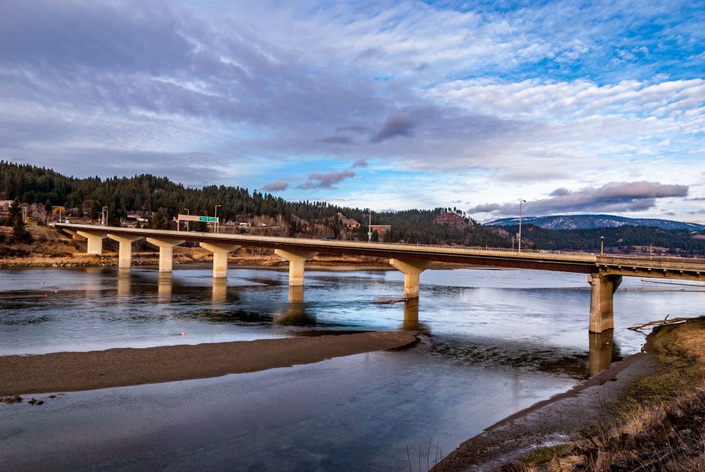
Bonners Ferry got its start with the miners heading north to gold fields in Canada. Then came the timber workers. Starting in 1883, the steamer Midge carried passengers and freight between the city and its neighbors to the north. Looking at the Kootenai River today, it’s hard to imagine a large boat being able to navigate the river. Although at high water… Of course Midge’s day was long before Libby Dam “tamed” the river’s flow.
Food and Lodging in Bonners Ferry
Yelp.com lists eleven places to stay in Bonners Ferry. The Northside School B&B sounds particularly inviting. A different caravansary has only one review, and its a pip. Stephen King couldn’t have done better. It’s also short, so I’ll quote it in its entirety. I just won’t mention the establishment’s name.
my grandfather was a resident at this horror house. his two cats were shot in front of him by a psychopath named larry. please do not stay here. many other places. a true nightmare.
Now doesn’t that make you want to check the place out?
As far as restaurants go, Yelp lists twenty-four. Subway and Simple Simon’s are the only chains. Most serve “American” cuisine, but one in particular caught my eye. I think, next time I’m in Bonners Ferry, I need to have lunch at the Bonners Ferry Pupuseria. OK. I had to look it up. What else. A pupuseria is a place that serves pupusas. Duh! I’ve never tried Salvadoran food. I didn’t even know that was a thing. I learn so much writing these posts. And next time I’m in Bonners Ferry… Full disclosure: the place got a 1-star review. But the writer didn’t mention any Salvadoran food, just macaroni salad and a PBJ sandwich. Why go to an ethnic restaurant and order PBJ? Some people.
One other place to check out is the Pearl Theater. Located in an old church, the Pearl offers live music, theatre, dramatic readings. You can rent the venue for your event, and while everything is on hold right now, a glance at their past events makes me wish the Pearl were closer.
Other Communities (for lack of a better term)
Moyie Springs is the only other “city” in Boundary County. Moyie Springs is the first town you reach driving west from Montana on U.S. Highway 2. Less than ten miles northeast of Bonners Ferry, Moyie Springs is probably most famous for its location near the Moyie River Canyon. The town got its post office in 1927. Incorporation came some twenty years later. The 1950 Census counted 109 residents. The 2019 estimate suggests 761 folk live there now.
South of Bonners Ferry
South of Bonners Ferry, my map shows three black dots with names. Of those, only Naples rates a mention on Wikipedia. Named for the Italian city, thanks to a large number of Italian railroad workers in the 1880s, Naples today is most noted for being the closest community to the Ruby Ridge standoff in 1992. At least one commentator suggests that Ruby Ridge was the birth of the militia movement in the U.S.
The other two black dots on my map are labeled Moravia and McArthur. Moravia shows up a lot in a google search, but none of the sites I looked at give any real information about the place. The one exception is a genealogical site that lists more Boundary County communities than my map can account for. It states “All that remains of the town are the cemetery, the school house (now a residence), and a motel (also now a residence.)” It adds that the community had a post office from 1903 to 1917 and again from 1918 to 1943.
McArthur does not show up on the genealogy list, even though, like Moravia, it has an historic cemetery. It is best known as the location of the McArthur Lake Wildlife Management Area.
North of Bonners Ferry
My DeLorme Idaho Atlas shows four black dots north of Bonners Ferry. Two are on Idaho Highway 1. These are Copeland and Porthill. The genealogy site says “Still a thriving community, Copeland had a post office from 1900 to 1972.” The most detailed information comes from Diggings, a website devoted to mines and mining. It tells us that Copeland has 53 total mines and 2030 total claims, of which 1,975 are closed. On the site are buttons to link you to further information about all those mines and claims, should you be interested. The site also informs us that Copeland is on the Pacific Northwest National Scenic Trail.
Porthill
Another eleven miles northwest of Copeland, and the end of Idaho Highway 1, is Porthill. The genealogy site is downright offusive about Porthill, zip code 83853. Here is more than you ever wanted to know about Porthill, Idaho.
It was in December 1893 that “Ockonook” became the official name of the new post office with ex-customs official; J. I. Barnes was its postmaster. A more correct spelling of Ockonook is Ahquonook, which means rocky and grassy hillside. Editor Taylor was appalled that they had decided on such a “heathen savage” name. On January 1, 1897, the site was renamed Port Hill, after customs inspector C. P. “Chippy” Hill. He had acquired most of the town site through a mineral claim. In 1916 Port Hill was the second largest community with a monthly newspaper published by S. T. Jordan. David McLaughlin was the official weather recorder.
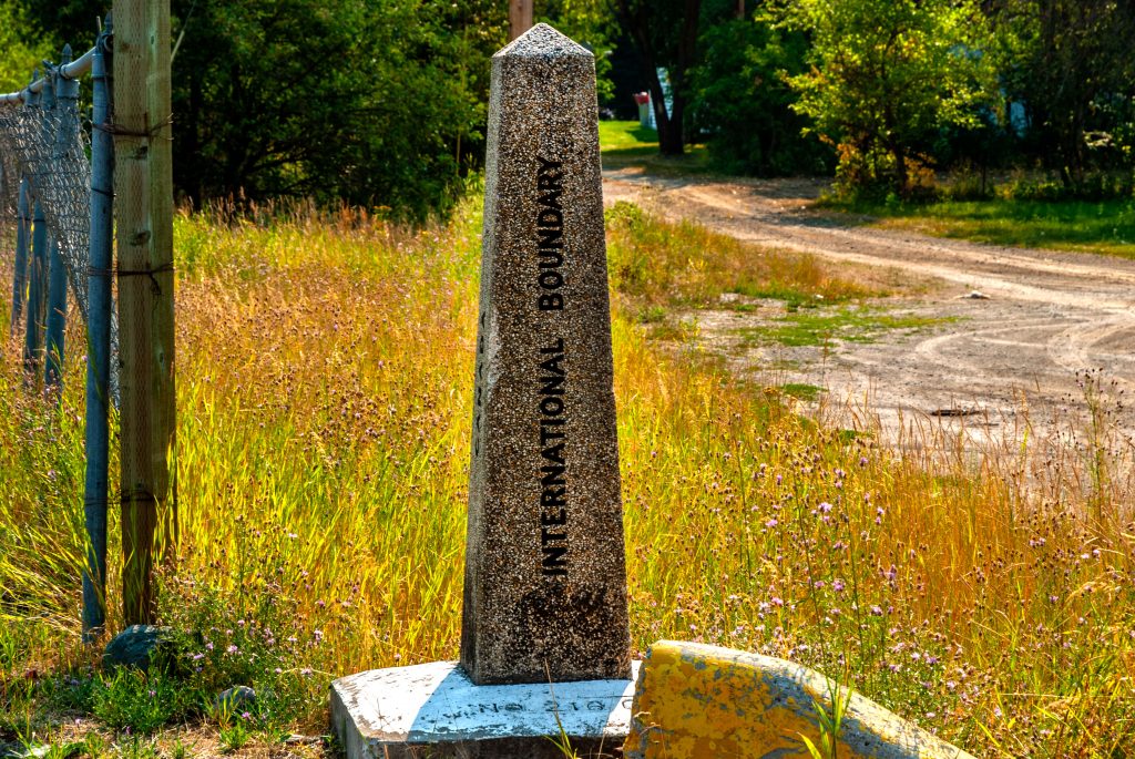
Porthill is also home to a border crossing. Idaho Highway 1 becomes British Columbia Highway 21 and leads on to Creston, BC. The border is closed at night, so get there before 11:00 p.m. or you’ll have to wait till the next morning. The old US Customs house is on the National Register of Historic Places.
Staying on U.S. 95
Just before you get to Copeland, US Highway 95 turns northeast to pass by Addie and end at Eastport. Beyond Eastport, you’ll be on British Columbia Highway 95 headed for Cranbrook. We won’t go there this trip.
Addie shows on the map, but all that remains is the old school. It had a post office from 1908 to 1954. It also has a store. In fact, that’s pretty much all that’s there now. And it’s not even Addie these days. Sometime in the 1950s,Paul Springs bought the store and didn’t tell his wife. When she found out, she cried “Good Grief!” And that’s what everyone says these days. The town, and I use the term loosely,even made it to the TV show Hee Haw. They saluted the community announcing that it was home to “three people, two dogs, and one old grouch.” New owners bought the place in 2019 and you’ll have to reach them through Facebook. They don’t have a landline.
And that brings us to Eastport. Unlike Porthill, Eastport is a 24 hour crossing. That is, when we’re allowed to cross the border. I’ve been through Eastport several times. Can’t say I remember anything there except the border. But then again, I don’t remember Good Grief. I need to pay more attention the next time I head to Cranbrook.
Boundary County’s Topography Leads to Recreation
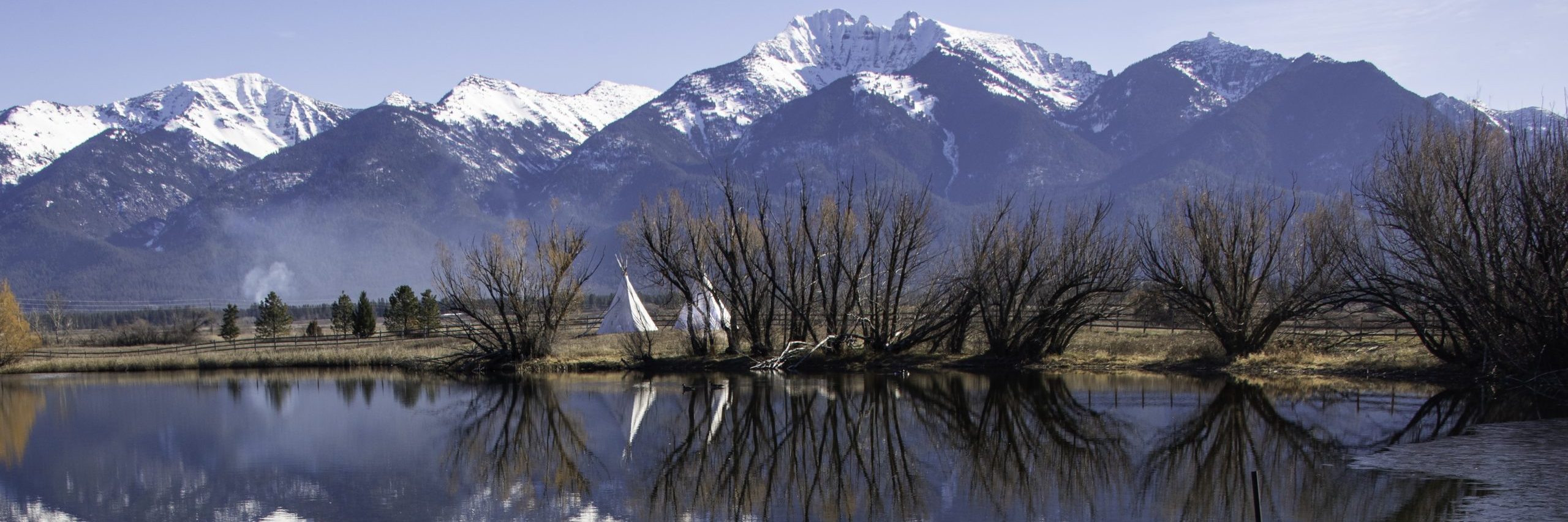
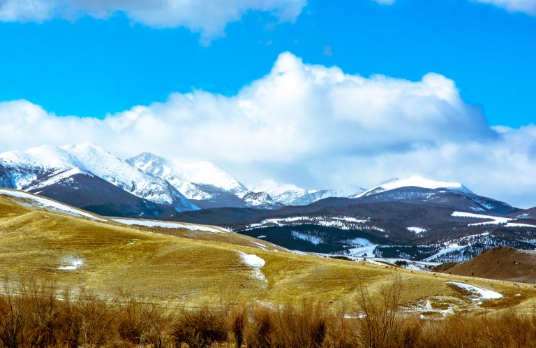
Two valleys define Boundary County Idaho. The Kootenai River and the Moyie River both cut through mountain ranges. Both rivers originate in British Columbia. The Moyie flows into the Kootenai just east of Bonners Ferry, and at that city, the Kootenai turns north again to re-enter Canada at Porthill. The Selkirk Mountains cover western Boundary County, and the Cabinets take precedence in the eastern part of the County. McArthur Lake is the only lake of any size in the County.
The Boundary County Chamber of Commerce has a great page on their website dedicated to recreational opportunities. They even have a map you can download and print. They list eleven different attractions, as well as four waterfalls,and four scenic drives. I’ll be taking the list with me on my next trip.
My Next Trip to Boundary County Idaho
I have been to and through Boundary County Idaho many times. Usually it was passing through on my way to Cranbrook, British Columbia or taking a scenic drive to Sandpoint. That said, writing this post, as always, showed me how much I’ve missed. Good Grief! Just to mention one. I’ve never driven Idaho Highway 1 past Copeland to Porthill. I’ve never taken any of the four scenic drives the Chamber of Commerce recommends. And I’ve never had Salvadorean cuisine. Believe me, I won’t be ordering macaroni salad when I eat my pupusas.
Again, I hope you’ve enjoyed this time spent in Boundary County Idaho. Last week we looked at the southern neighbor, Bonner County. Next week we’ll travel quite a distance to visit Butte County. For now, we’re skipping 8B, Bonneville County, because I need to go back to Idaho Falls and get some photos to share. So what’s left to say but
TTFN
PS:
Just for Fun
I’ve created a word search puzzle with 24 names from Boundary County. Most, but not all, appear in the text of this post. If you’d like to play along, go to my Boundary County Puzzle page. It will probably be best if you print it out before you take a pen to your screen.
![]()

Great post.
Thank you.
Thank you.