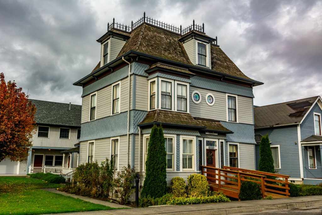
Snohomish County Washington
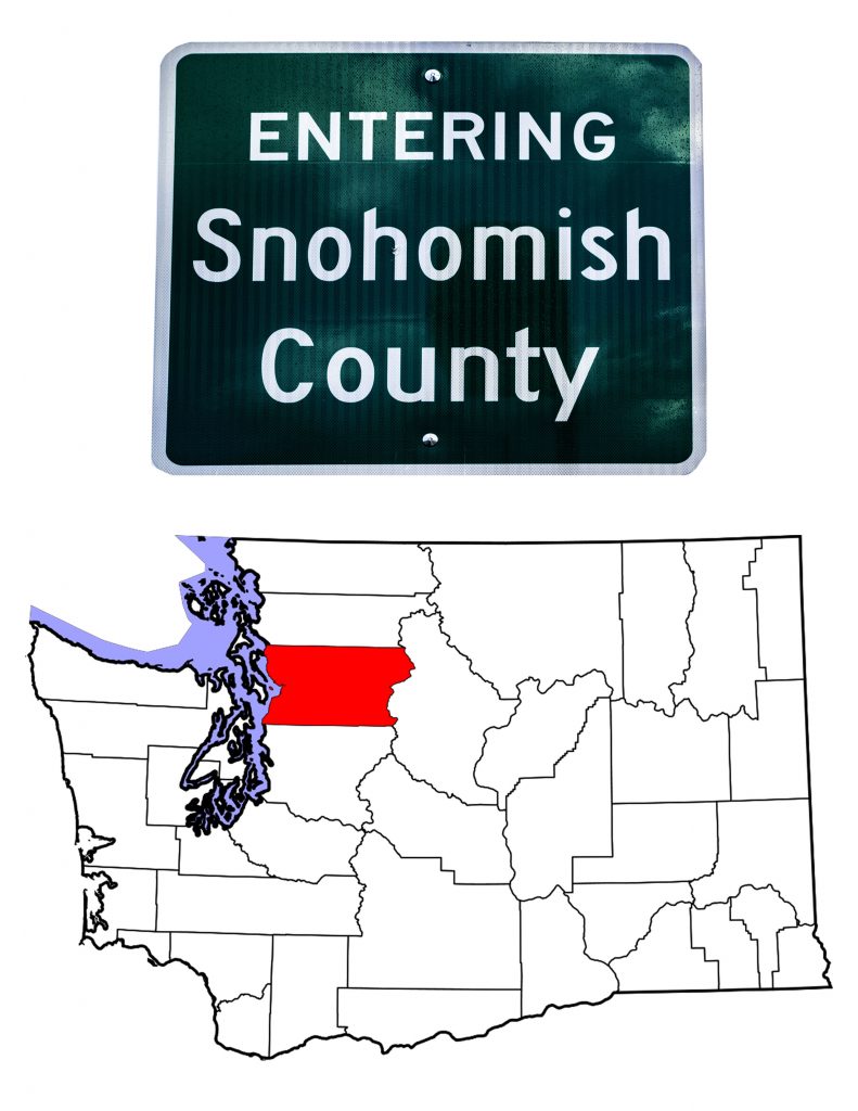
Introducing Snohomish County Washington
On January 14th, 1861, the Washington Territorial Legislature took a portion of mainland Island County to create Snohomish County. The first U.S. Census that looked just at Snohomish County (1870) counted 599 residents. Today, with a 2019 estimated population of 822,083, it is the third largest Washington county by population. In area, the County covers 2,196 square miles, of which 109, or 5%, are water.Looking just at land area, the County is Washington’s 13th in size. It stretches from Puget Sound to the crest of the Cascade Mountains. Almost all the County’s population lives less than ten miles from Puget Sound. The central and eastern portions of the County are largely uninhabited. Three wilderness areas, Glacier Peak, Henry M. Jackson, and Boulder River together cover 1,131 square miles. (Portions of Glacier Peak Wilderness are in Chelan and Skagit Counties.)
A Brief History of Snohomish County
When Captain George Vancouver landed near today’s Everett in 1792, he became the first Euopean known to visit the area. Of course, native people had been living there for thousands of years. U.S. Navy Lieutenant Charles Wilkes came through in 1841 and mapped the area.
With the creation of Island County in 1853, all of what is now Snohomish County was part of Island. Anyone wanting local government services had to travel to Coupeville. When natives attacked a white settler near today’s Snohomish, the local settlers sought their own government. Accordingly, the Territorial Legislature created Snohomish County on January 14th, 1861. I find it ironic that a county created as the result of a native attack should bear the name of those native people. The act creating the County, named Mukilteo as temporary county seat.
Seven months later, on July 8th, 1861, Snohomish County voters chose Snohomish City to replace Mukilteo as County Seat. And there the seat remained for the next thirty-six years. In 1894, Snohomish County voters chose Everett as Seat. Two years of fighting and legal battles followed until in December 1896, Everett officially became the Seat—a position it still holds today.
As noted above, the 1870 census counted 599 residents in Snohomish County. That number increased dramatically over the next four decades. The 1910 Census counted 59,209 residents. Growth was slow, but constant until 1960, and has continued to grow rapidly since then. Today, Snohomish County, as noted above, is third of Washington’s thirty-nine counties as far as population is concerned.
The Snohomish and other Native People
The Treaty of Point Elliot, signed on January 22nd, 1855 at Mukilteo, created the Tulalip Reservation along Possession Sound. The U.S. Government did not ratify the Treaty for another four years, creating confusion and distrust among the native people affected.
The Tulalip Reservation is part of the traditional homeland for the Snohomish people.
The Snohomish, a coastal Salish people, were friendly toward white settlers, for the most part. Today, the Tulalip Tribes are one of the largest employers in Snohomish County, coming in 3rd county-wide. The tribe counts over 4,900 members of which 2,700 live on the Reservation.
The Point Elliot Treaty set aside the reservation not just for the Snohomish, but also for the Skykomish, the Snoqualmie, and the Stillaguamish. The latter, who call themselves Stuləgwábš,the people of the river, have their own tribal headquarters in Arlington. Their casino, Angel of the Winds Casino Resort, is also in Arlington.
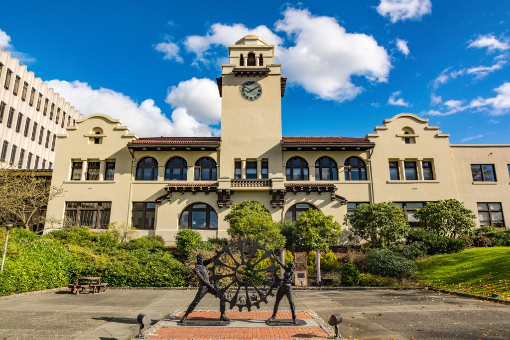
Everett, The County Seat and Largest City
Everett, Washington
It took a while for Everett to become County Seat. The “temporary” seat designated by the Territorial Legislature was Mukilteo. At the time, Mukilteo was the largest community in the new County. It didn’t take long, though, for the voters to move their government to the interior community of Snohomish. As noted above, the voters chose to move the Seat to Everett in 1894, but it was another two years before that actually happened.
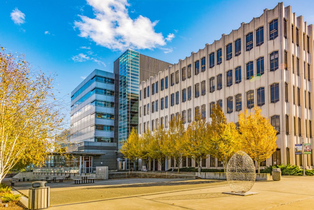
In 1897, the County hired architect August Franklin Heide to design a structure worthy of the growing community. Heide’s design was a romanesque building. It resembled other Washington courthouses built at the same time. Unfortunately, it burned on August 2nd, 1909. The County brought Heide back to build a new courthouse using what could be salvaged from the fire. Instead of rebuilding a similar structure, Heide designed a completely new looking building in the Spanish Mission style. Remarkably he was able to do this on the bones of the former building.
Over time, the County outgrew the courthouse. Today, there is a complex of buildings on top the hill, including the modern looking behemoth shown above. Fortunately, the lovely 1911 courthouse is still in use as part of the complex.
Everett–the City Named for a Teen-ager
As with most American communities, a few intrepid pioneers established homesteads near Possession Sound and Port Gardner Bay. In July 1890, a pair of entrepreneurs traveled north from Tacoma looking for a site to build “the Pittsburg of the West.” Henry Hewitt, Jr. and Charles L. Colby envisioned an industrial city with an ocean port. They were certainly aware that the Empire Builder, James J. Hill, was pushing his Great Northern Railway toward the coast. Perhaps their industrial city could be its western terminus.
At the same time, Wyatt and Bethel Rucker, two brothers from Ohio, also came north from Tacoma. They, too, saw a new city on the peninsula, though nothing as grand as Hewitt and Colby’s dream. The Ruckers bought land and filed a plat for a 50 acre townsite. That was August 1890.
By November, the four entrepreneurs had joined forces, and with financing from John D. Rockefeller, among others, the city of Everett was born. Everett Colby was Charles Colby’s fifteen-year old son. Like a teen-aged boy, the city grew quickly. After incorporation in 1893, Everett sought the county seat. An election in 1894 showed that Snohomish County voters wanted to move the seat, but the vote was contested. The Washington Supreme Court ruled against Everett, but a recount showed that Everett had, indeed, won. With that known, the Supreme Court reversed its position, and finally, in 1897, Everett became County Seat.
The 1900 U.S. Census counted 7,838 residents in Everett. That was ten years after the four entrepreneurs dreamed of the city. Ten years later, the count was up to 24,814. In 1940, the Census showed a 1% drop in population from 1930, down to 30,224. But the city has grown in every count since then. The town named for the teen-aged boy has grown into Washington’s seventh most populous city.
Other Snohomish County Communities
Snohomish County is home to sixteen cities, two towns, and a large number of unincorporated places. Of the sixteen towns, half are part of the greater Seattle metropolitan area. The others, and both towns, are further out in the country.
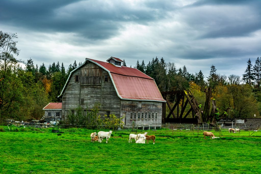
Most Snohomish County communities have a similar history. They were lands used by the native people until the Treaty of Point Elliot forced the natives onto the Tulalip Reservation. At that point, the timber industry moved in. As the lands were logged, timber often gave way to agriculture. And in most cases, agriculture gave way to suburban life as Seattle grew ever larger and more important.
This is certainly the case for the second largest city in Snohomish County. Marysville started out as a Trading Post. Located on the eastern edge of the Tulalip Reservation, it was the logical spot for such a venture. The land around the town was covered with timber. Well, until the loggers cleared it. It then became a major strawberry-growing area. In fact, since 1932, Marysville has hosted the annual Marysville Strawberry Festival. Located just north of Everett, Marysville has joined the suburbs. Its estimated population in 2019 was 70,298.
East of Stanwood, Washington
Similar stories could be told of Edmonds (2019 population 42,605), Lynnwood (39.141),and Lake Stevens (33,911). All three are located in the metropolitan area between Everett and Seattle.
Other cities in the metropolitan area are Brier (6,970), Mill Creek (20,897), Mountlake Terrace (21,338), Mukilteo (21,441), and Woodway (1,391). Note that Mill Creek never had a mill, and Mountlake Terrace got its start as a planned housing development for World War II veterans.
Stanwood, Washington
Snohomish County Topography
Rivers
The North Folk Stillaguamish River flows out of Skagit County, to flow westward across northern Snohomish County. The River’s South Fork rises in central Snohomish County. The two forks meet near the city of Arlington. From there they flow on to Port Susan, that portion of Puget Sound separating Snohomish and Island Counties.
The Skykomish River flows across southern Snohomish County, meeting the Snoqualmie River to make the Snohomish River which then flows northwesterly toward Everett.
The Sauk and Suiattle Rivers flow north out of central Snohomish County to meet and merge with the Skagit River near Rockport in Skagit County. All four of these rivers have major tributaries that drain eastern and central Snohomish County.
Mountains
The Cascade Mountain Chain runs north/south through eastern Snohomish County. Glacier Peak at 10,541 feet is the highest point in the County. You can see Glacier Peak from certain places in Everett. More prominent, though not nearly as high, is Three Fingers, also in the Snohomish County Cascades.
The Coastal Plain and Lakes
Western Snohomish County, with most of the population and most of the agricultural land lies on the coastal plain next to Puget Sound. Lake Stevens and Lake Goodwin are on the Plain as well. Larger lakes, further inland, and small mountain lakes are found throughout the central and eastern portions of the County. The Seattle North Country website states that there are “approximately 460 lakes in Snohomish County, most of which are very small or located in the Cascade Mountains and foothills. Approximately 60 lakes are located in the populated lowland portions of the County.”
Business and Industry
Traditionally, timber and farming were the primary economic engines in the County. As with so much of the West, logging lost its sway. In the 1960s, Boeing built a new assembly plant near Everett which led to significant growth. Today, Boeing is the largest employer in the County. It employs seven times the workers as the concern in second place: Providence Regional Medical Center. As I wrote previously, the Tulalip Tribe is third in the number of people employed. If we ignore the predominant position of Boeing, the rest of the County’s economy seems to be well balanced.
Everett, Washington
My travels through Snohomish County
I have driven through Snohomish County, Washington many times. The two main roads I’ve used are Interstate 5 and U.S. Highway 2. Interstate 5 runs north to south. For my purposes, it connects Seattle with Vancouver, British Columbia. I have also driven U.S. Highway 2. Doing this allows for a different bit of scenery than the faster Interstate 90. The two roads run parallel.
On October 25th, 2016, I set out to see what I could find to photograph north of Seattle. I stayed off the Interstate until I crossed the county line into Snohomish County. I bypassed most of the urban southern part of the County by returning to I-5. Somewhere north of the Stillaguamish River, I left I-5 again, heading west to Stanwood and the Davis Slough which marks the Island County line.
After driving around northern Camano Island, I crossed the slough again, stopping in Stanwood. From that city, it’s not far until I entered Skagit County. On my way back south, I stayed on I-5 until I got to Everett. I drove through the city looking for the Courthouse. Unfortunately, I didn’t spend much more time there.
In the future
On future trips, I will definitely spend more time in Everett. I would also like to visit Wenberg State Park, and the city of Arlington. From there I would follow the North Fork of the Stillaguamish to Darrington, then north on Washington Highway 530 and up into Skagit County.
I will definitely drive U.S. 2 again, this time with my camera ready. I plan to stop in Sultan and Gold Bar, and most definitely, I’ll check out Wallace Falls State Park. As someone who loves photographing waterfalls, I’ll also stop to catch the falls west of Halfway: Eagle Falls, Canyon Falls and Sunset Falls.
As I researched Snohomish County, I kept reading about the Mountain Loop Highway. By now, my readers should know that I’m always up for a “Sunday Drive.” Supposedly the “Loop” is fifty-miles long, but even reading about it, I can’t quite follow along on my atlas. When has that ever stopped me. I know I’ll have to take this drive when I’m back in Snohomish County, Washington.
In short, there’s lots left for me to see and do in Snohomish County. Next Thursday’s post will look at Stevens County. Be sure to tune in for that. And before we leave, if you like word search puzzles, here’s one based on names found in this post. That’s right, a word search puzzle strictly about Snohomish County. I suggest doing a screenprint, then putting the image on paper before taking a pen to your computer screen.
TTFN
![]()