Wahkiakum County, Washington
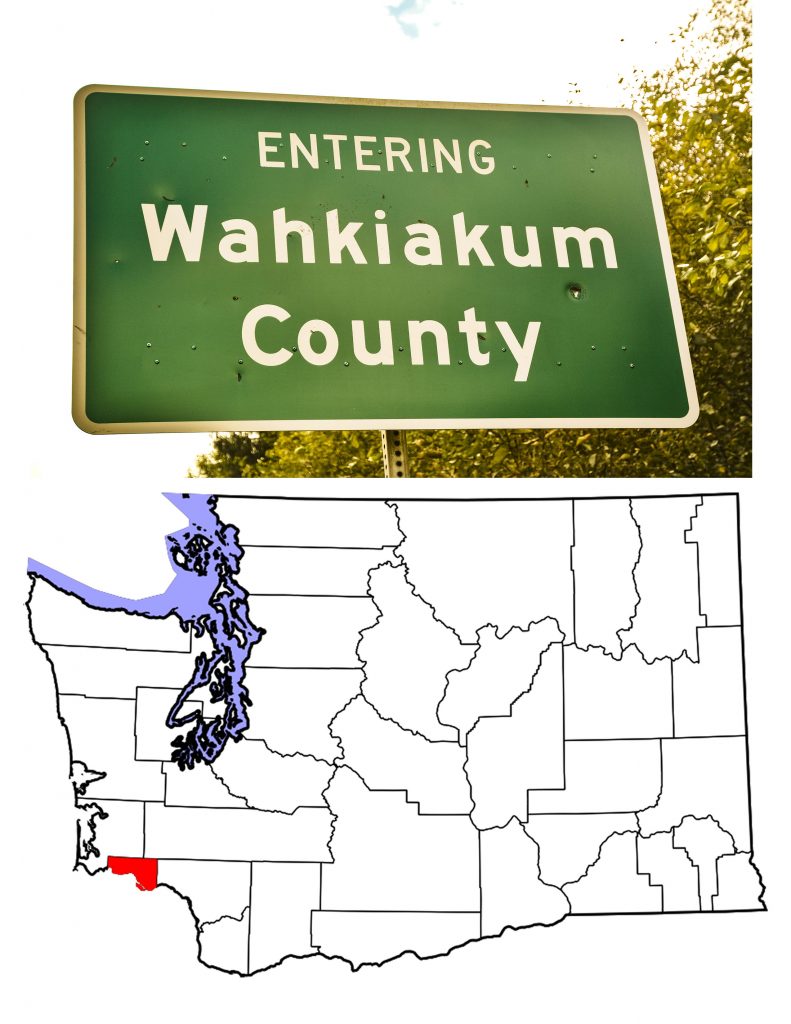
INTRODUCTION TO WAHKIAKUM COUNTY, WASHINGTON
On April 25th, 1854, just four days after they created Cowlitz County, the Washington Territorial Legislature cut off the western end of that county to create Wahkiakum County, Washington. They named this new county for the native people and their chief who had lived in the area for centuries. Chief Wahkiakum was one of the Chinook leaders in the area. Some references speak of the Wahkiakum Tribe, but any such tribe has long disappeared. The name means “Tall Timber” in the Chinook language.
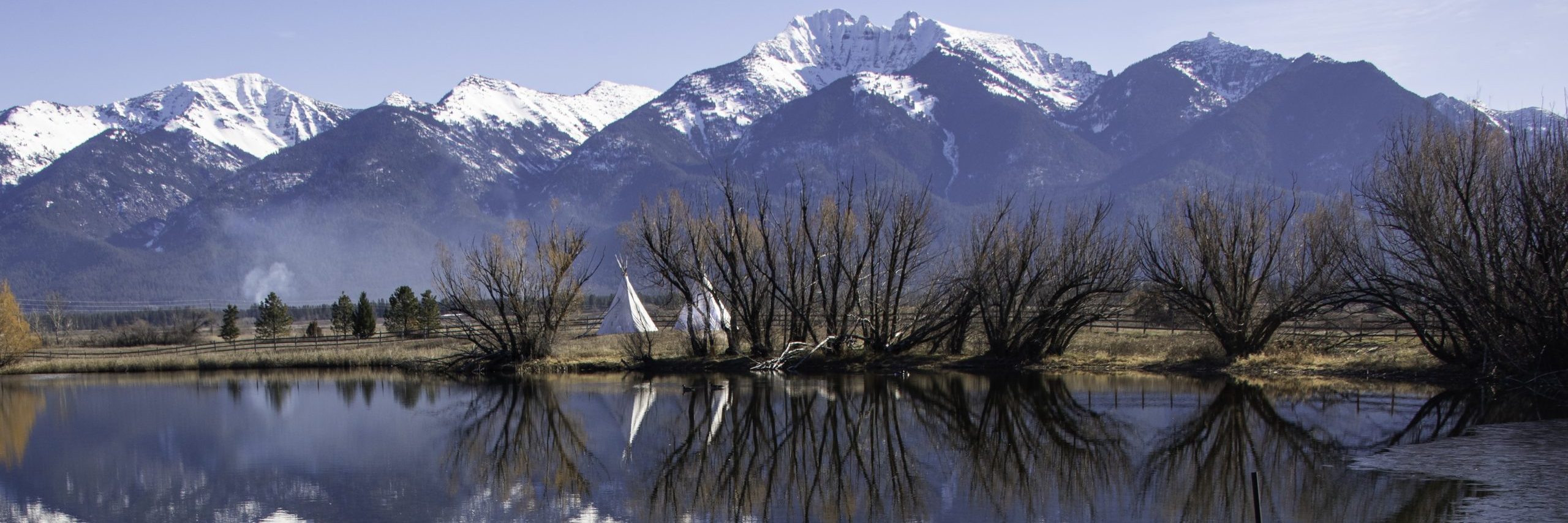
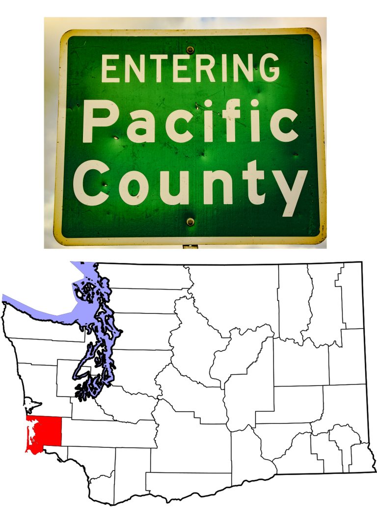
Smallest of Washington’s 39 counties, by total area, and 37th by land alone, Wahkiakum County sits on the north bank of the Columbia River, between Cowlitz County to the east and Pacific County to the west. It covers 287 square miles of which 24 are water. As of the 2010 US Census, Wahkiakum County was 38th in the state. Only Garfield County had a smaller population. The 2019 estimates show that with a population of 4,488, the County has passed Columbia as well, to become 37th state-wide.
A Brief History of Wahkiakum County, Washington
On May 11, 1792, Robert Gray, a merchant sea captain from New England, was able to cross the sand bars. He entered the large river he named for his ship, the Columbia Rediviva. Gray sailed fifteen miles up the Columbia and mapped the area. His maps included a large bay and river flowing from the north. Gray’s breaching of the Columbia’s sand bars are what gave the United States a reason to claim ownership of Oregon Country. I find it fascinating that at a time when Great Britain and the US both claimed the area, it was a Brit, William Broughton, who gave Gray’s name to the bay and river the American had mapped. It was also the British captain Vancouver who named Gray’s Harbor for the American. Today, Gray’s Bay marks the western end of Wahkiakum County.
When Lewis and Clark came through, they met the Wahkiakum/Cathlamet people both near the present site of Cathlamet and near Skamokawa. They were so impressed, they stopped again on their way east. Lewis recorded seeing the Pacific Ocean for the first time from a spot in present-day Wahkiakum County. Unfortunately, he was mistaken. Most likely what he saw was the Tongue Point Channel, a part of the Columbia that is considerably wider than any river should be.
White Settlement in Wahkiakum County
Fish brought the first white settlers to the area. A Scotsman, James Birnie, set up a salmon operation in the 1830s. Later, when he retired from the Hudson Bay Company, he brought his wife and twelve children to settle in Cathlamet—at that point one of the largest Chinook towns on the river. American captain John Crouch started a trading post, and traded for fish which he salted and sold in Hawai’I.
Canneries which operated into the 1930s, sprung up all along the Columbia River shoreline, but the thickly timbered hillsides drew Scandinavian settlers in the 1870s. As the trees disappeared for lumber, the settlers turned to farming. Dairy farms soon covered the arable parts of Wahkiakum County. Even today, demographics show that people of Norwegian and Swedish descent make up a sizeable portion of the Wahkiakum County population.
The Native People of Wahkiakum County
We know little about the people who lived along the Columbia River, other than what Lewis & Clark and other explorers recorded. We call the lower Columbia people Chinook, and we know that they were experienced traders. They had connections reaching from British Columbia to California and east to the Great Plains. They lived in communities from Astoria to the Dalles, on both sides of the River. One of their largest villages was Cathlamet, which means “Rocky Shores.” Today’s town of Cathlamet is at the same location. Historians believe that the Chinook originated south of the River, but for some reason moved north prior to European-American encroachment. Wahkiakum (”Tall Timber”) and Skamokawa (”Smoke on the Water”) were two of the best known chiefs. Both left their names on the map.
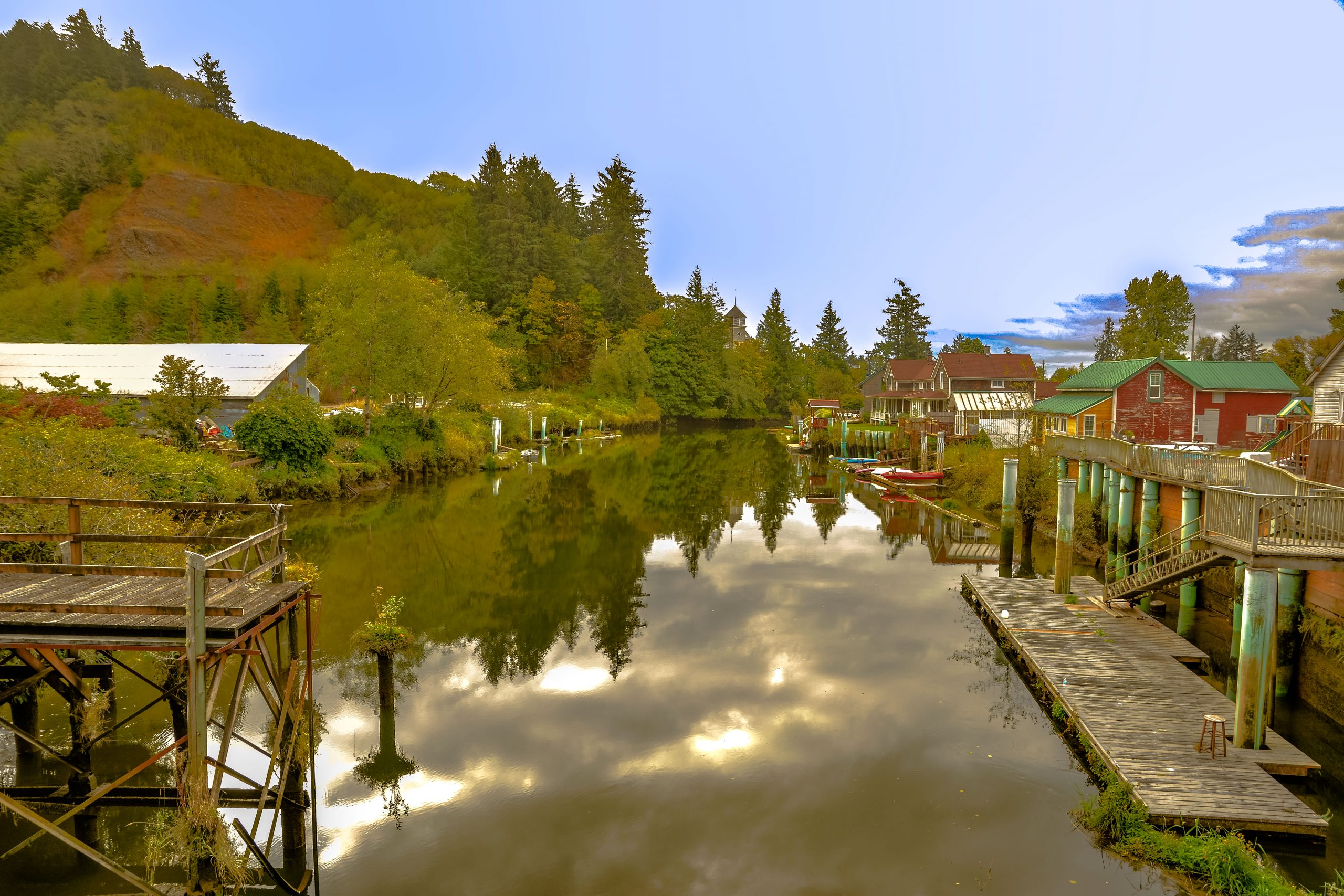
Cathlamet—the Seat of Wahkiakum County, Washington
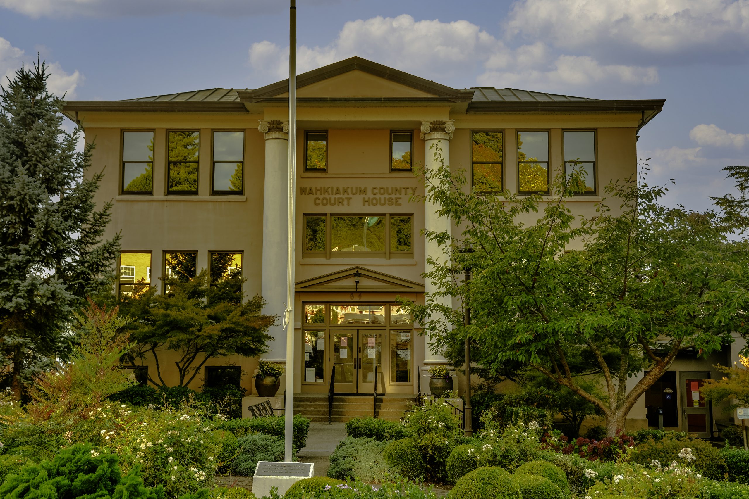
The only incorporated town in Wahkiakum County, Cathlamet’s roots go far back in history. With a population of 532, the town is Washington’s smallest county seat. In 1846, James Birnie founded his trading post, Birnie’s Retreat, in the Chinook village of Cathlamet. He may have been the first European to settle here, but he was not the last. When Washington Territory created Wahkiakum County, the legislators named Cathlamet Seat.
Today’s town is barely larger than the original Chinook village which had 300-400 residents when Lewis and Clark visited in 1805. Still, it is a lovely town, with good restaurants available and the Cathlamet Hotel sitting right on Main Street. The Pioneer Church rises above the town at the east end of Main Street. Built in 1895 as a Congregational Church, the building today houses the Cathlamet Pioneer Community Association. It serves as a performing arts center and public meeting venue.
Visitors to Cathlamet can stay at the Cathlamet Hotel, at a number of bed and breakfasts, or on their own boat at the Elochoman Slough Marina, which is just off Main Street and visible from the county court house. Yelp lists four restaurants in Cathlamet, and my experience says that Maria’s Place is the place to go. (I’m sure the others are fine. My only eating experience was at Maria’s Place.)
Julia Butler Hansen
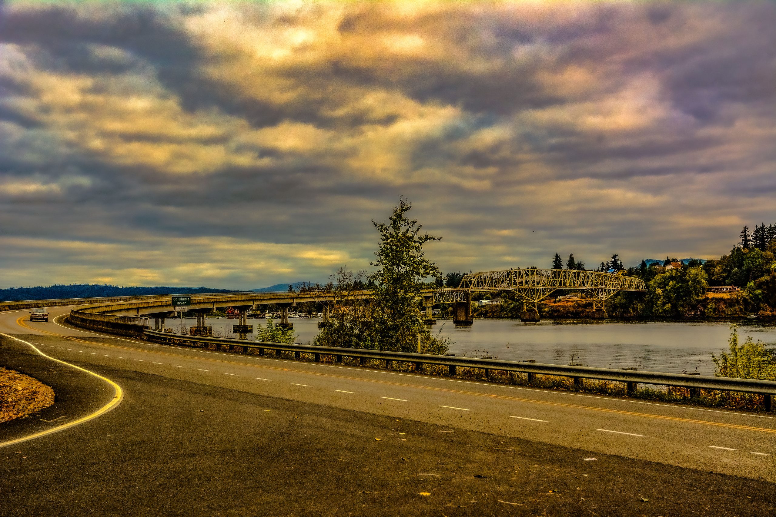
One of Cathlamet’s leading citizens was Julia Butler Hansen. Daughter of a Wahkiakum County Sheriff, Julia became involved in politics and served in the Washington State Legislature. She became the first woman to serve Washington in the U.S. Congress where she represented Washington’s Third District from 1960 to 1974. While she died in 1988, her name lives on with the Julia Butler Hansen bridge which connects Cathlamet to Puget Island. The Julia Butler Hansen Wildlife Refuge and the Julia Butler Hansen Heritage Center also honor the woman, as does a school in Olympia, Washington.
Other Wahkiakum County Communities
While Cathlamet is the only incorporated town in Wahkiakum County, there are many smaller communities along Highway 4. Seven miles west of the county seat, the community of Skamokawa attacts visitors looking to relax in a setting much like Lewis and Clark found it. The original Skamokawa school, but in 1894, became the meeting hall for the Improved Order of Redmen in 1926. Today, the building is on the National Register and services as the River Life Interpretive Center. With the Columbia at its doorstep (in the form of Vista Park) and the Skamokawa Slough running through the town’s center, one visitor said “Bring your kayak.” I know I’ll have my kayak along when I return to Wahkiakum County, Washington.
Another 12 miles along Highway 4 brings us to Grays River. Grays River, a census-designated place with a 2010 population of 263, is home to another of Wahkiakum County’s places on the National Register. Gray’s River Covered Bridge, built in 1905, is the only covered bridge still in use in Washington State.
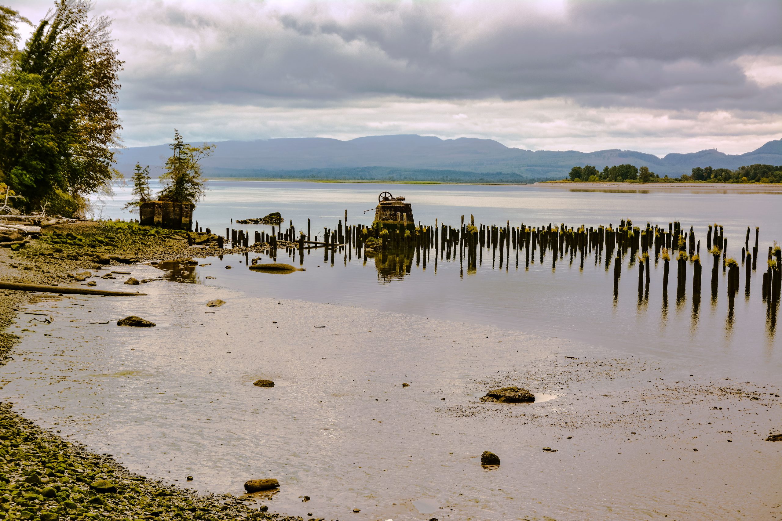
The community of Rosburg lies just down the road from Grays River, along the river of the same name. At Rosburg, you can turn off Highway 4 and head downstream to the Columbia and Wahkiakum County’s ghost town of Altoona. Altoona housed several fish canneries in its heyday, but today it is mostly a series of pilings in the Columbia River. Still worth a visit, in my opinion.
My Drive Across Wahkiakum County
Only one highway crosses Wahkiakum County, Washington State Highway 4. On Sunday, September 4th, I drove west from Kelso in Cowlitz County, arriving in Cathlamet in time for supper. I had found the Hotel Cathlamet on Hotels.com, and had called to reserve a room. When I drove into town, the doors to the hotel were locked. I parked on Main Street, and set out to explore my options. By the time I had finished supper at Maria’s Place, the hotel doors were open and I was able to check in. My room was lovely and quiet, even though I know I was not the only guest.
The next morning, I woke long before breakfast would be ready, so I took a drive. Following highway 409, I crossed the Julia Butler Hansen bridge and explored Puget Island. Personally, I think that a bicycle would be the proper way to see Puget Island, but my bike was home in Montana and I had places to go. Back in Cathlamet, I had breakfast at the hotel, then checked out. I spoke with both local residents and visiting tourists, amazing on Labor Day when I would have expected everything to be closed.
On to Skamokawa
Continuing west on Highway 4, I stopped next at Skamokawa. I photographed both the Methodist Church and the slough that runs parallel to the highway. I missed Skamokawa Vista Park, and the Wahkiakum County Fairgrounds, but I have included an aeriel visit to the region in today’s Video of the Day.
West of Skamokawa, the highway leaves the river. It curves north to cross Gray’s River and then Deep River before crossing into Pacific County. I took photographs as I drove west, getting off the highway to visit the Gray’s River Covered Bridge. Built in 1905, the sign at the bridge proclaims that it is “the last Covered Bridge in use in Washington State.” I was not the only photographer at the bridge site. Further on, I passed through the community of Rosburg, where once again, I left the highway to sightsee.
This time I drove quite a distance—ok, mapquest says 6.5 miles—to the ghost town of Altoona. At Altoona, I stopped to take photos of the landscape and the pilings. The pilings are all that’s left of the old canneries that made the town thrive back in the 1930s. If there’s more to this “ghost town,” I missed it.
From Altoona, I returned to Rosburg where I continued on westward on Highway 4, across the Deep River and out of Wahkiakum County. My overall impression was that this is a place I would love to visit again, I would stay longer to explore more out-of-the-way places. If you’re interested in someone else’s perspectives, Dayna Smith, a Seattle-based musician and writer, has a blog titled “I Ate the State.” One of her posts talks of her experiences in Wahkiakum County. I recommend it highly.
..
![]()
Yes! Finally someone writes about website.
Thank you. –Bryan