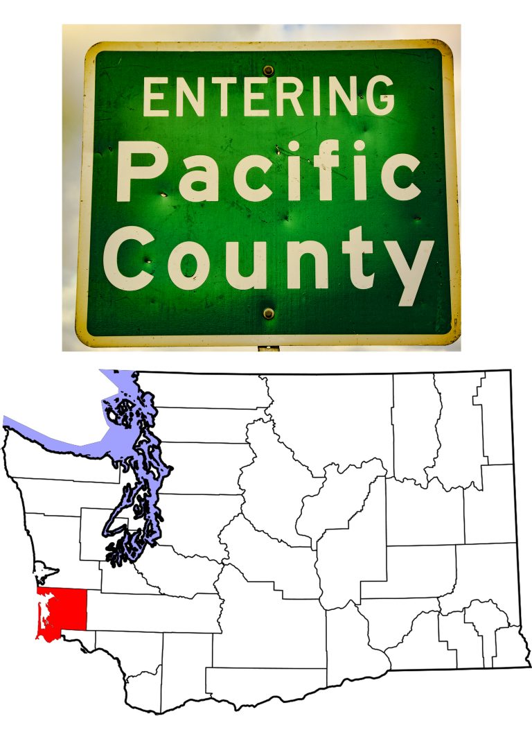
Benewah County Idaho
Introduction to Benewah County, Idaho
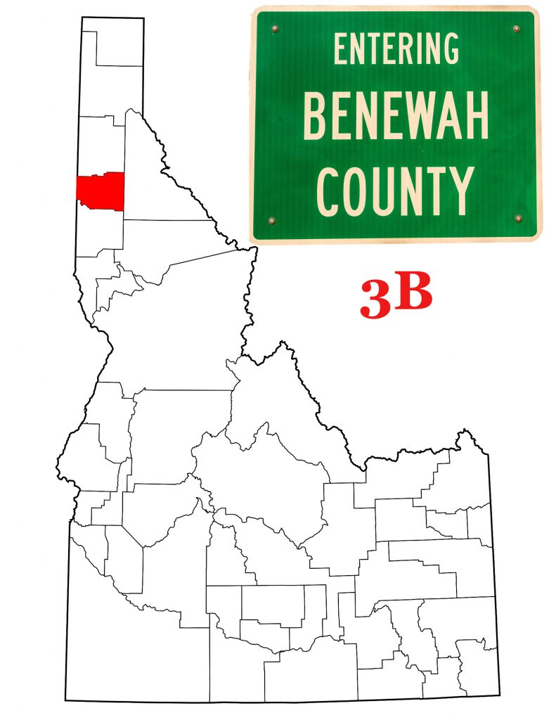
Benewah County Idaho came into being on January 23rd, 1915. On that date, the state legislature took a chunk of southern Kootenai County and named it for a chief of the Coeur d’Alene tribe. With a total area of 784 square miles, it is the second smallest county in Idaho’s northern panhandle. According to the 2010 U.S. Census, 9,285 people lived in Benewah County. Once again that figure makes it the second smallest in the panhandle. (In both area and population, only Lewis County is smaller.) The 2010 count shows the highest population count in the hundred years of Benewah County’s history, but the 2018 estimate predicts a .6% loss from 2010.
The Coeur d’Alene Tribe
The opening paragraph of the Coeur d’Alene tribe’s website says this about the Salish people who live near the lake that shares their name:
The modern Coeur d’Alene Tribe is the sum of uncounted centuries of untold generations. In the tribe’s own ancient language, it is called Schitsu’umsh, meaning “Those who were found here” or “The discovered people”. In this remains a land abundant in beauty and resources, a legacy of leadership, and a lineage that continues from the time immemorial. The Coeur d’Alenes are who they always were and who they will always be.
A non-nomadic people, the Coeur d’Alene lived in what is now eastern Washington, northern Idaho and western Montana. Historically, their lands stretched from Spokane, Washington to St. Regis, Montana, and from Lake Pend Oreille to the Clearwater River. In 1873, President Grant created the Coeur d’Alene Reservation. The new reservation covered 600,000 acres (as opposed to the 3.5 million acres of the tribe’s traditional homeland). Subsequent federal legislation has reduced the reservation to 345,000 acres today. All western Benewah County is on the Reservation, which extends into the city of St. Maries.
St. Maries, the Benewah County Seat
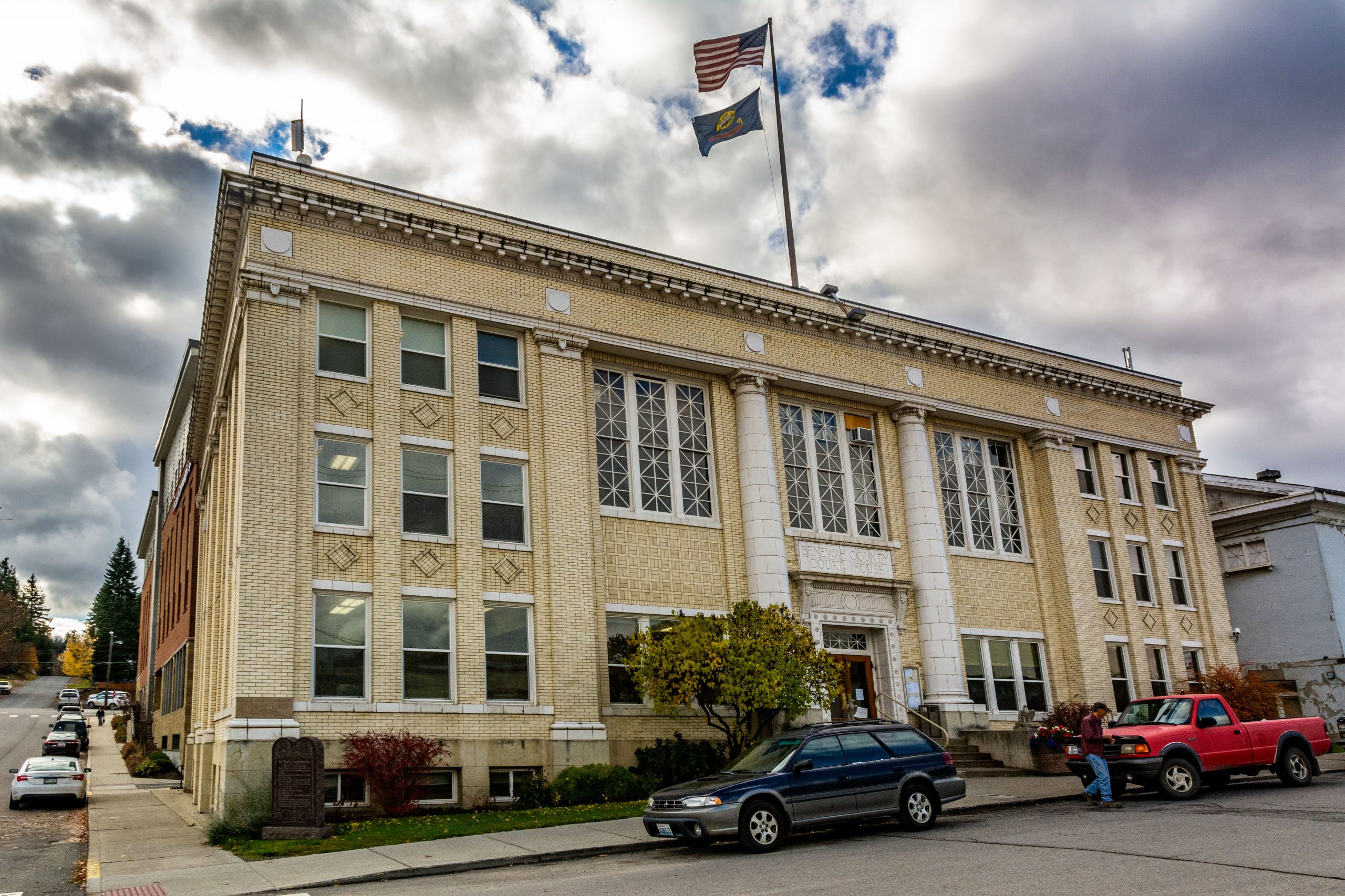
The County has three incorporated cities, of which the largest, St. Maries, serves as County Seat. Located at the confluence of the St. Joe and St. Maries Rivers in the central part of the County, St. Maries got its start as a sawmill in 1889. The city incorporated in 1913, five years after the Pacific Extension of the Milwaukee Road brought rail traffic to the area. With the establishment of Benewah County in 1915, St. Maries became the County Seat. Benewah County has nine spots on the National Register of Historic Places. Five of those nine are in St. Maries.
Plummer and Tensed
Plummer on U.S. Highway 95 is home to the tribal headquarters for the Coeur d’Alene tribe. It is the second largest city in the county. The 2010 Census counted 1,044 people in the town. In addition to the tribal headquarters, Plummer is also home to several tribally owned businesses including the local ACE Hardware store. The city is racially diverse, with less than 40% of the inhabitants claiming Native American ancestry.
Fifteen minutes (13.5 miles) south of Plummer is Benewah’s third city, Tensed. Tensed is one of two communities in Benewah County honoring Father Pierre de Smet. DeSmet was the Jesuit missionary who brought Catholicism to the inland Northwest in the mid 1800s. If you are a bit confused how Tensed could refer to the priest, try spelling the town’s name backwards. Yes, that’s an “n” and not an “m,” but nonetheless, the name still honors DeSmet. You see, when the town applied for a post office, the Postal Service powers that be refused the name DeSmet. There was already a DeSmet nearby—the mission community just a few miles west of US 95. The city fathers turned the name around, and somehow the “m” became an ‘n.”
Other Benewah County Communities
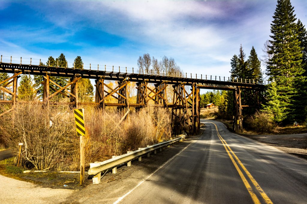
In addition to the three cities, Benewah County has two “Census-Designated Places”: the afore-mentioned De Smet and Parkline. Hard to imagine, but prior to 2001, Parkline was an incorporated city. Today it has a population of 80 and doesn’t even show up on my DeLorme Idaho Atlas. Wikipedia lists twenty-nine unincorporated communities in the County, many of which do appear on my DeLorme Atlas. One in particular, Santa, had me stopping to photograph the railroad trestle crossing Idaho Highway 3. Santa’s post office dates from 1887 and has the zip code 83866. In 2005, the community agreed to change its name for one year. It received $20,000 by promoting the website SecretSanta.com.
Where the Palouse Meets the Mountains
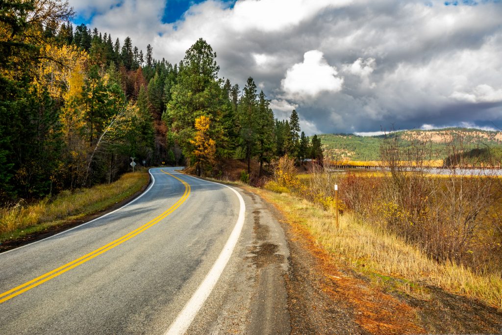
Western Benewah County Idaho is part of the Palouse, a land of rolling hills that covers much of neighboring eastern Washington state. Driving across the County on US 95, you pass miles and miles of wheat fields. The USDA’s 2017 Census of Agriculture shows that wheat, in its various forms, makes up most of Benewah County’s produce. Livestock is negligible as a commodity—Benewah County ranks 43rd of Idaho’s 44 counties in that sector.
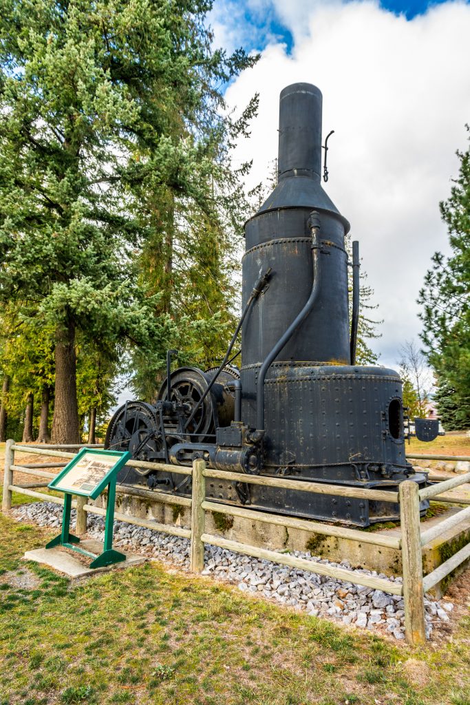
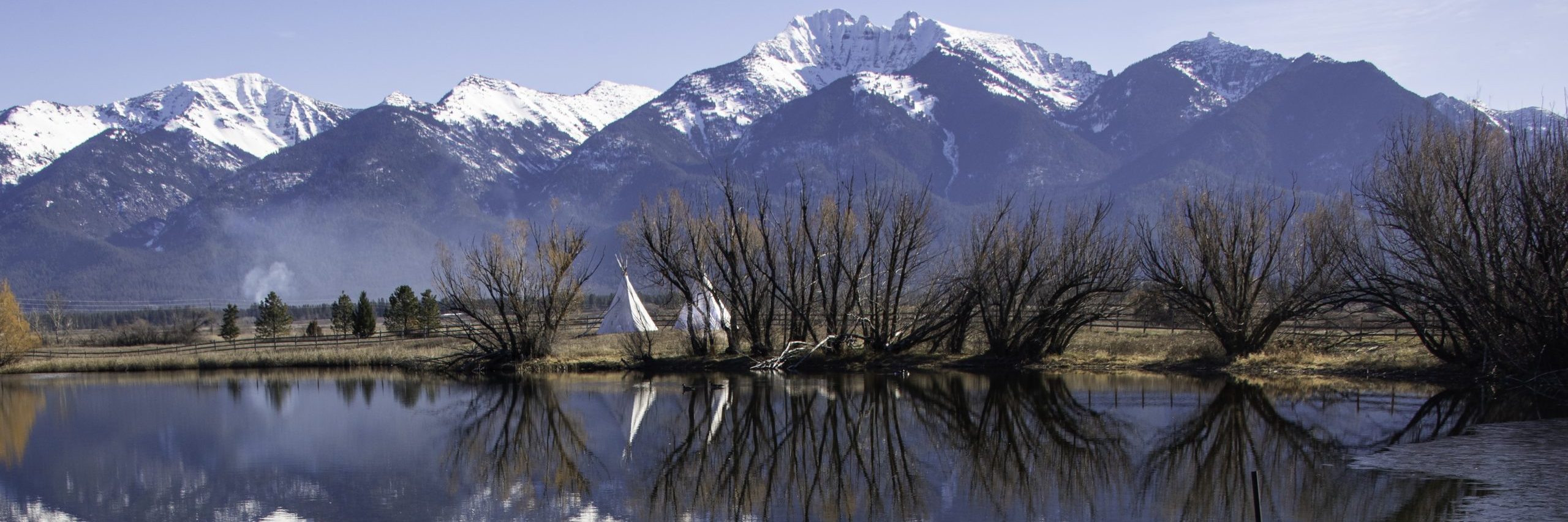
Eastern Benewah County rises into the Clearwater and St. Joe Mountains, with timberland predominating as a “crop.” The St. Joe River flows westward across the county, dividing the two mountain ranges and providing “the highest navigable river in the world,” as one historic marker claims. It was precisely the navigability of the river that encouraged Joseph Fisher to build his sawmill back in 1889.
Two State Parks and a Bike Trail
Chatcolet Lake and Benewah Lake are the southern extensions of Lake Coeur d’Alene and both are fully within Benewah County, Idaho. An act of Congress in 1908 created Heyburn State Park on the lakefront by taking land from the Coeur d’Alene Reservation. Prior to World War II, the Civilian Conservation Corps built roads, bridges and trails, and constructed buildings in the park, many of which are still in use today. Three of Benewah County’s National Register sites are in Heyburn State Park.
Mary Minerva McCroskey State Park lies on the western edge of the County, along the Washington state line. The land for the park was purchased over time by conservationist Virgil McCroskey. McCroskey presented the 5,300-acre parcel to the state of Idaho. However, the State accepted the land only if McCroskey would maintain it, at his expense, for fifteen years. McCroskey did, dying shortly after his 15-year agreement expired. He named the park for his mother and dedicated it to pioneer women everywhere.
Created as part of the environmental clean up of silver mining waste (the EPA’s second largest project), the Trail of the Coeur d’Alenes runs from Plummer in the west to Mullan in the east (in neighboring Shoshone County). The trail is seventy-three miles long. It gives bikers, hikers, skaters, and others a chance to cross almost all of Idaho’s northern panhandle on a smooth asphalt surface. One word of warning: Do NOT drink the water along the way.
Previous Post: Walla Walla County Washington
Previous Idaho County Post: Adams County
![]()

3 Comments
Comments are closed.