Walla Walla County Washington
Introduction to Walla Walla County
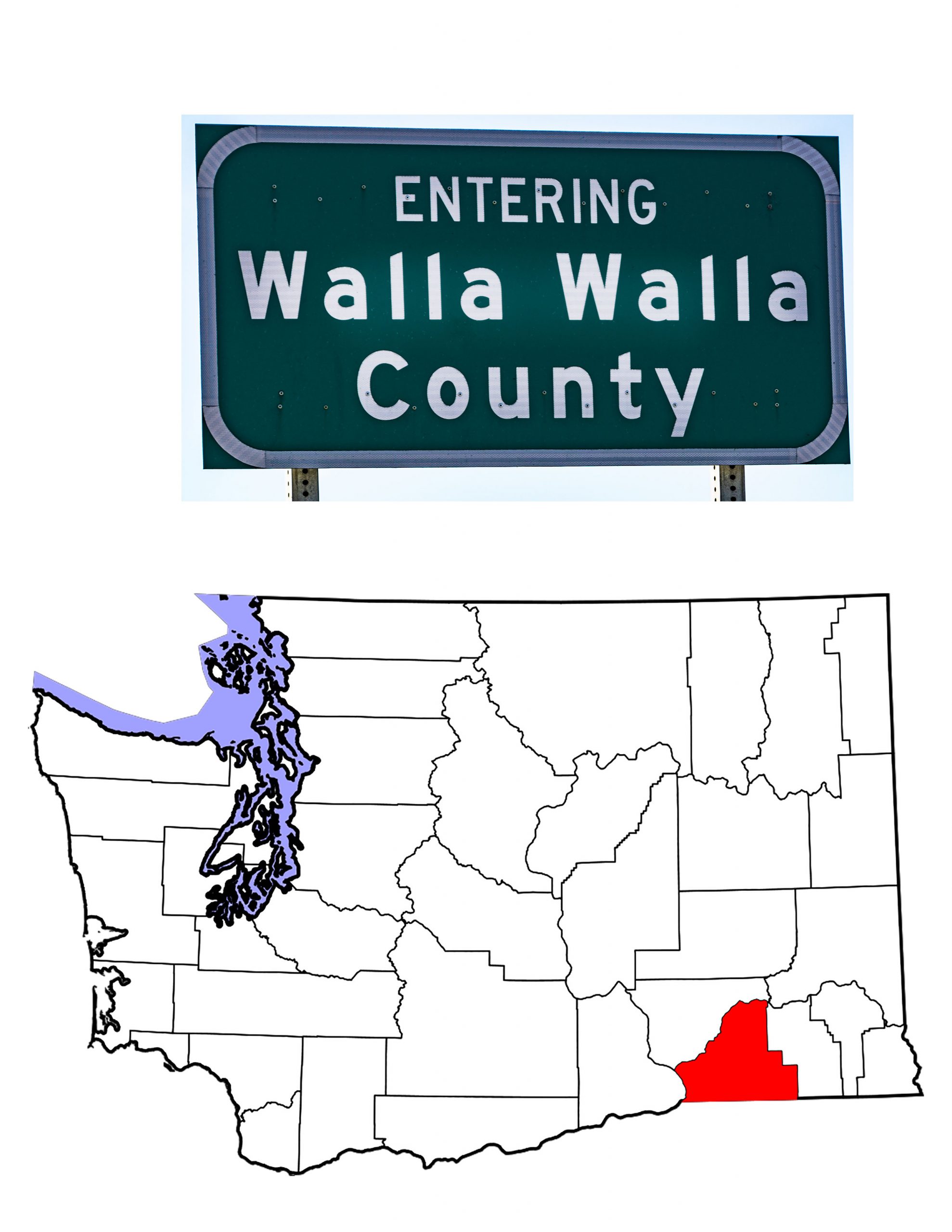
On the same day they created Wahkiakum County, April 25th, 1854, the Washington Territorial Legislature created Walla Walla County. At that point, Walla Walla County covered all of Washington east of the Cascades. It included what is now northern Idaho and western Montana. Over the next two decades, the legislature would take Walla Walla’s land to create several new counties. With the creation of Columbia County on its eastern border in 1875, Walla Walla County Washington came to its present size and shape. Bordered on the north by the Snake River, and by the Columbia on its southwestern edge, the County lies on the northern side of the Washington/Oregon state line. It covers 1,299 square miles (of which 29 are water) and has an estimated population of 60,760 (2019 U.S. Census estimate). The County’s name comes from the indigenous people of the region, the Walla Walla.
History
When David Thompson visited the region in 1811, he promised a trading post. Fort Nez Percé, at the confluence of the Walla Walla and Columbia Rivers, marked the beginning of European-American settlement in Washington State. The year was 1818. Originally an outpost of the North West Company, Fort Nez Percé became part of the Hudson Bay Company when HBC merged with the North West Company in 1821. Hudson Bay continued to operate the Fort, which they renamed Fort Walla Walla. The fort ceased operations in 1857 when Hudson Bay Company gave up all activity south of the 49th parallel.
The Whitman Mission
Walla Walla County has the distinction of being the location of the first white settlement between the Rockies and the Cascades. In 1836, Marcus Whitman, his wife Narcissa, Henry and Eliza Spalding came west with fur traders. They came as missionaries. Narcissa Whitman and Eliza Spalding were the first documented European-American women to cross the North American continent. Whitman built a mission to the Cayuse Indians who lived along the Walla Walla River. The Cayuse were not receptive, indeed they were suspicious of these strangers. Whitman learned the Cayuse language which helped mend some ill-feeling. He did, however, insist that the native people adopt western ways. That was not welcome.
The Whitman Mission became a popular stopping off point for people traveling west on the Oregon Trail. As more and more white folk came through their land, the Cayuse became increasingly displeased. When travelers brought the European disease of measles to the area, many Cayuse became ill and died. The Whitman group also became ill, but fewer died from the disease. The Cayuse blamed the Whitmans for the illness, and on November 29th, 1847, they attacked the mission. The natives killed both Marcus and Narcissa as well as eleven others. They took many more hostage. This event became known as the Whitman Massacre. When news reached the east, it enraged the American nation. The massacre lead to new anti-Indian policies, and caused the government to create Oregon Territory. In 1936, the US created the Whitman National Monument and in 1963 designated it the Whitman Mission National Historic Site.
The Cayuse and Walla Walla People
The indigenous people of Walla Walla County included the Cayuse, the Walla Walla and the Nez Perce. Because most of these people were nomadic, they shared the territory with other tribal people. The Cayuse called themselves the Liksiyu. They spoke a language unrelated to the sahaptin speaking tribes who lived nearby. The name Cayuse comes from the French word “cailloux” meaning stony. With the introduction of horses to the Northwest, the Cayuse became expert breeders. Some families owned thousands of horses. As noted above, they did not welcome the Whitmans, barely tolerating their presence on Indian land. A shaman who could not heal his people was a fraud. When measles ravaged the Cayuse community, Whitman could not cure the natives. That was the last straw for the Cayuse. The remaining Cayuse today share the Umatilla Reservation near Pendleton, Oregon.
The people who gave their name to the area, the Walla Walla, are a Sahaptin people, related to the Yakama and the Nez Perce. When Lewis and Clark crossed the region on their way west, they met a Walla Walla chief, Yellepit, and promised to stay longer on their way home. East-bound, Clark gave Yellepit his own sword as well as several other gifts. When David Thompson arrived in 1811, he promised to build a trading post (and claimed the area for Great Britain). Yellepit showed Thompson his gifts from Lewis and Clark, but encouraged the building of a post. Today the Walla Walla are one of the tribes at the Umatilla Reservation, but some live on the Yakama Reservation as well.
Walla Walla—The County Seat
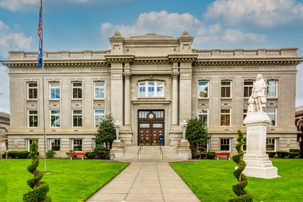
The largest city in the County is the county seat, also named Walla Walla. In 1856, Colonel E.J. Steptoe built a new fort taking the name of the Hudson Bay post. The new Fort Walla Walla grew into a town with the discovery of gold in what is now Idaho. The fort served the U.S. military, and the community served the fort. A former colleague of the Whitmans, Cushing Eells moved back to the area and got a charter for a school. That school grew into Whitman University, one of three institutions of higher education in the Walla Walla area. In 1886, the Territorial Legislature built a prison at Walla Walla. Today, the Washington State Penitentiary is the second largest penal institution in the state.
As the County’s agriculture grew in importance, so did the city. Today, Walla Walla’s population is roughly half that of the entire county. When you add in its two suburbs,nearly two-thirds of the County’s people live in the urban area. The City is home not only to Whitman University and the state penitentiary, but also to Walla Walla College and Walla Walla Community College.
College Place
Incorporated in 1946, College Place is the second largest city in Walla Walla County, Washington with a 2019 estimated population of 9,317. Seventh-Day Adventists constitute a large portion of the city’s population. As a result, most businesses close on Saturday and re-open on Sunday. The city’s Walla Walla University is an Adventist institution. Founded in 1892 as Walla Walla College, the school replaced three schools in Oregon that merged at church request. Originally designed to offer elementary through second year college courses, the school awarded its first BA degree in 1909. As an Adventist institution, the school was the first to offer an entirely vegetarian diet. Today, the school has a full-time student body of 1,900 and offers graduate degrees as well as undergrad. The town, named for the school, sits on the western edge of Walla Walla.
Waitsburg and Prescott
People began settling the Touchet Valley in the late 1850s. In 1865, Sylvester Wait’s grist mill started shipping flour made from locally grown wheat. The town that grew around Wait’s mill took his name. Today, Waitsburg is a thriving community of 1,231 people (2019 estimate). Wait’s mill ceased operation in 1957 but the town remains a center of wheat farming. To me, Waitsburg is most notable for the 90 degree turn US Highway 12 makes in the center of town. Driving east, 12 turns till it’s heading almost due north. In Waitsburg, however, a right turn takes you eastward once more, and shortly thereafter, you leave Walla Walla County.
Nine miles west of Waitsburg, or twenty miles north of Walla Walla, lies Prescott. Incorporated in 1903, Prescott is the only other city in Walla Walla County. The post office dates from 1881, and the 1900 Census counted 657 residents. No census since has shown so many people living in the town. In fact, the 2019 estimate of 305 shows fewer people than the first count in 1890 (313).
The (Really) Small Towns of Walla Walla County
In addition to the four incorporated cities, Wikipedia lists 12 unincorporated communities and census-designated places. Some of these, like Garrett and East Walla Walla are suburbs of the county seat. Garrett had a 2010 population of 1,419 while East Walla Walla showed 1,672 residents that year. Burbank, the largest of these other communities, is basically a suburb of the Tri-Cities. Pasco and Kennewick are its closest neighbors. The 2010 Census counted 3,291 residents in this community named for botanist Luther Burbank. The census-designated place covers 15 square miles at the confluence of the Snake and Columbia Rivers.
Wallula, on the Columbia River, lies just north of the confluence of the Walla Walla and Columbia Rivers. Lewis and Clark estimated that 550 native people lived in the immediate area. The 2010 Census counted 179. Touchet (421 residents), Lowden and Whitman are all in the Walla Walla Valley, along US Highway 12. Lowden is best known today for its wineries. The Woodward Canyon Winery, L’Ecole No. 41, and Waterbrook Winery all are within a couple of miles of Lowden. Whitman, of course, takes its name from Marcus and Narcissa Whitman. Halfway between Walla Walla and Waitsburg, you drive through Dixie. Named for the song, Dixie has had a post office since 1881. The 2010 Census counted 197residents.
Walla Walla County Topography
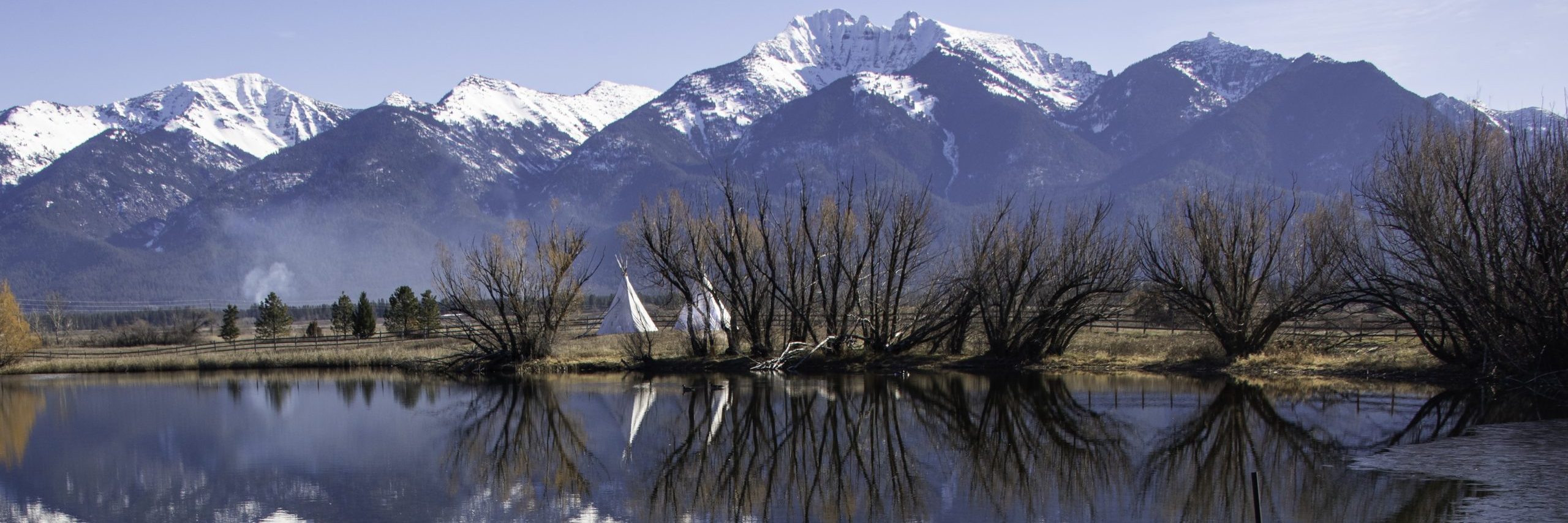
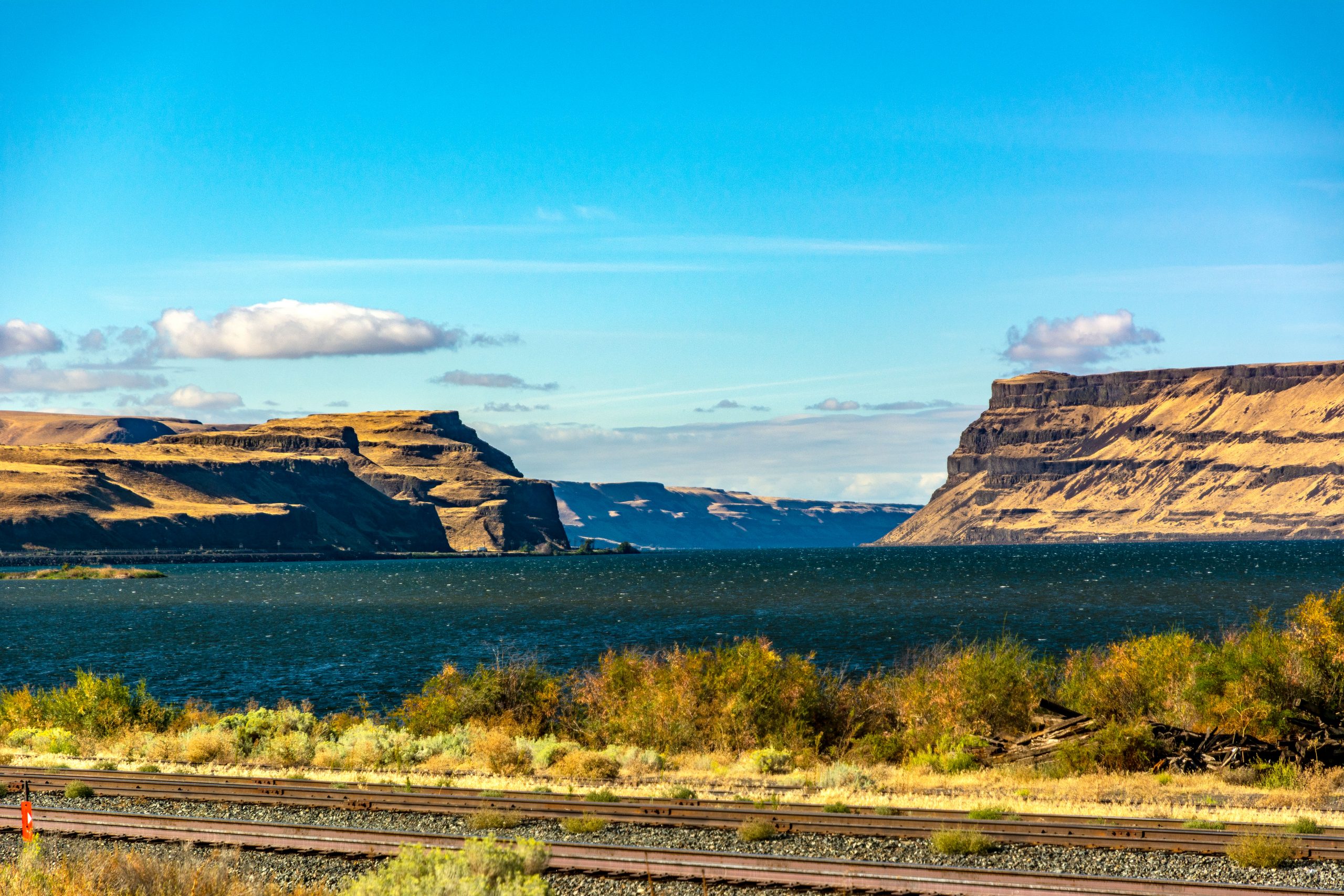
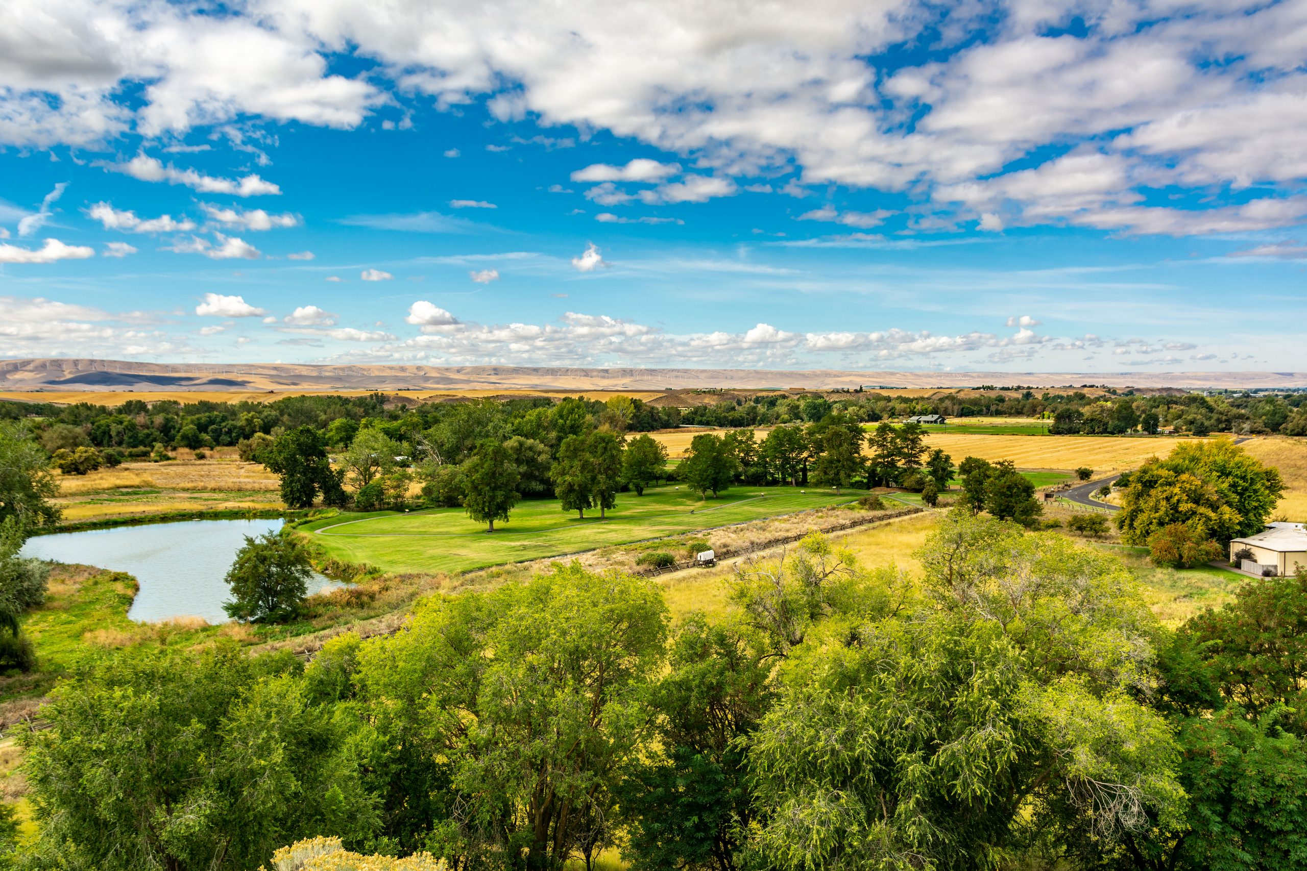
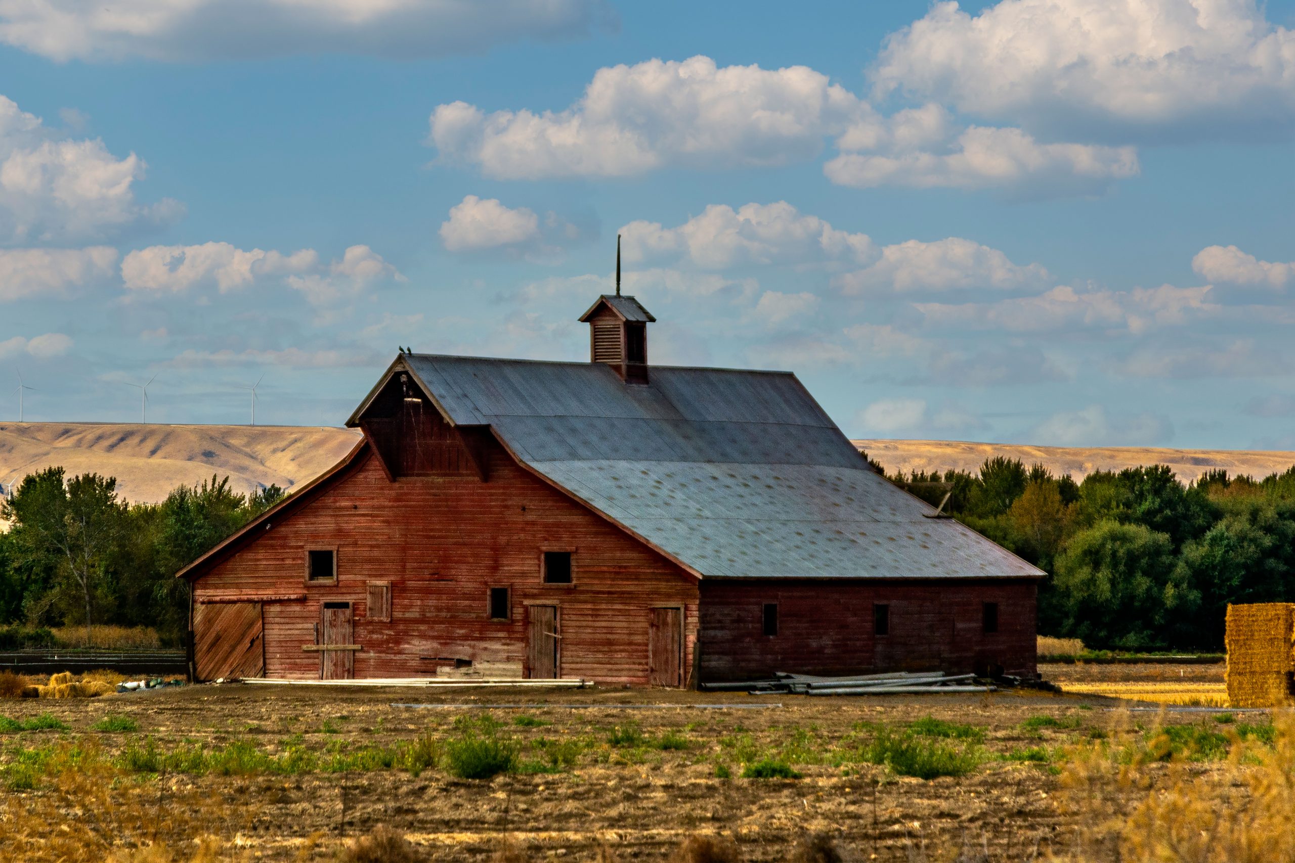
Like most of Washington State, water defines Walla Walla County. The name itself means “running water.” Or maybe “many waters.” Or even “small waters flowing into larger waters.” You get the idea. The Snake, the Touchet and the Walla Walla Rivers all flow westward across the countryside to converge with the Columbia. Numerous creeks feed into these rivers and the land is made up of rolling hills. Looking at an atlas of the county, we find a series of valleys and canyons that run southwest to northeast across the county. Names such as Walker Canyon, Eureka Flat, Winnett Canyon, Ninemile Canyon, Woodward Canyon and Spring Valley follow in succession as you drive east across the county. The eastern edge of the county finds the foothills of the Blue Mountains, from which both the Touchet and the Walla Walla Rivers flow.
From Burbank in the west, at 374 feet above sea level, to Waitsburg in the east at 1,263 feet, you climb gradually as you get further from the Columbia. Lewis Peak, near the Walla Walla Columbia County line is the highest point in the county at 4,888 feet.
The Business of Walla Walla County is Agriculture
As has been hinted above, agriculture is the primary business of Walla Walla County. Historically wheat was king. Even as recently as 2017, the census of agriculture showed 188,653 acres of land devoted to wheat. That’s almost 295 square miles. But fruit, predominately apples and grapes are a rising industry. Out of a total sale of $526,236,000 for 2017, $249,181,000 came from fruit and fruit products—47%. Apple orchards alone accounted for 11,658 acres.
And viticulture is a growing business. The three wineries noted above at Lowden are just one part of what is becoming a major industry for Walla Walla County. Some 120 wineries operate in the County, with 30 tasting rooms in downtown Walla Wall alone. The Walla Walla Valley Wine Alliance website is a great source of knowledge about the industry. And of course, we have to remember the Walla Walla Sweet Onion, Washington State’s state vegetable since 2007.
My travels through Walla Walla County
Over the years, I have driven across Walla Walla County many times. Starting back when I was a teen-ager, I remember my father choosing to drive US 12 to get us from our home in California to our cabin in Montana. As an adult, I have taken the same route many times. A couple of times, I turned south at College Place to take Washington Highway 125 to Milton-Freewater, Oregon. Most recently I drove US 12 in September, 2016, which is when I took all the photographs included in this post.
I should point out that all of the photographs are available for sale at my redbubble.com gallery. If you click on a photo, you will open a new tab showing all the great stuff you can get with that image. On a future trip, I would want to take Washington Highway 124 between Burbank and Waitsville, and I would like to head up the Ayers Road to see the northern extent of the County. I hope you have enjoyed this visit to Walla Walla County Washington.
| <Previous Post: A November Sunday Drive | Next Post: Benewah County Idaho> |
| <Previous Washington County Post: Wahkiakum County | Next Washington County Post: Clallam County > |
![]()

4 Comments
Comments are closed.