Clallam County, Washington
Introduction to Clallam County, Washington
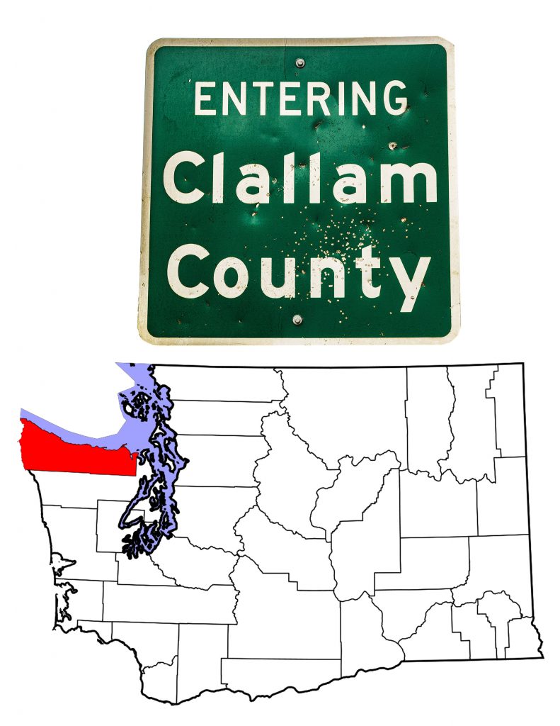
On April 26th, 1854, the Washington Territorial Legislature created Clallam County by taking the northwestern corner of Jefferson County. New Dungeness was, at that time, the largest community in the new county, so the Legislature named it County Seat. It held that position until 1890, when a county-wide election chose Port Angeles, the current seat. Despite an unsuccessful effort to divide the county, Clallam County today is the same size and shape as in 1854. It covers 2,671 square miles, which includes 932 square miles of water–thirty-five percent of the total area. As of 2019, the U.S. Census estimated that 77,331 people live in the County. The County takes its name from the Klallam tribes, meaning “the strong people.”
European Exploration and Settlement
Clallam County’s European history goes back to the 1700s. Captain James Cook named Cape Flattery in 1778, when his ship the HMS Resolution sailed by. Cook missed the Strait of Juan de Fuca, lost in the fog. But ten years later, Charles William Barkley, another British sea captain, sailed into the Strait. He named it for the Greek sailor who claimed to have first seen the strait in 1592 when sailing for the Spanish King Phillip II,Ἰωάννης Φωκᾶς (John of Fuca, or Juan de Fuca in Spanish).
De Fuca’s description of the strait that now bears his name makes historians suspicious of his claim. The co-ordinates are wrong, for instance. That didn’t keep other Spanish ships from entering the Strait. Captain Francisco Eliza named one bay on Clallam County’s north shore Puerto de Nuestra Senora de Los Angeles—now Port Angeles. Over time, the Spanish laid claim to the territory, as did the Russians. The British and Americans both claimed Oregon Country until 1846 when they settled on the 49th parallel as the dividing line between the U.S. and British North America. Settlers didn’t come to Clallam County until the 1850s.
The Original Inhabitants of Clallam County
Of course the Europeans were not the first to experience Clallam County, Washington. Three main groups lived along the Pacific Coast and the Strait of Juan de Fuca. The S’Klallam, the Makah, and the Quileute had inhabited the region for thousands of years when the Spanish arrived. Of the three, the S’Klallam gave their name to the County.
The S’Klallam are a Salish-speaking people, related to many other tribes in the Pacific Northwest. Today, there are four main groups of S’Klallam, two of which live in Clallam County. An e-book published by the Jamestown S’Klallam gives this brief history of the S’Klallam people:
The nəxʷsƛ̕áy̕əm̕ or S’Klallam (Strong People) are today comprised of three Tribes, the Jamestown S’Klallam, Port Gamble S’Klallam, and Lower Elwha Klallam. At the time of European arrival around 1790, the S’Klallam were one people whose territory stretched across the northern Olympic Peninsula and across the Strait of Juan de Fuca to Vancouver Island. They continued to expand this range into the historic era, occupying Port Townsend and the lower (northern) reaches of Hood Canal and the new mill town of Port Gamble by the mid-1800s.
The (S’)Klallam People
I should note that the S’Klallam people themselves use different spellings for their name. The modern Jamestown S’Klallam as well as the Port Gable S’Klallam use the S’ while the Lower Elwha do not. There is, as well, a Klallam community at the Beecher Bay First Nations Reserve on Vancouver Island.
In Clallam County, the two organized tribes of Klallams are the Lower Elwha Klallam Tribe and the Jamestown S’Klallam Tribe. The Lower Elwha have a reservation 4 miles west of Port Angeles at the mouth of the Elwha River. Note that this is not the reservation set aside for the Klallam people in the 1855 Treaty of Point No Point. As with most of the treaties devised by Isaac Stevens, the purpose of the Point No Point Treaty was to remove the native people from their ancestral lands. The S’Klallam were supposed to move to the head of Hood Canal in what is now Mason County. The Lower Elwha Reservation only came to exist in 1968. The tribe’s website is a compendium of information about the tribe, its history and culture, and modern day reality.
The Jamestown S’Klallam Tribe got its start when Lord James Balch realized that times had changed. He knew that if his people were to continue to live on their homeland in the Sequim Prairie, they would have to own their own land. In 1874, at a time when native people were prohibited from owning land, Balch and his followers purchased 250 acres and founded a town, Jamestown, named for Balch. By so doing, they forfeited any federal assistance and it was not until 1981 that the federal government recognized the Jamestown S’Klallam Tribe of Washington. Their website, also quite a font of information is at jamestowntribe.org.
The Makah–or Cape People
The Makah have lived at the northwestern corner of the U.S. for millenia. Long before there was either a United States or Canada, the Makah people lived in villages along the Pacific Coast and hunted whales as far as a 100 miles off-shore. One of the non-Salish people of the Pacific Coast, the Makah numbered in the thousands prior to European contact. While not a nomadic people, the Makah had both permanent villages and summer homes—sort of prehistoric snowbirds. Their summer homes were close to the water where they spent their days whaling.
The name “Makah” is not what the people call themselves. No US representatives at the Treaty of Neah Bay spoke the Makah language, so they used the Salish term for the people of the western cape. In their own language, the Makah are the Qwiqwidicciat, or the people who live by the rocks and seagulls. Makah translates as the people who are generous with food, a phrase the Makah people have adopted. Their reservation covers just shy of 47 square miles surrounding Cape Flattery. The tribal headquarters is in the town of Neah Bay. Roughly 1,500 people live on the reservation.
The Quileute
Today’s Quillayute Reservation lies in southwestern Clallam County at the mouth of the Quillayute River. This is the ancestral homeland of the Quileute people, for as their tribal website says:
Thousands of winters before the arrival of the White Drifting-House people (ho-kwats, the Quileute Indians and the ghosts of their ancestors lived and hunted here.
Unrelated to any other people on earth, and speaking a language unrelated to any other, the Quileute were a sea-going people. Their canoes ranged from two-person models up to whaling or cargo sized craft capable of carrying three tons of cargo over the Pacific.
Tribal headquarters are at La Push. The town, whose name comes from the French for La Bouche (the mouth), lies at the western end of Washington State Highway 110. The Quileute lost much of their tribal heritage in 1889 when a white settler, claiming the land as his own, burned all 26 native houses at La Push.
Port Angeles–the Clallam County Seat
Port Angeles, Washington
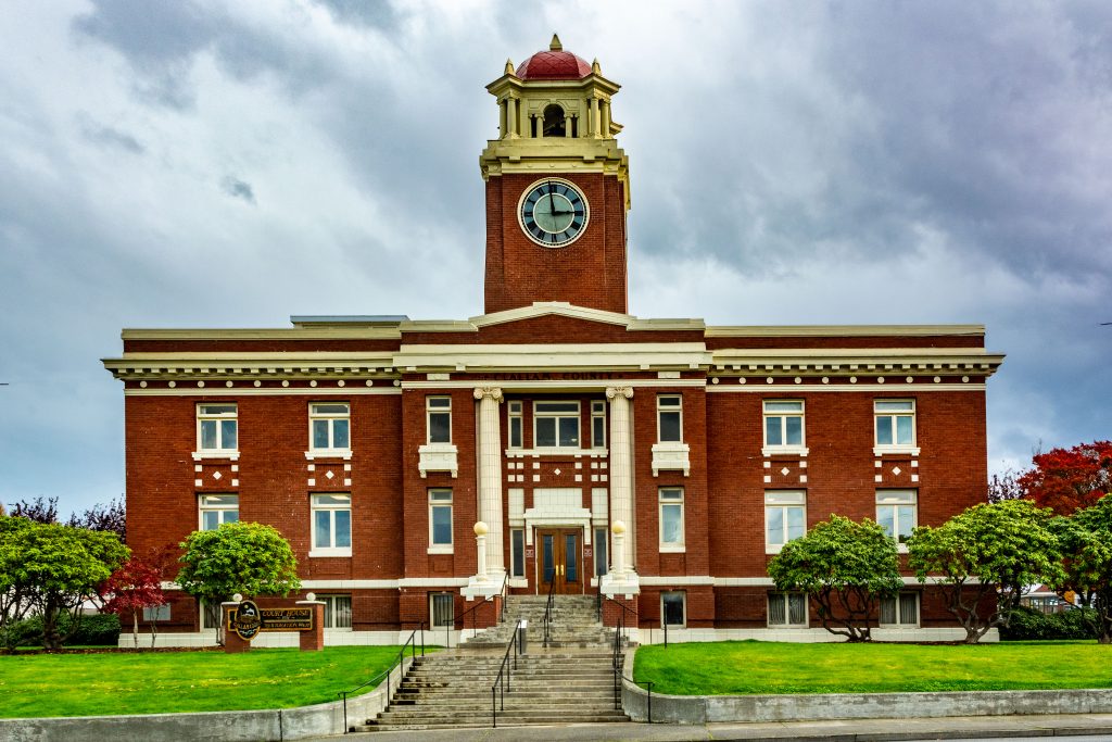
The largest city in Clallam County, Port Angeles has served as County Seat since 1890. The court house, seen above, was built in 1914 and has been renovated at least twice since then. The city got its start when settlers moved in among the Klallam villages that fronted Angeles Harbor. Early on, Port Angeles attracted attention. Isaac Stevens, acting as Washington Territory’s congressional delegate, suggested that the sheltered harbor would be a perfect naval base, much as Cherbourg was in France. This led to the creation of the Cherbourg Land Company, a business concern. Even U.S. Secretary of the Treasury Salmon P. Chase may have invested in Cherbourg.
One of Chase’s protegés, Victor Smith, came west to serve as Collector of Customs. Although his office was officially in Port Townsend, Smith worked to get the Port of Entry moved to Port Angeles. He was able to convince President Lincoln to designate a federal reserve in the smaller community. Accordingly, the Corps of Engineers platted a “federal townsite,” the only such city in the U.S. other than Washington, D.C. Smith moved his familty there—and several of his relatives did the same.
Utopianism and Port Angeles
The nineteenth Century was full of Utopian dreams. The Shakers and several other quasi-religious groups founded colonies all across the United States. One such group was the Puget Sound Co-operative Colony. Though not religious in nature, the Colony was the brain-child of two Seattle dreamers. Anti-Chinese and pro-labor, the founders saw a collective as the way to promote good working conditions—for white laborers only, of course. In the late 1880s, proponents raised money and recruited members across the nation. They bought land near Port Angeles and started businesses. Just as many such utopian communities, the Colony did not last. It did, however, succeed in building quite a city at Port Angeles. The 2019 Census estimated that 20,229 people live in Port Angeles, almost ten times the number counted in the city’s first census, 1890.
Forks and Sequim
Forks, Washington
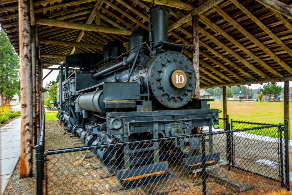
Forks, in the southwestern corner of Clallam County, lies on the site of an ancient Quileute village. Whites began settling in the 1860s, and Forks became an agricultural center with hops as a principal crop. Logging, however, built the town and even today, with logging in decline, the town calls itself “the logging capital of the world.” Incorporated on August 7th, 1945, Forks takes its name from the forks of three rivers in its immediate vicinity. With a 2019 estimated population of 3,880, Forks is the third largest community in Clallam County, Washington. The Shay locomotive shown above rests in a park alongside US 101—itself a reminder of the importance of logging to this community.
Sequim, with an 2019 estimated population of 7,640, is the second-largest community in the County. Located in the northeastern corner, on what topographers call the Sequim Prairie, Sequim lies in the rain shadow of the Olympic Mountains. Accordingly, it gets as little rainfall as Los Angeles. The air, however, is remarkably humid due to the proximity of the Strait of Juan de Fuca. This leads to a climate suited to growing lavendar, and indeed, the Sequim Prairie is second only to France as a producer of that herb. Every year, Sequim hosts the Sequim Lavendar Weekend on the third weekend in July. It also hosts the Irrigation Festival every May. Were it not for irrigation, the Sequim Prairie would be too arid for agriculture.
The Topography of Clallam County, Washington
Water defines Clallam County, as it does most of Washington State. The county is, of course, bordered by the Pacific Ocean and the Strait of Juan de Fuca. In addition six major lakes dot the county, and six major rivers flow from the Olympic Mountains down to the sea. Eight major bays grace the coastline and four lighthouses light the way. The highest point in Clallam County is Mount Angeles, south of Port Angeles. At 6,454 feet, Mount Angeles is the highest point along Hurricane Ridge. A trail leads to the peak from the Klahhane Ridge Trail in Olympic National Park. The Washington Trails Association suggests not attempting the climb if you are not up to a challenge.
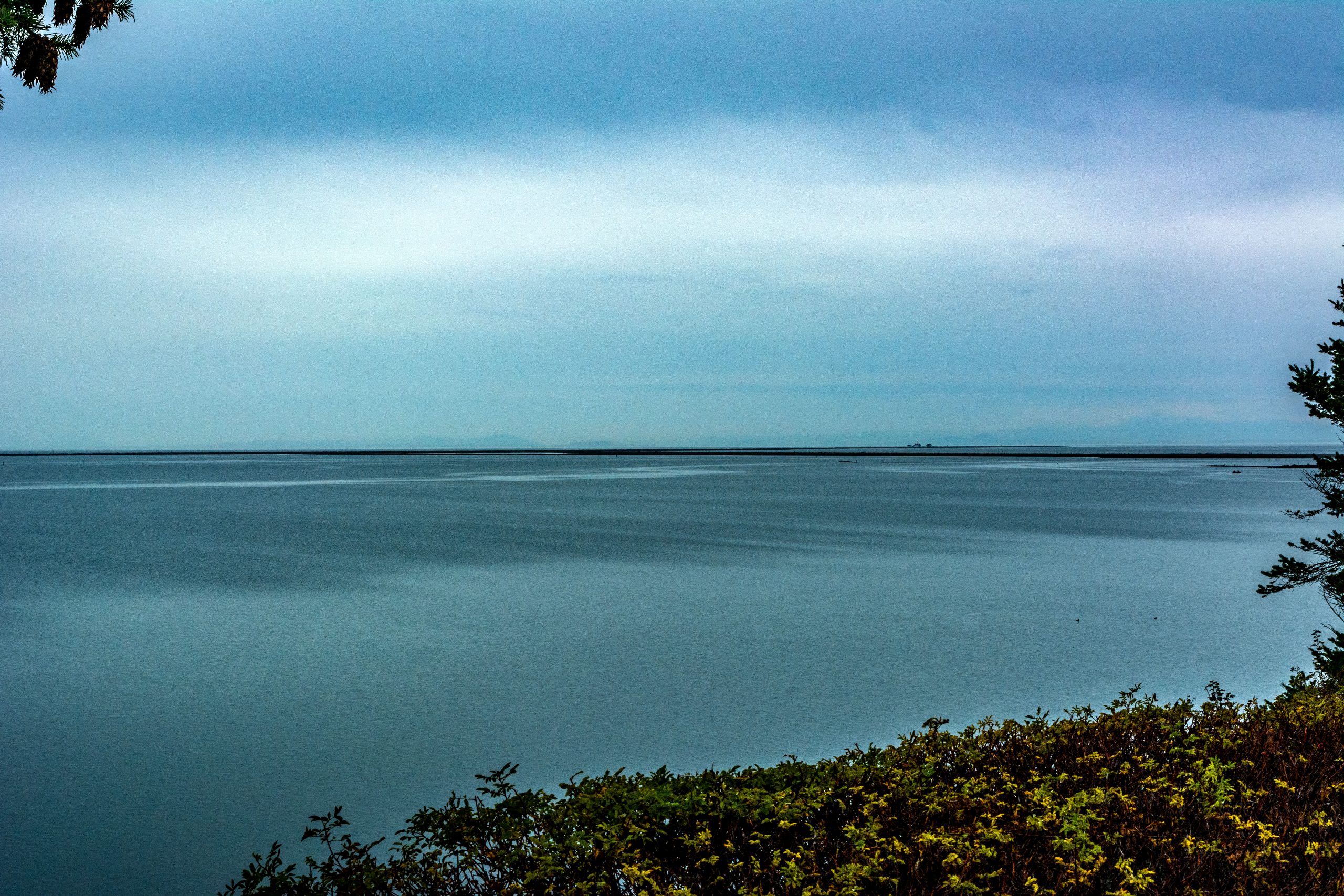
Two of the more unusual formations in Clallam County are the two sand spits that reach into the Strait of Juan de Fuca. The Encyclopaedia Brittanica defines a spit as “ in geology, narrow coastal land formation that is tied to the coast at one end.” A spit forms when river deposits are swept by prevailing winds or currents away from the immediate mouth of the river. The Ediz Hook protects the harbor at Port Angeles. Further east, the Dungeness Spit extends over five miles out into the Strait north of Sequim. Dungeness Spit is the longest naturally occurring sand spit in the United States.
My Travels in Clallam County, Washington
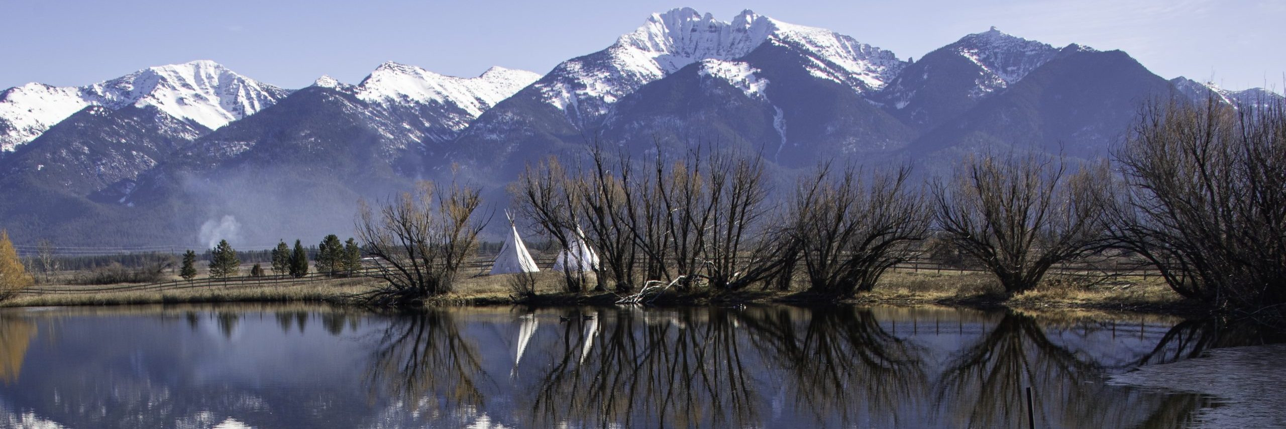
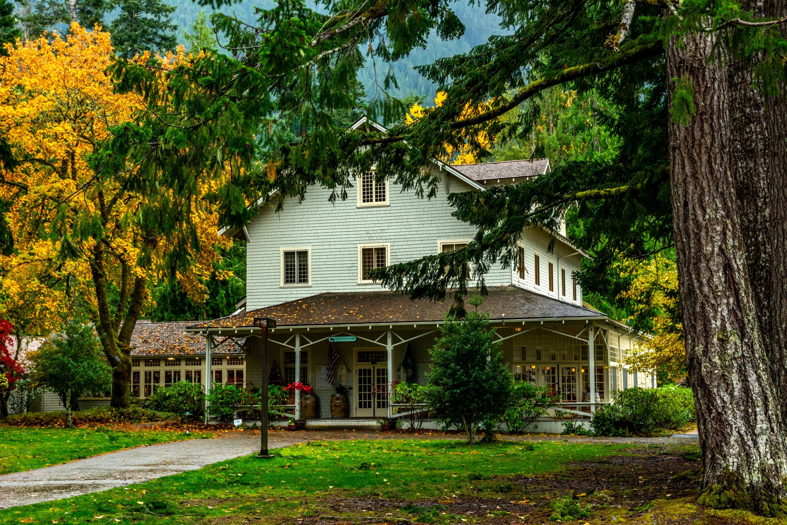
I have driven US Highway 101 through Clallam County twice. In 1972, a Swiss friend and I drove through the County without stopping on our way from Los Angeles to Boston. On October 24th, 2016, I returned to the Olympic Peninsula to get photographs for this work. On the latter trip I stopped at Forks, Lake Crescent, Port Angeles and Sequim. Four of the photographs I took are included in this post.
What I did not get to see, and have every intention of visiting on my next trip to Clallam County, is the northwestern corner of the Olympic Peninsula. To get there, you turn off US 101 at Sappho (if you’re going around the Peninsula clockwise). From that point you take Washington Highway 113 north toward Clallam Bay. Washington Highway 112 will take you the rest of the way to Neah Bay and eventually to Cape Flattery. An alternative route is to take Washington 112 all the way from Port Angeles to Neah Bay.
I would like to see Ozette Lake as well, and I’d love to drive north from Ozette to Cape Flattery. The roads as shown on my DeLorme Atlas are very thin red lines—but they are solid. I assume my SUV would be able to handle whatever the Olympic Peninsula throws at it. Many entrances to Olympic National Park head south off US 101, and I would love to explore these, too. In short, I still have much of Clallam County to see. Anyone want to come with me?
Endnotes
In closing, I need to mention that the phrase “The Authentic Northwest” is actually the motto of the city of Port Angeles. I have appropriated it for the entire county, but that is strictly my doing.
Also, I need to express my gratitude to the writers and compilers of History Link. History Link is a project devoted to sharing the history of Washington State. In this post I have used History Link writings by the following authors:
- Treaty of Point No Point, HistoryLink.org Essay 5637
- Clallam County Thumbnail History, Kit Oldham,,HistoryLink.org Essay 7576
- Port Angeles Thumbnail History, Kit Oldham, HistoryLink.org Essay 8210
- The Puget Sound Co-operative Colony, Kit Oldham, HistoryLink.org Essay 8219
| <Previous Post: Benewah County, Idaho | Next Post: Reviews of Two Important Books> |
| <Previous Washington Post: Walla Walla County | Next Washington County Post: Kitsap County> |
![]()
3 Comments
Comments are closed.