Ferry County, Washington
Introduction to Ferry County, Washington
In 1872, the U.S. Government set aside western Stevens County as the Colville Indian Reservation. The discovery of gold in British Columbia led to an influx of miners seeking to make their fortunes. In response, the Government reduced the size of the reservation and opened the northern half to non-native settlement. Prospectors sought gold south of the international boundary, settling in the area. In 1899, the state legislature created Ferry County, Washington, from the western portion of Stevens County. They named the new county for the last territorial and first state governor of Washington, Elisha P. Ferry.
From the beginning, the largest community in the county was and still is Republic. That city, Ferry County’s only incorporated municipality, became the County Seat. Northern Ferry County is predominately mountainous, with deep river valleys running north to south from the Canadian border. The forested mountains in the north are under Federal ownership (through the U.S. Forest Service’s Colville National Forest). With the Colville Reservation in the southern half the county, only 18% of the county’s land area is taxable. Covering 2,204 square miles, Ferry County is ninth in size among Washington’s thirty-nine counties. But with only 7,551 residents (according to the 2010 U.S. Census), it is 36th in population.
The Economic History of Ferry County, Washington
For most of its history, Ferry County has seen its share of boom and bust cycles. The County has depended on extractive industries (especially mining and logging). Between 1900 and 1970, the County’s population grew and declined as logging replaced mining, and cycles turned. But 1970 was the nadir, with the population down almost 20% from the County’s first census. Between 1970 and 1980, however, the population rebounded, growing almost 60% to 5,811 with no discernable reason for the growth. A call to the Republic Library got this answer. “We moved here in 1979. It was the ‘back to the land’ movement.” If indeed participants in that movement were set on finding a place away from the trials and rampant commercialism of urban life, it would be hard, in Washington State, to find a place more remote than Ferry County.
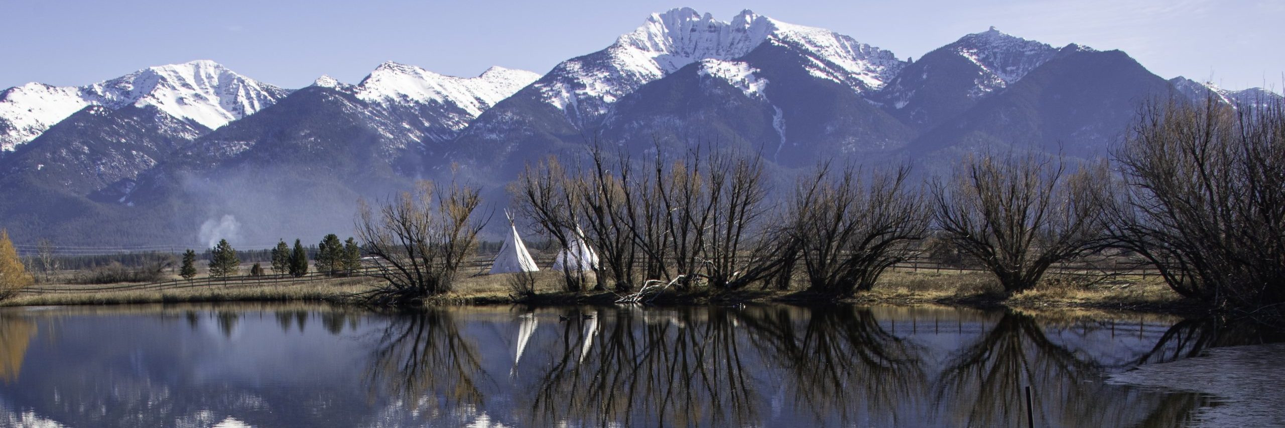
For 32 miles, U.S. Highway 395 runs north from Kettle Falls (in neighboring Stevens County) to the Canadian border. That is the only federal highway in the County. Washington State Highways 20 and 21 serve the rest of the County. Sherman Pass on Highway 20 at 5,574 feet is the highest pass in Washington that is open year-round. It is roughly half-way between Republic and Kettle Falls. Highway 21 connects the Canadian border to the Columbia River and beyond. However, the only way to cross the river is by ferry at Keller. The County, in my opinion, is scenically beautiful, but largely unsuited for suburban life.
Republic, the Seat of Ferry County, Washington
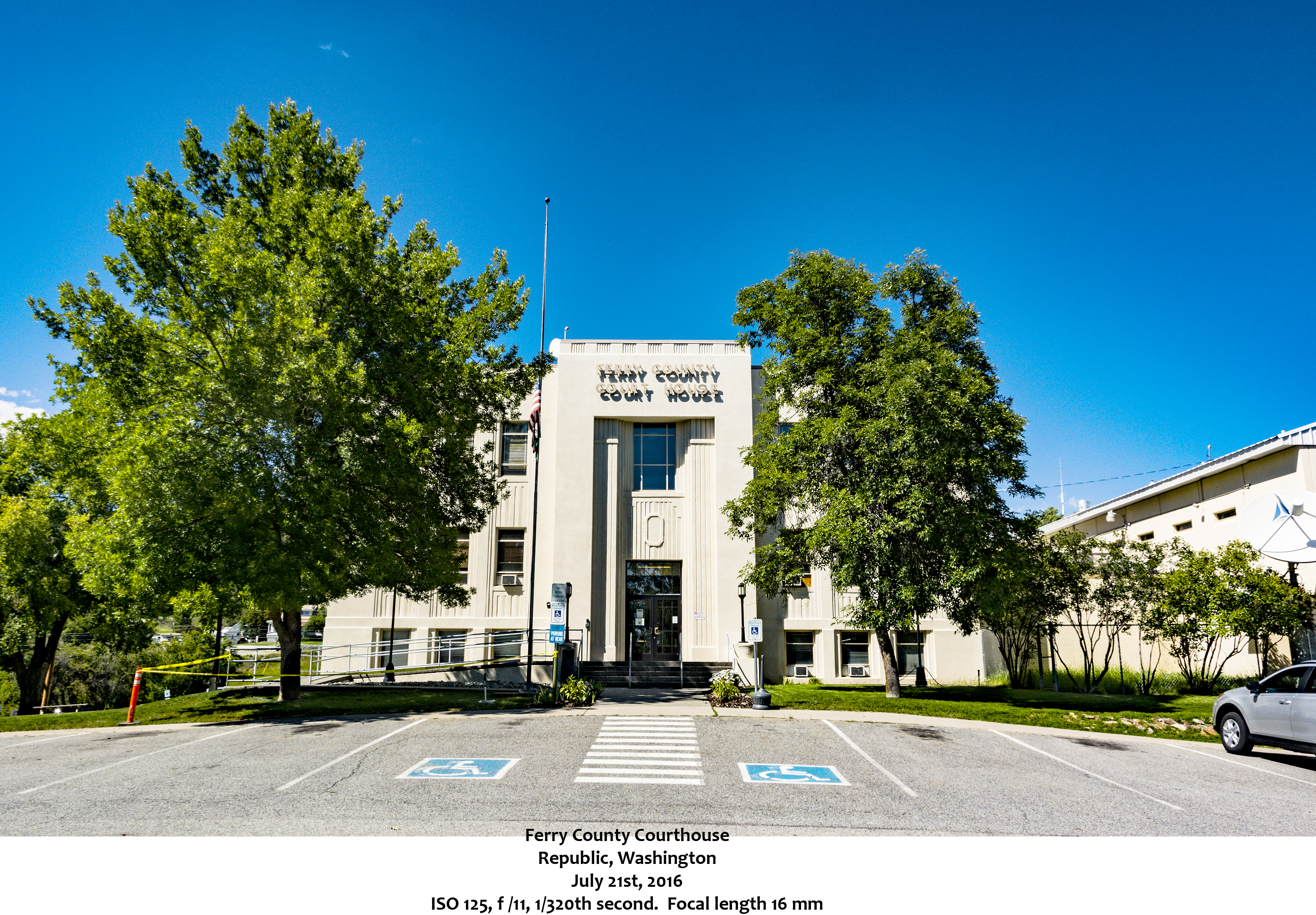
The county seat, Republic, was incorporated as a city on May 22, 1900. Originally named Eureka, the town had to take a new name. The U.S. Post Office rejected the name Eureka as a post office in Clark County already had that name. The new name came from the Great Republic Mine, the highest producer of gold in the immediate area. To this day there are gold mines in the hills surrounding the city. Prospectors’ Days, the second weekend in June each year, celebrates the history of mining and logging in the region.
The Kinross Gold Company is one of the city’s two largest employers along with the Ferry County Memorial Hospital. Republic is home to the Ferry County Fair where children of all ages can enjoy the Ferry County Carousel. The city is also the site of the Stonerose Interpretive Center and Fossil Site. Stonerose is famous for the Eocene fossils found in a 49-million-year-old lake bed at the north end of Republic.
Recreation in Ferry County, Washington
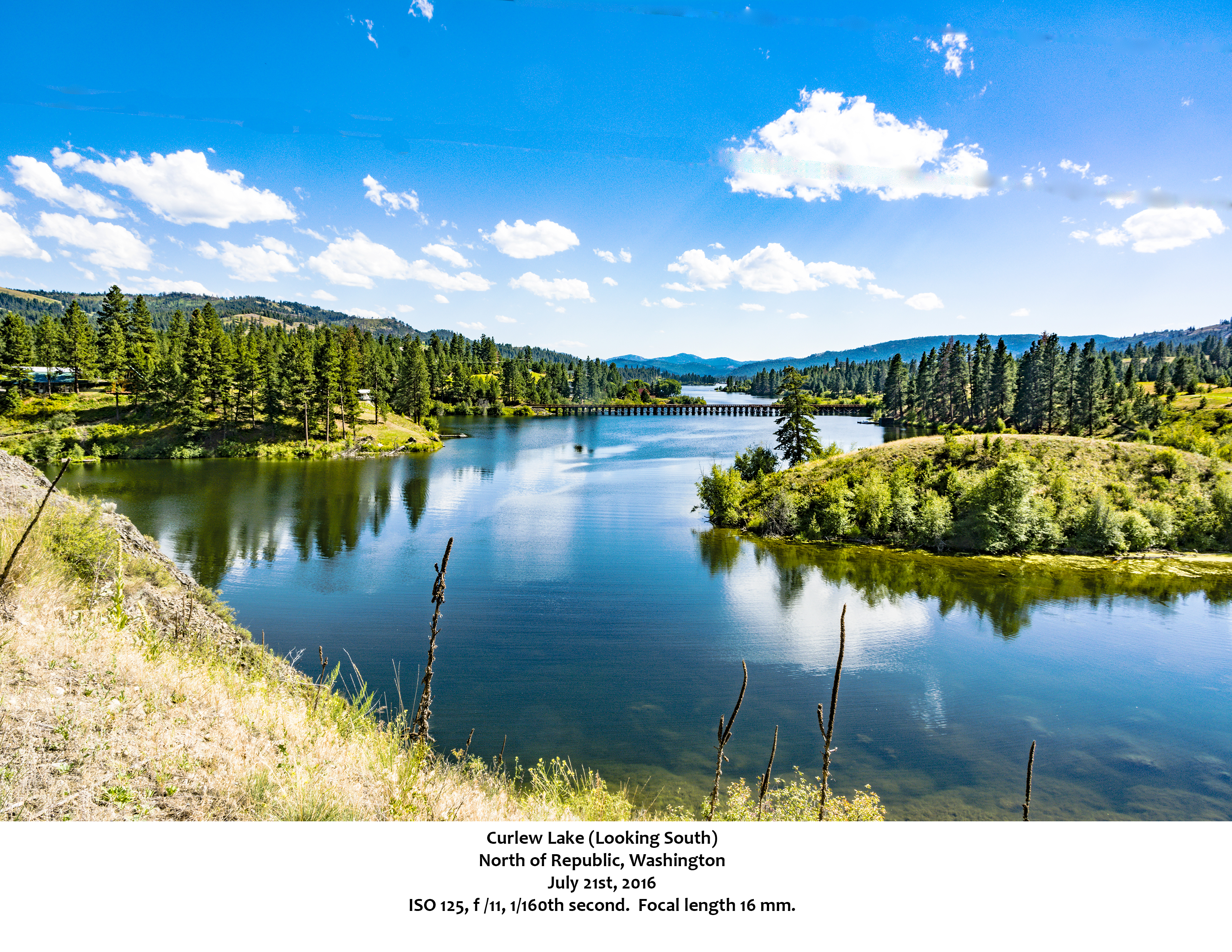
Ferry County provides almost endless recreational opportunities. Curlew Lake (and the eponymous State Park) are just north of Republic. The park has bike and hiking trails, a boat ramp and docks. It also has camping spots, and, as the State Park’s web site notes, “snow play” in the winter. Fishing is popular on the lake, both for humans and for birds. That makes it an ideal spot for birdwatching as well.
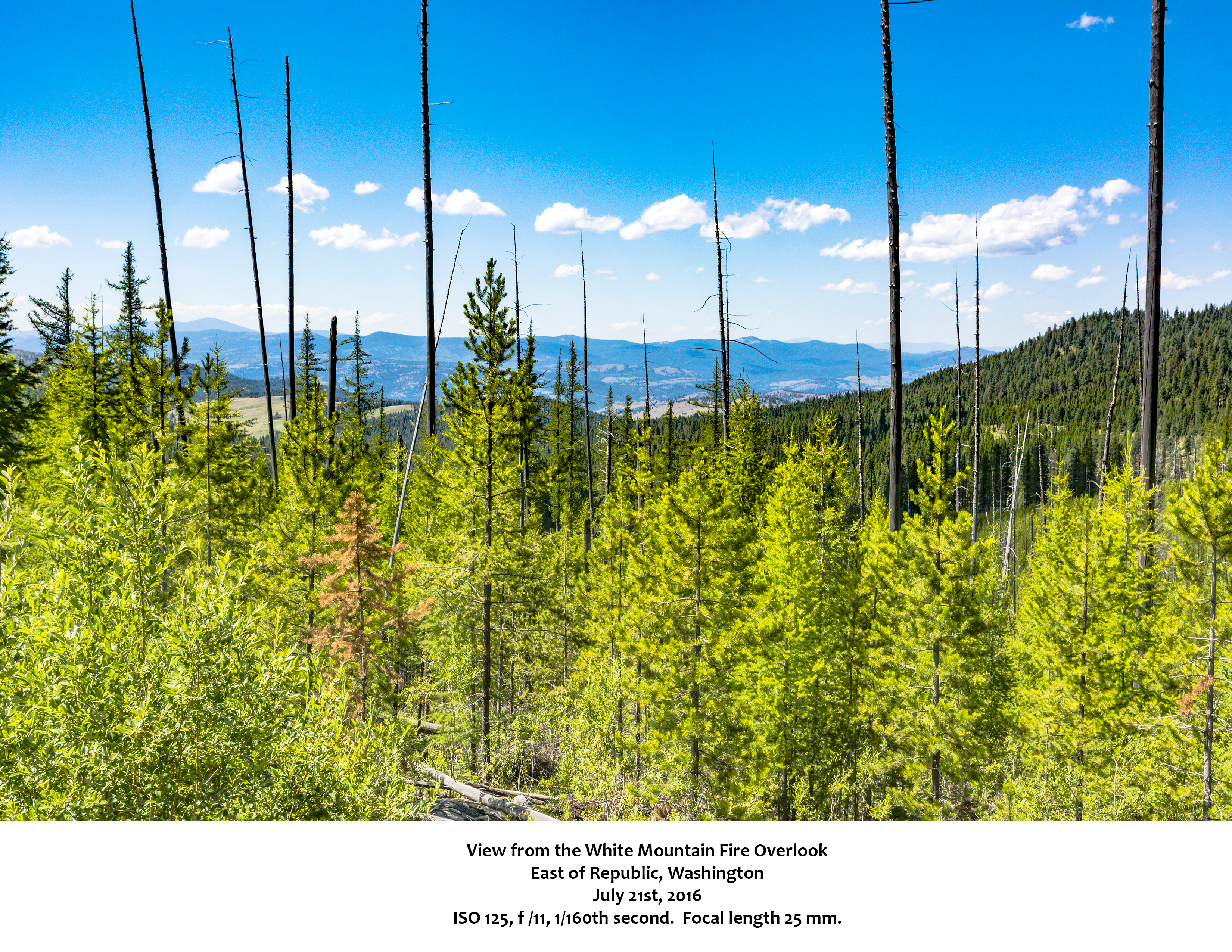
Other lakes nearby include Swan Lake, Ferry Lake, Fish Lake and Long Lake, all clustered off Highway 21 south of Republic. Trout Lake and Emerald Lake lie east of Republic across Sherman Pass. Of course, Lake Roosevelt pretty much defines the eastern and southern borders of Ferry County. At Sherman Pass, visitors can park their vehicles and walk a short trail marked with interpretive signs.
Other Communities in Ferry County, Washington
Many small towns dot the Ferry County landscape. Technically, these are Census Designated Places, as none have incorporated. The smallest, Laurier, is surely one of the few US towns named for a Canadian Prime Minister. It had a 2010 population of one. Curlew Lake was the largest with a 2010 population of 462. Do not confuse Curlew Lake with the town of Curlew (2010 population 118). Curlew Lake CDP rings the lake itself just north and west of Republic.
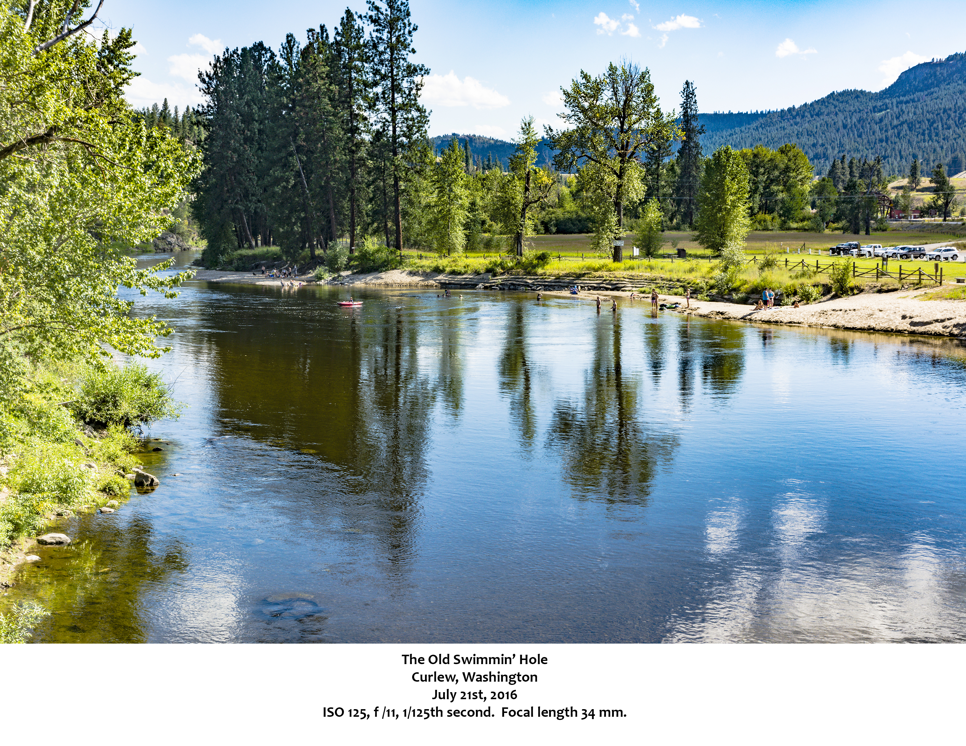
Curlew lies further north on Highway 21, twenty-one miles north of Republic and ten miles south of the Canadian border. One of Curlew’s notable features, “the old swimmin’ hole,” attracts crowds to the Kettle River. During Prohibition, people dropped barrels of liquor in the River across the border in Canada. The barrels then floated downstream. Curlew was the point where they took the “fire water” out of the River. Today, those early times are remembered the first Sunday each June with the Curlew Barrel Derby Days.
Danville, the first town settled in the county, sits just below the international border on Highway 21. Keller, at the southern end of the county, has moved progressively north in an attempt to avoid the rising waters of Lake Roosevelt. At one point, Keller had a population of over 3,000, but apparently people got tired of watching their homes flood. The 2010 Census counted 234 people in the town. Inchelium, in the southeastern part of the County, is the largest community (2010 population 409) in Ferry County’s portion of the Colville Reservation. Like Keller, Inchelium relocated to avoid Lake Roosevelt which covered the original town site. All of Ferry County’s towns have fascinating stories, much worth researching and visiting.
My Drive Around Ferry County, Washington
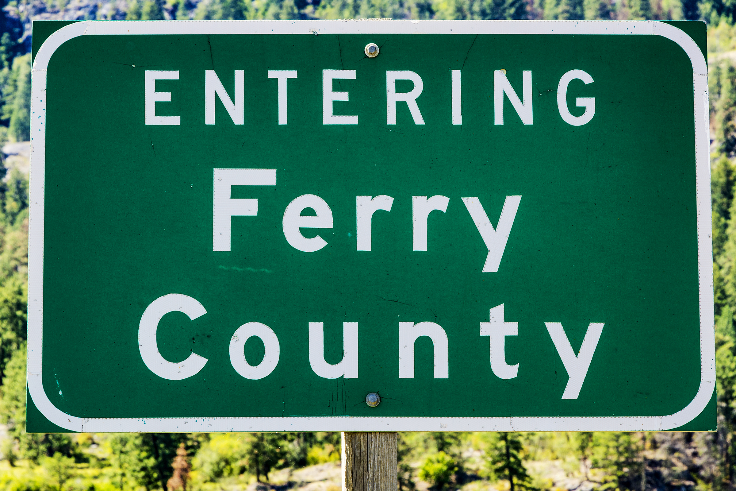
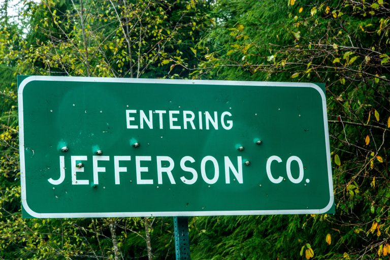
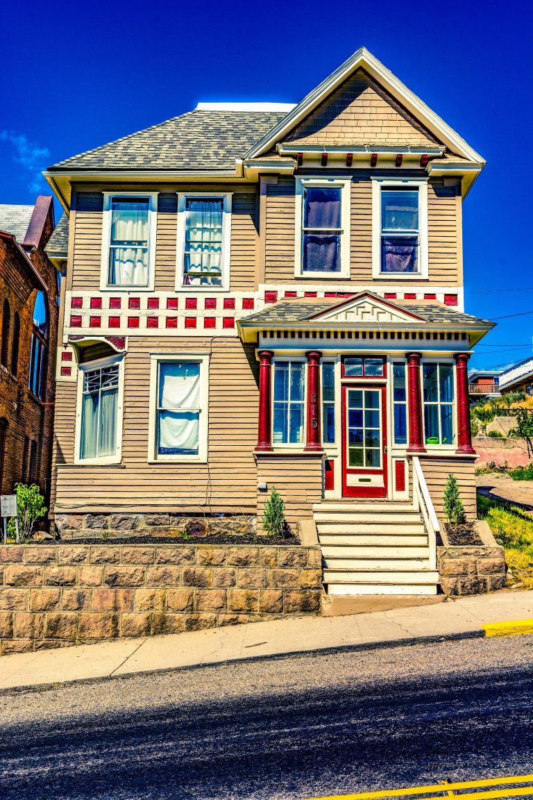
On July 21st, 2016, I spent a day driving around northern Ferry County. I entered the County by crossing the Columbia at Kettle Falls on Washington Highway 20. I proceeded west, crossing Sherman Pass and stopped in Republic. After photographing the Court House and several other buildings, I continued west on 20 to the Okanogan County line where I captured the Ferry County sign. Heading back toward Republic, I turned north on Swamp Creek Road which led me to Curlew Lake Road.
After stopping in Curlew for several photographs, I headed east on the Deer Creek-Boulder Creek Road which crossed the mountains. Once I reached U.S. 395, I turned south and returned to Kettle Falls. My drive meant that I missed all of southern Ferry County as well as the northern end of the County. I hope to rectify both of those gaps with my next visit to Ferry County, Washington.
![]()
Wow that was strange. I just wrote an very long comment but after I
clicked submit my comment didn’t show up. Grrrr…
well I’m not writing all that over again. Anyways, just wanted to say great
blog!
Thank you. I wish I could see the whole comment–the one that disappeared.