Klickitat County Washington
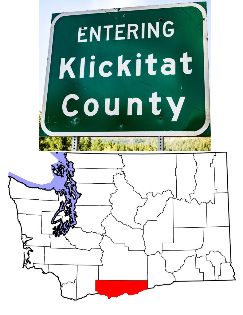
An Introduction to Klickitat County Washington
The Washington Territorial Legislature created Klickitat County on December 20th, 1859. To do this, they took land along the Columbia River from Walla Walla County. The County’s name comes from the people native to the area, the Klickitat Tribe. The long, relatively narrow county covers 1,904 square miles of which 33 are water. It is the 16th largest county in Washington. The 2019 estimated population was 22,425 which ranks 30th of Washington’s thirty-nine counties.
A Brief History of Klickitat County
1860 marked the first U.S. Census for Klickitat County. The total count that year was 230. Twenty years later, the official count was up to 4,055. For its first ten years, the new county spelled its name with a “C”, Clickitat. Only in 1869 did it take its current spelling.
White settlement began with folk moving east from the Willamette Valley. Erastus S. Josyln was the first to farm in the area. He and his family built their home around 1852. It was in the southwestern corner of the County, near today’s White Salmon.
The Birth of Agriculture
The dry hills between the Columbia and the Simcoe Mountains encouraged ranching. Both cattle and sheep were important parts of the early County economy. Ranching led to growing hay and grain for fodder. That in turn led to growing wheat for human use.
And I am Marie of Romania
There are many contenders for the origin of the phrase “What the Sam Hill.” Klickitat’s own Sam Hill isn’t one of them. Entrepreneur, visionary, millionaire, Sam Hill was a strong proponent of Klickitat County. It was Hill who built the first World War I memorial in the U.S. Located on a bluff above the Columbia River, a concrete version of Stonehenge honors the men of Klickitat County who lost their lives in the War. Today, the memorial has company. Across the parking lot is a memorial to those lost in more recent wars.
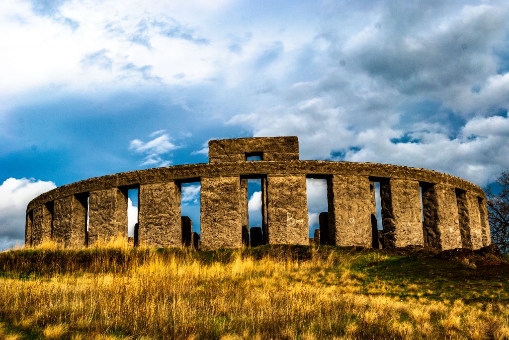
The First World War I Memorial in the U.S.
Maryhill, Washington
Hill also built a mansion near his memorial. He planned for the mansion to be his personal home, but that didn’t happen. Before he could finish the building, Queen Marie of Romania came for a visit. She dedicated the building as the Maryhill Museum of Art, and so it stands today. With an impressive collecton that includes Rodin sculptures, French couture and Russian icons, Maryhill would stand out anywhere. High on a bluff overlooking the Columbia in rural Klickitat County, it is amazing.
A parenthetical side note–not for the humor impaired
I do apologize, but the combination of Sam Hill and Marie of Romania brings Dorothy Parker to mind. In her 1939 collection of light verse, Enough Rope, Parker included this quatrain:
“Oh, life is a glorious cycle of song,
a medley of extemporanea,
And love is a thing that can never go wrong,
and I am Marie of Romania.”
We just don’t hear enough about Marie of Romania these days. And the U.S. 97 bridge across the Columbia is the Sam Hill Memorial Bridge.
The Native Inhabitants of Klickitat County
When Lewis and Clark traveled through the region, they met a people they named the Wah-how-pums. This is actually pretty close to what the people called themselves. The name the Klickitat tribe used was X̣ʷáɬx̣ʷaypam or, as Wikipedia transliterates it Qwû’lh-hwai-pûm. Lewis noted that the Wah-how-pums spoke a language related to the Choppunish. Modern linguists conquer. Lewis’s Choppunish were the Nez Perce and both Nez Perce and Klickitat are Sahaptin languages. You can read the accounts Lewis, Clark and others left on April 23rd, 1806.
Conboy Lake National Wildlife Refuge
Archaeological research in the Conboy Lake area show humans in the area as long as 11,500 years ago. Conboy Lake is in a region called the Camas Prairie in northern Klickitat County. It lies within the boundaries of the Yakama Indian Reservation. The U.S. Fish and Wildlife Service states that there are 76 recorded archaeological sites on the Conboy Lake National Wildlife Refuge. While these include sites showing remnants of white settlement, there are numerous sites proving pre-contact native use of the area—predominantly Klickitat and Yakama.
The Klickitat People
The Klickitat likely came into the region from the east. The proved to be fierce warriors but also astute traders. They would travel in bands of as many as 700, which overwhelmed smaller native communities they encountered. Their travels took them as far south as the Rogue River in Oregon. At one point, they claimed to have defeated the native people of the Willamette Valley. White settlers in the Willamette knew the truth, and forced the Klickitat to return north of the Columbia.
With the Treaty of 1855, the Klickitat became part of the Confederated Tribes and Bands of the Yakama Nation. Most now live on the Yakama Reservation, a portion of which lies in Klickitat County. The NDNHistoryResearch website has a inciteful article on the Klickitat People.
Goldendale–The Klickitat County Seat
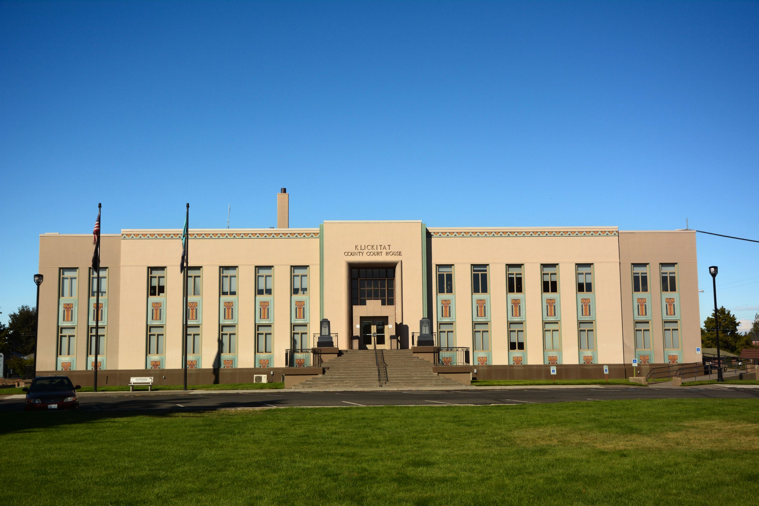
Prior to 1878, Rockland Flats on the Columbia served as the Seat of Klickitat County Washington. Rockland Flats, now called Dallesport, has the third highest population of any community in the County. It is, however, unincorporated and the U.S. Census calls it a Census Designated Place. It was the location of the first ferry across the Columbia which started operation in 1854. Ninety-nine years later, the Dalles Bridge opened for traffic connecting Washington and Oregon via U.S. Highway 197. Dallesport, Washington, is also the home of The Dalles Oregon Airport.
Goldendale began when John Golden settled there in 1859. Golden was responsible for surveying and platting a townsite in 1872, a town he named for himself. On November 5th, 1878, the voters of Klickitat County chose Goldendale to be the seat of government.
Located in the Klickitat Valley on the Little Klickitat River, Goldendale became a hub for the farmers and ranchers in the Valley. Hub it may be, but one without spokes. No roads or rails connected Goldendale to the outside world until the Columbia River & Northern Railway began operations in 1903. The Spokane, Portland and Seattle Railway came through in 1908. In 1970, the SP&S became part of the Burlington Northern Railway.
Highway connections did not exist until 1926 when State Route 8 came through from Vancouver. In 1939, the highway that is now U.S. 97 allowed travel to Yakima and points north.
Goldendale Today
Goldendale today is home to the Goldendale Observatory. During the total solar eclipse on February 26th, 1979, the town expanded to host 15,000 people wanting to experience totality. Dedicated in 1973, the Goldendale Observatory is a Washington State Park Heritage Site. It offers educational programs and the use of a public telescope.
With a 2019 estimated population of 3,505, Goldendale has lost population over the past 20 years. In fact, the 2019 estimate doesn’t even match the City’s population in 1980. Part of the problem lies with the closure in 2003 of the Goldendale Aluminum Plant. The plant had been in operation since 1970, and its closure meant the loss of a substantial number of jobs.
Other Communities
Two thirds of the County’s residents live outside of incorporated areas. Wikipedia lists ten “Census-Designated Places” around the County, and seven unincorporated communities. It also lists four ghost towns. But only two communities other than Goldendale are incorporated.
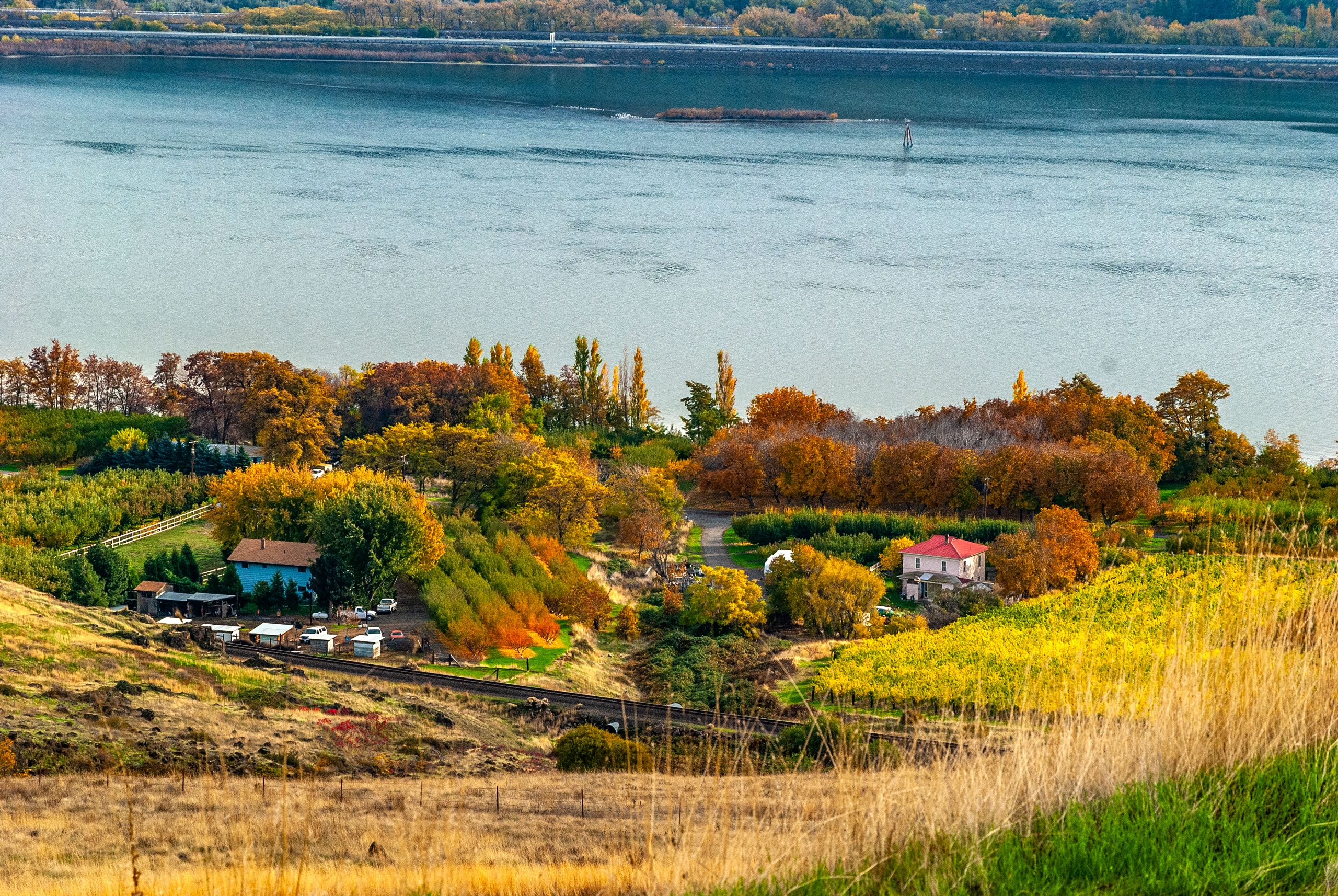
Bingen (2019 population estimate 742) lies on the north bank of the Columbia in western Klickitat County. Founded in 1892 by P.J. Suksdorf, it takes its name from the German town Bingen-am-Rhein. The city incorporated in 1924.
White Salmon grew up side by side with Bingen. The story is that two families feuded. The Suksdorf family called Bingen home and the Jewett family lived in White Salmon. Bingen is on the river, White Salmon up on the bluff overlooking the river. The 2019 estimate puts 2,691 residents in White Salmon, second only to Goldendale in Klickitat County.
The two towns fought over the railway station. This resulted in the only Amtrak station in the U.S. named for two towns: Bingen-White Salmon. Amtrak’s Empire Builder stops at Bingen-White Salmon and also at Wishram , 28 miles east and also in Klickitat County. Those are the only stops between Vancouver and Pasco.
With the exception of Dallesport noted above, no other Klickitat County community has over 1,000 residents. Most have much fewer. Trout Lake, twenty-four miles north of Bingen, had 557 residents in 2010, and Lyle, ten miles east of Bingen, had 499. Lyle is where the Klickitat River meets the Columbia.
Topography
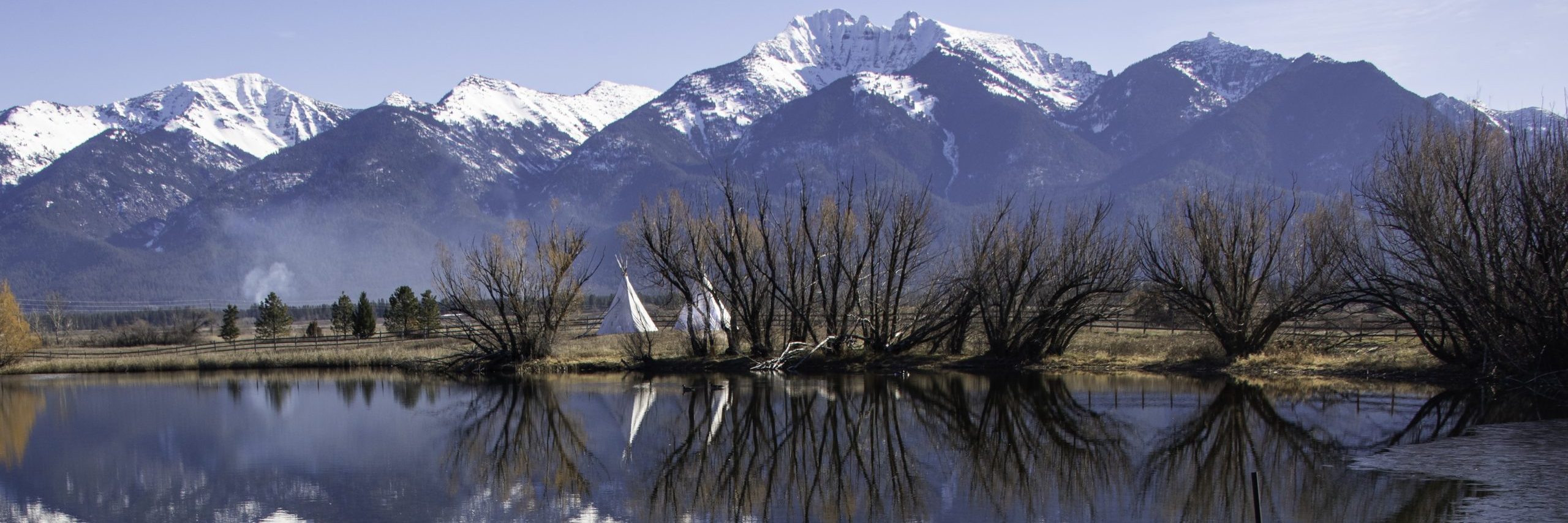
Klickitat County Washington is bordered on the north by the Simcoe Mountains. These are a much older volcanic area than the arc of volcanoes in the Cascades. To the south, the Columbia Hills rise before dropping off into the river of the same name. In between are various areas my map names “High Prairie,” “Klickitat Valley,” and The Burn. A closer look at a topo map shows that even eastern Klickitat County is far from flat. (Western Klickitat County is part of the foothills to the Cascades.) The map shows such designations as Tule Canyon, Stegman Canyon, even Dead Canyon.
The County has few lakes, and most of them appear to be landlocked portions of the Columbia River. Conboy Lake on the Yakama Reservation is the largest lake in the County. The centerpiece of the 11 square mile Conboy Lake National Wildlife Refuge, the lake is accessible by back roads off Washington 141 and 142.
Wild and Scenic Rivers
Washington has six Wild and Scenic Rivers, so designated under the National Wild and Scenic Rivers Act of 1968. Two of those six are in Klickitat County. The Klickitat River flows south from Mount Adams to merge with the Columbia at the town of Lyle. The lower 10.8 miles are “Recreational” in classification under the Act. The river drops 26 feet per mile, and is a popular boating and fishing stream. The federal website covering the river states that boaters are required to take out above Lyle Falls. It adds: “The first drop, Lyle Falls, is a class 5+ and combined with the narrow canyon beyond is deadly to almost all who miss the take out.” Consider yourself warned!
The White Salmon River’s classification is split between 6.7 miles of “Wild” and 21 miles of “Scenic.” Also flowing south from Mount Adams, the river is 44 miles long. The two designated stretches are not contiguous. The lower portion of the river drops 50 feet per mile. The river flows through the White Salmon River Gorge which the government website calls “the longest vertical wall gorge in the region…” It also says “Continuous rapids, waterfalls, and abrupt drops challenge boaters of advanced skill.” I’m up for a challenge.
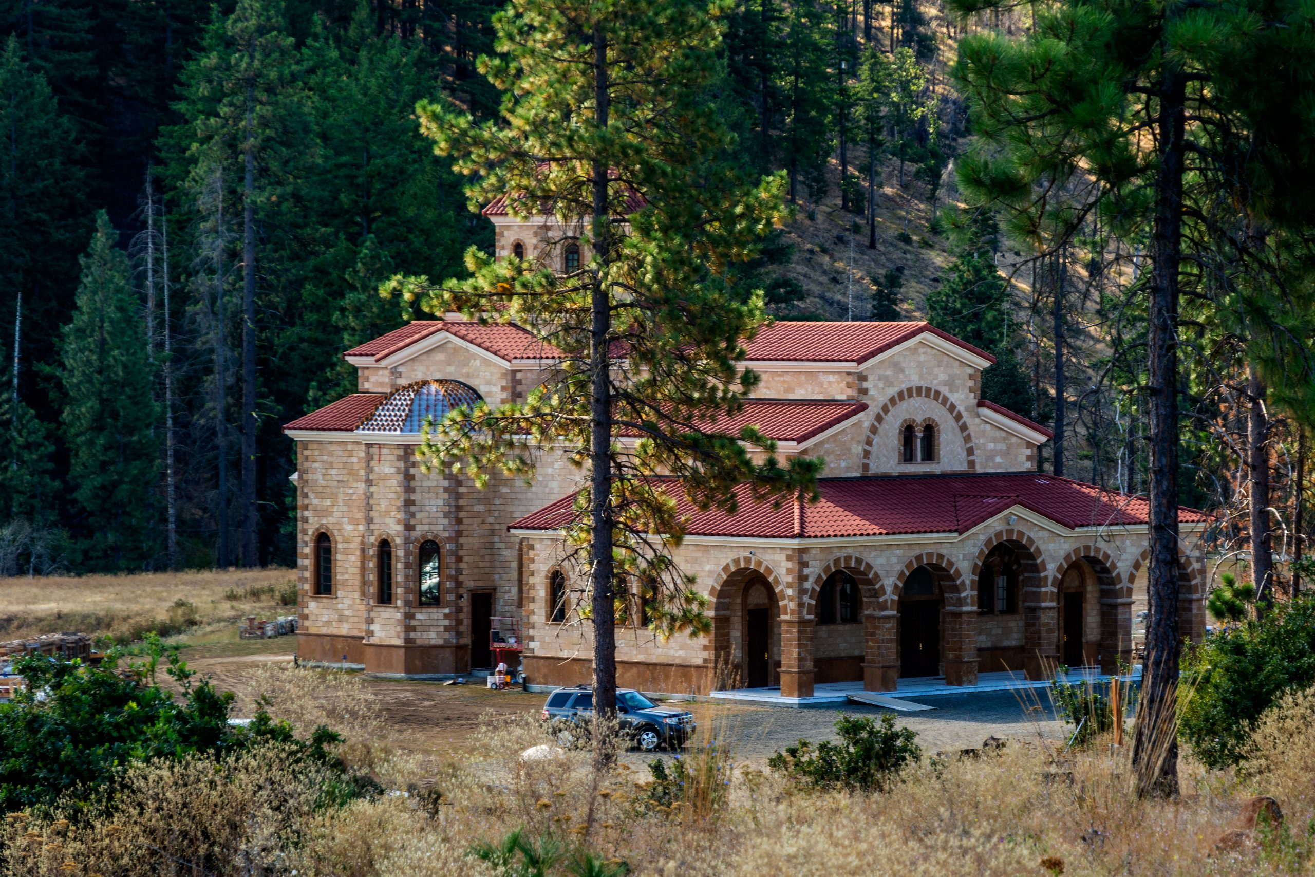
TheGreek Orthodox Monastery of St. John Forerunner, Goldendale, Washington
My Drives Through Klickitat County
There are two main roads crossing Klickitat County. U.S. Highway 97 runs north to south, entering the County from Yakima County south of Toppenish. It crosses the County, passing through Goldendale, and leaves the county (and Washington State) when it crosses the Columbia via Sam Hill bridge. Washington Highway 14 runs east to west parallel to the Columbia. Those are the only two highways that actually cross the whole county. I have driven both in their entirety.
The next time I drive U.S. 97, I will stop at the Greek Orthodox Monastery of St. John Forerunner. Founded on May 13th, 1995, the Monastery was built by nuns who came from Greece with instructions to build a community and make it pay for itself. The built their new home and added a bakery and coffee bar. They have been very successful at paying for their monastery.
Two other state highways cross the County, but do not have any connections outside of Klickitat County. Washington Highway 141 is a scenic drive that begins at Bingen and heads north toward Mount Adams. Washington Highway 142 begins at Lyle and follows the Klickitat River north until it turns east and terminates at US 97 in Goldendale. I have not been on either highway, but both call to me. Highway 141 climbs along the White Salmon River and crosses the river at Husum. Apparently, it’s great fun to watch first time rafters dropping the 12 feet over Husum Falls.
Sites to Visit
Highway 141 is also the only way to get to Trout Lake where in 1893 Swiss immigrant Chris Guler built a hotel and camp ground. He thought he would capitalize on the area’s resemblance to his native land. The area’s population grew and in 1904, German brothers Herman and Henry Thode built an Amusement Hall. It had a dance floor, a stage, a soda fountain, and even a bowling alley. The alley, I must say, had only two lanes. Today, the Trout Lake Tourist Club is on the National Register of Historic Places. I think I have to visit.
A similar, though more wholesome spot would be the Appleton Log Hall. Built entirely by local volunteers in 1912, the Log Hall served as Community Center for the small community of Appleton. North of Lyle and west of Klickitat, Appleton is not on the way to anywhere. Still, it sounds like a place I need to see. Especially since the Log Hall is also on the National Register. Sounds like I need to return to Klickitat County Washington.
![]()
i love this appropriate post
Thank you. –Bryan