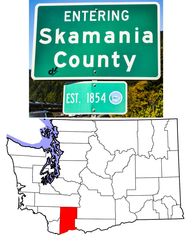
Skamania County
Skamania County History
In 1854, the new Washington Territory went a bit crazy. It created eight new counties between March 9th and April 26th. The two created on March 9th were Skamania County and Whatcom County. Taking alphabetical order into consideration, we will start with the large block on the southern edge of the state.
In the beginning, all of Oregon Territory north of the Columbia was part of Clark County. As we have seen, Oregon Territory created several counties out of the western section of Clark County–that is everything west of the Cascades–between 1845 and the establishment of Washington Territory in 1853. Central and eastern Washington fell to the Washington Territorial Legislature for county creation. Looking at the map above, it is hard to ignore the fact that the eastern line of those counties from Whatcom in the north to Lewis in the south is jagged, following the crest of the Cascade Mountains. When that line reaches Skamania County, however, it becomes a straight line south. Indeed, with the exception of the County’s southern line–the Columbia River–all the County boundaries are ruler straight.
Having created Skamania County from Clark County on March 13th, 1854, the Territorial Legislature took most of the new County’s land to form Walla Walla County on April 25th, 1854. Eleven years later, in January 1865, the Territory decided to abolish Skamania County altogether. The U.S. Congress did not approve of this action, however, and in 1867 the Territory reversed itself, and recreated Skamania County. I’d love to know what they were thinking. You can find an excellent article on the history of Skamania County on the Washington State History site, HistoryLink.org here.
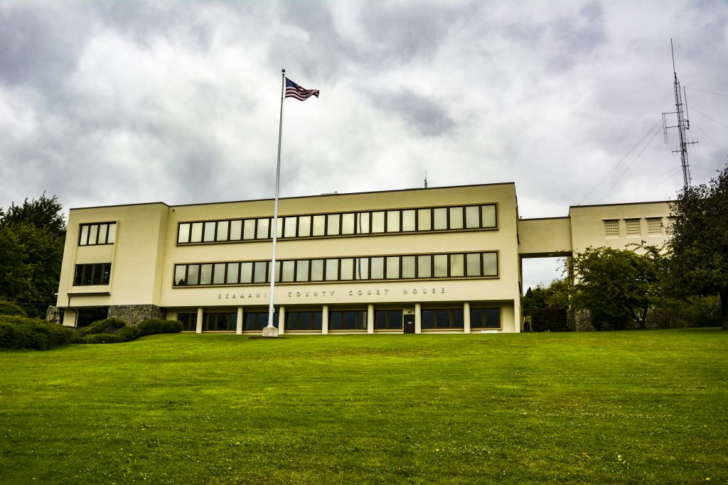
Today, Skamania County covers 1,656 square miles (24th of the 39 Washington counties) and as of 2016 had a population of 11,659 (34th). The County is completely rural, with Stevenson, the County Seat, having an estimated population of 1,555 (2016) Three Federal entities cover almost 80% of the land area in the County which severely impacts the County’s tax base. In fact, when you add State and County land to the Federal acres, and include tax exempt organization’s property, less than 2% of the County’s land base is fully taxable.
The People of Skamania County
In the grand scheme of history, the Columbia River was the home to the Chinook people. The Chinook lived in villages scattered along both sides of the Columbia from east of the Dalles all the way to the Pacific. Three major groups of Chinook exist–Lower, Middle and Upper–and these various groups lived in over fifty separate villages. In what is now Skamania County, the specific Chinook people were the Chilluckittequw, an Upper Chinook people. Salmon made up their primary food source, but they also hunted game and collected nuts and berries. Lewis and Clark met them on their way west, and estimated their number at 2,500. It is these people who gave the County its name. The Chinook word sk’mániak means “swift waters.”
The Corps of Discovery may have been among the first European Americans to visit the area, but they were certainly not the last. A geographic feature no longer visible, the Columbia Cascades, forced travelers to leave the river and portage around the treacherous water. The enterprising Chilluckittequw charged a toll to cross their lands. Unfortunately for the native people, the newcomers brought diseases to which the natives had no immunity, and by the middle of the nineteenth century, the local native population had dropped to a few hundred.
As travelers on the Oregon Trail reached the area, some chose to stay, and white settlement increased until the three communities, Upper, Middle and Lower Cascades became one of the largest population centers in Washington Territory. Indeed, in 1854, when Skamania County came into being, the military post at Lower Cascades became the County Seat. For reasons that remain unclear, in 1893 a group of men stole the County records and took them to what would become Stevenson. Their action, unlawful though it undoubtedly was, saved the County records as a major flood distroyed the Lower Cascades site in 1894.
Stevenson, Skamania’s County Seat
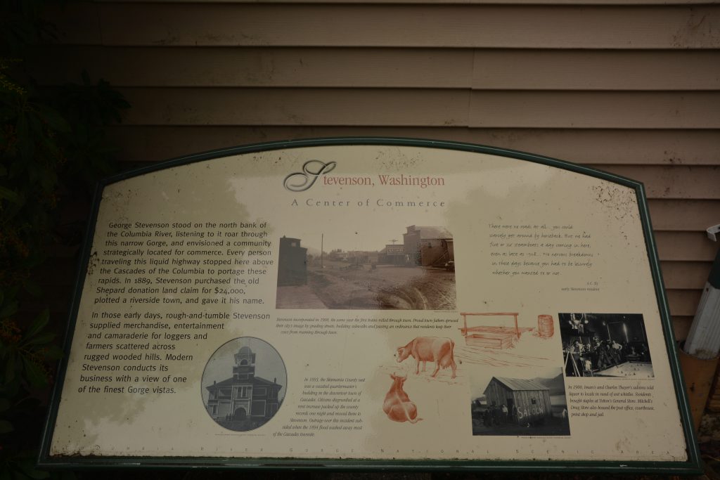
The historic sign in the center of Stevenson reads:
George Stevenson stood on the north bank of the Columbia River, listening to it roar through this narrow Gorge, and envisioned a community strategically located for commerce. Every person traveling this liquid highway stopped here above the Cascades of the Columbia to portage these rapids. In 1889, Stevenson purchased the old Shepard donation land claim for $24,000, plotted a riverside town, and gave it his name.
In those early days, rough-and-tumble Stevenson supplied merchandise, entertainment and camaraderie for loggers and farmers scattered across rugged wooded hills. Modern Stevenson conducts its business with a view of one of the finest Gorge vistas.
The sign gives a good description of the founding of Stevenson. It even hints at some the town’s history. But what it doesn’t talk about is Stevenson today. I found it a charming little city in a beautiful location. Stevenson is a place I would gladly stay, as the town offers many attractions. The City’s website invites the viewer to “Make Stevenson Your [fill in the blank] Headquarters, and lists nineteen restaurants, ten adult drinking establishments, and activities that range from golf to fishing to windsurfing, not to mention hiking and exploring the Columbia Gorge’s north bank. George Stevenson’s plotted town has grown to accomodate a population of 1,555 (2017 estimate) and is home to the Columbia Gorge Interpretive Center Museum. Believe me, there’s plenty to keep your interest in Stevenson, Washington.
Skamania County Communities
Aside from the County Seat, several other communities scatter around southern Skamania County. North Bonneville, eight miles west of Stevenson on Washington Highway 14, grew up around the construction of Bonneville Dam in the early 1930s. Incorporated in 1935, the town showed a 1940 population of 643. Over the next several decades, the town lost residents until in 1980 only 394 people called it home. It probably didn’t help that in the 1970s, the Bonneville Power Administration decided to build a second powerhouse on the dam, and the whole town had to pick itself up and move. The federal government kicked in $35 million to create a new town with the same name, and on July 29th1978, the town celebrated its move. Designed to occommodate 1,500 residents, the town has grown, decade by decade to the point that the 2017 estimate shows 999 residents in the former “company town.”
Less than five miles east of Stevenson, Carson and the Carson Valley shows a 2010 population of 2,279, making it the largest community in the County. That said, I do not remember seeing any town when I drove around Skamania County and the internet has proven to be unreliable with regard to this “city.” (Wikipedia lists Carson as one of three cities in Skamania County, but when you click on “Carson,” Wikipedia refers to it as a “Census Designated Place.” Now I understand that even Honolulu is a “Census Designated Place,” but believe me, Carson is no Honolulu. A call to the Stevenson Community Library got me to Mike, who asked his coworkers. The general consensus is that Carson is just a rural community, not a city, and to quote one librarian “a pretty strange place,” but with the “best pizza in the world.” Not sure how Naples would feel about that.
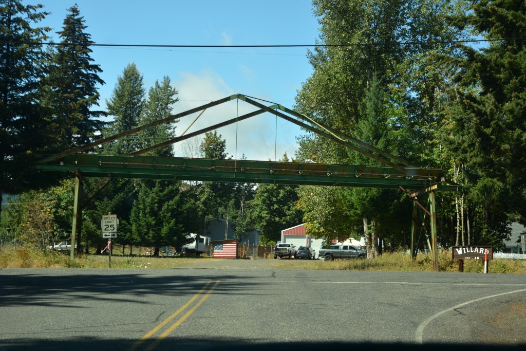
The rest of Skamania County’s towns are all unincorporated communities and include Willard (photograph above), population 46, Home Valley which had a post office from 1892 to 1959 and originally had a Norwegian name, Heim Dal, Mill A which has a nice elementary school and a neighbor Mill B, Prindle which had a Post Office until 1938, Stabler, AKA Hemlock, “The Gateway to Mount St. Helens,” Skamania, near Beacon Rock State Park and winter home to Tundra Swans, and Underwood, directly opposite Hood River, Oregon. All of these communities are either right on the Columbia River or within ten miles of that body of water.
Skamania County Topography
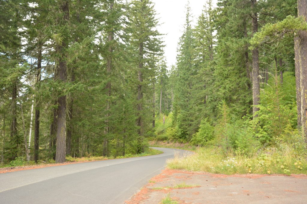
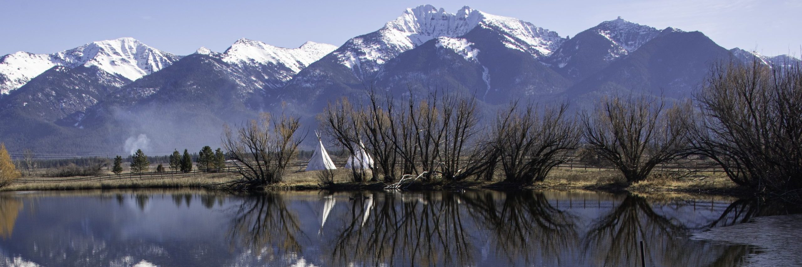
Most of Skamania County encompasses the southern end of Washington’s Cascade Mountains. As seen in the photograph above, the roads heading north from the Columbia tend to be narrow, winding, and lined with thick stands of timber. I drove quite a ways up the road pictured trying to get a view of the “Big Lava Bed” that my DeLorme Washington Atlas and Gazeteer showed quite clearly alongside. I was able to see the occasional rock, but for the most part, my drive reminded me of the Old Settler’s Song Acres of Clams and the lines in that song “…covered all over with timber/Thick as hairs on the back of a dog.” Notable mountains include Greenleaf Peak (3,424 feet), Lone Butte (4,780 feet), Mount Mitchell (3,980 feet), Sleeping Beauty Peak (4,970 feet),Table Mountain (3,417 feet) as well as Mount St. Helens and the western slopes of Mount Adams. St. Helens, Adams, and Lone Butte are all volcanoes and are part of the Pacific Ring of Fire.
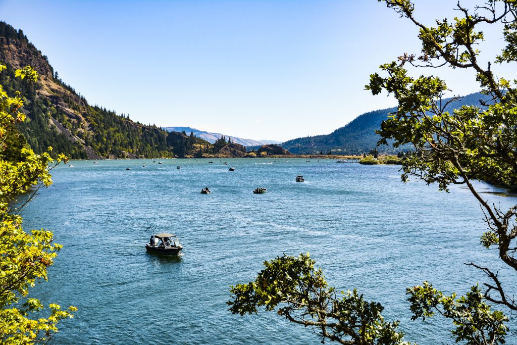
With the mountains reaching to the Columbia, Skamania County is part of the Columbia Gorge National Scenic Area. While the Oregon side is better known, and with Interstate 84 traversing it, more heavily traveled, the Washington side is worth the time, and Skamania County has many hiking trails through the Gorge and great vistas as the Columbia cuts through the mountains.

Skamania County’s Disasters, Natural and Other
In 1100 A.D., or maybe 1450, or even 1700, no one seems to know exactly when, the Bonneville Landslide occurred. Table Mountain slid into the Columbia creating a dam which scientists estimate was three times higher than today’s Bonneville Dam. This natural dam flooded the area upstream, creating a reservoir that reached all the way to present day Arlington, Oregon, 94 miles upstream. In time, the river breached the dam and the resulting rush of water created the Columbia Cascades. The dam itself and the subsequent series of waterfalls provided a barrier to the salmon trying to swim upriver, and the native population took advantage of the situation. The Chinook people moved to the area in large numbers, catching salmon for themselves and for trade. When the white settlers started arriving, the Chinook built a toll road and charged the new settlers to portage around the cascades. They also hired themselves out as porters. It truly is an ill-wind that blows noone any good.
The Klickitat people have a legend about the landslide. They say that the chief God, Tyhee Saghalie, along with his two sons Pahto and Wy’east came down from the far north and stopped when they reached the area where The Dalles, Oregon now stands. Finding the land beautiful, the three decided to stay, but Saghalie knew that his sons would need their own homes. Accordingly, he took his bow and fired an arrow in a southerly direction to find a home for Wy’east. Again he shot an arrow to the north for Pahto. He then created a bridge across the river so that the brothers could get together. This bridge was called The Bridge of the Gods. Unfortunately, both brothers fell in love with the same maiden, Loowit, who could not choose between them. The two brothers fought so violently, that they destroyed both forests and villages. Their fighting also caused the earth to quake, and destroyed the bridge, leaving the Columbia Cascades in its place. Saghalie punished all three by turning them into mountains. Wy’east became Mount Hood. Pahto became Mount Adams, and Loowit became the smoking mountain, Mount St. Helens.
Extremely heavy rains in the winter and spring of 1893 and ’94 caused the heaviest flooding ever seen on the Columbia River. From Umatilla, Oregon almost to Astoria flood waters drove people from their homes, flooded farms, and in Skamania County destroyed the township of Cascade which had been the County Seat. The flood waters at Cascade washed the soil down to bare rocks, and with the County records safe in Stevenson, no one felt the need to rebuild the community of Cascade. Even today, its location on Hamilton Island remains a trail that leads through large boulders. (Note that the Willamette also flooded, leaving 250 blocks of Portland, Oregon under water.)
In recent times, the Smoking Mountain, Mount St. Helens, did more than smoke. On May 18th, 1980, the mountain blew her top in the largest volcanic eruption in the lower 48 United States since Mount Lassen blew in 1915. The Smithsonian Channel has footage of the eruption available on Youtube. Mount St. Helens is fully within Skamania County, but the devastation from the eruption reached even my home in Missoula, Montana, where the city was shut down, and its residents held in virtual house arrest for four days as the volcano’s ash settled.
While not a “natural” disaster, as happened countless times in U.S. history, disease spread through the area which would become Skamania County as white men moved among the native people. The natives had no resistence to European diseases, and as I have previously remarked, thousands of Chinook people died in the early 1800s.
Skamania County Business and Industry
As noted above, after the Bonneville Landslide, salmon fishing became the predominate activity of the native Chinook people. As white folk moved through and into the area, the Chinook became interested in transportation. They worked to portage people and goods past the Columbia Cascades, but in time canals, locks, and eventually railroads replaced their work.. On November 6th, 1896, the U.S. Army Corps of Engineers opened the Cascade Locks and Steamboat traffic was able to run between Portland and The Dalles. In 1906, James J. Hill, the Empire Builder, brought the Spokane, Portland and Seattle Railroad to Skamania County. This new railroad, child of Hill’s competing Great Northern and Northern Pacific railroads, laid its tracks along the north bank of the Columbia which greatly improved both freight and passenger traffic to and through the County. Improved transportation led to increased logging and milling in the County, but by the 1970s, forest products industries were in decline throughout the West. Indeed, by 1993, over a quarter of the County’s employable citizens were out of work. Fortunately, the natural beauty and almost non-stop winds led to a new industry. I always stop in Hood River, Oregon, to watch the windsurfers on the Columbia, and I couldn’t help but notice that they are just as concentrated on the Washington side of the Gorge. Capitalizing on the area’s recreational blessings, the Skamania Lodge opened in Stevenson, and today it stands as the largest private employer in the County. Tourism has come to Skamania County in a big way.
![]()
Hey! I know this is kind of off topic but I was wondering
which blog platform are you using for this site? I’m getting fed up
of WordPress because I’ve had issues with hackers and I’m looking at alternatives for another
platform. I would be awesome if you could point me in the direction of a
good platform.
Are you using wordpress.com or wordpress.org? They are different. I’m using .com and I have it hosted on 1&1. –Bryan