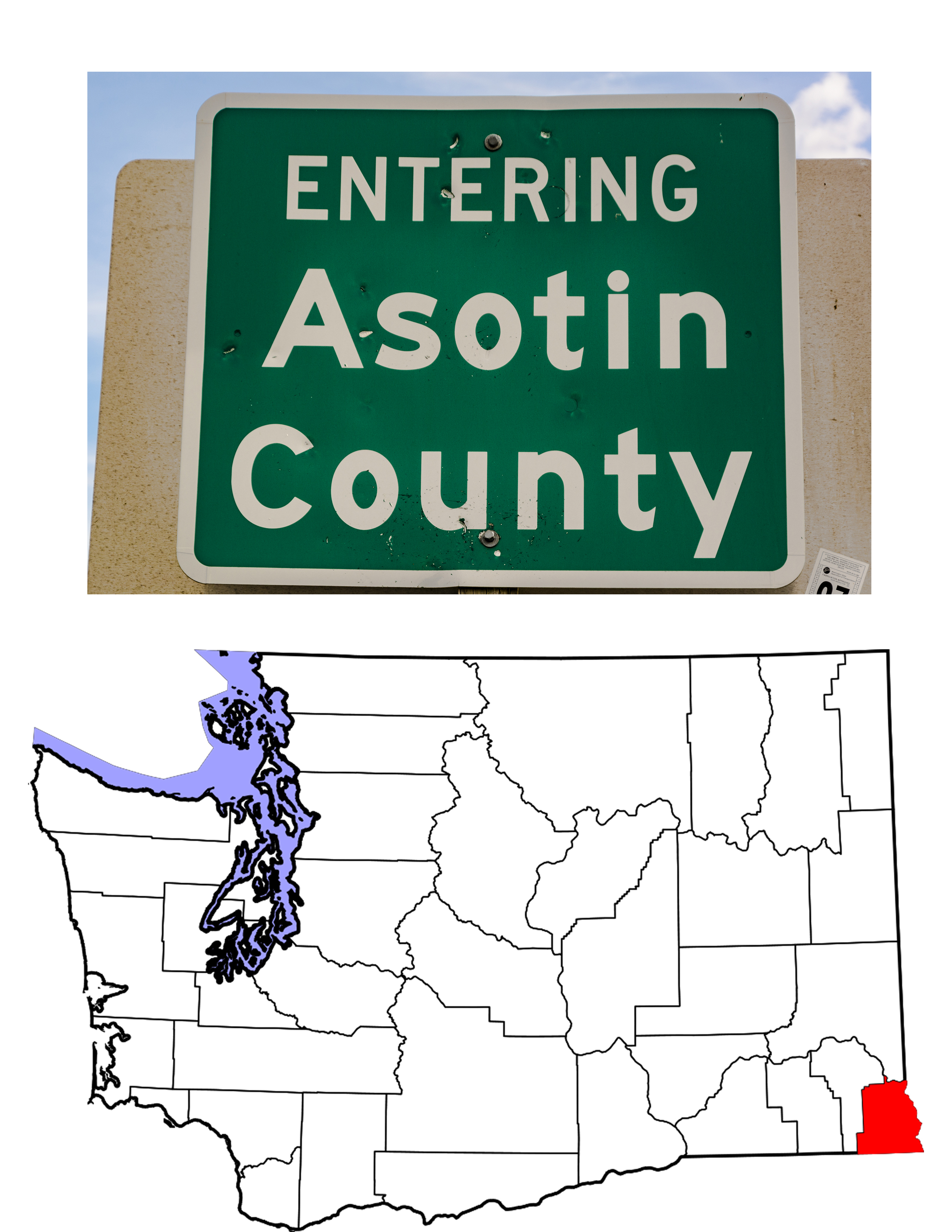
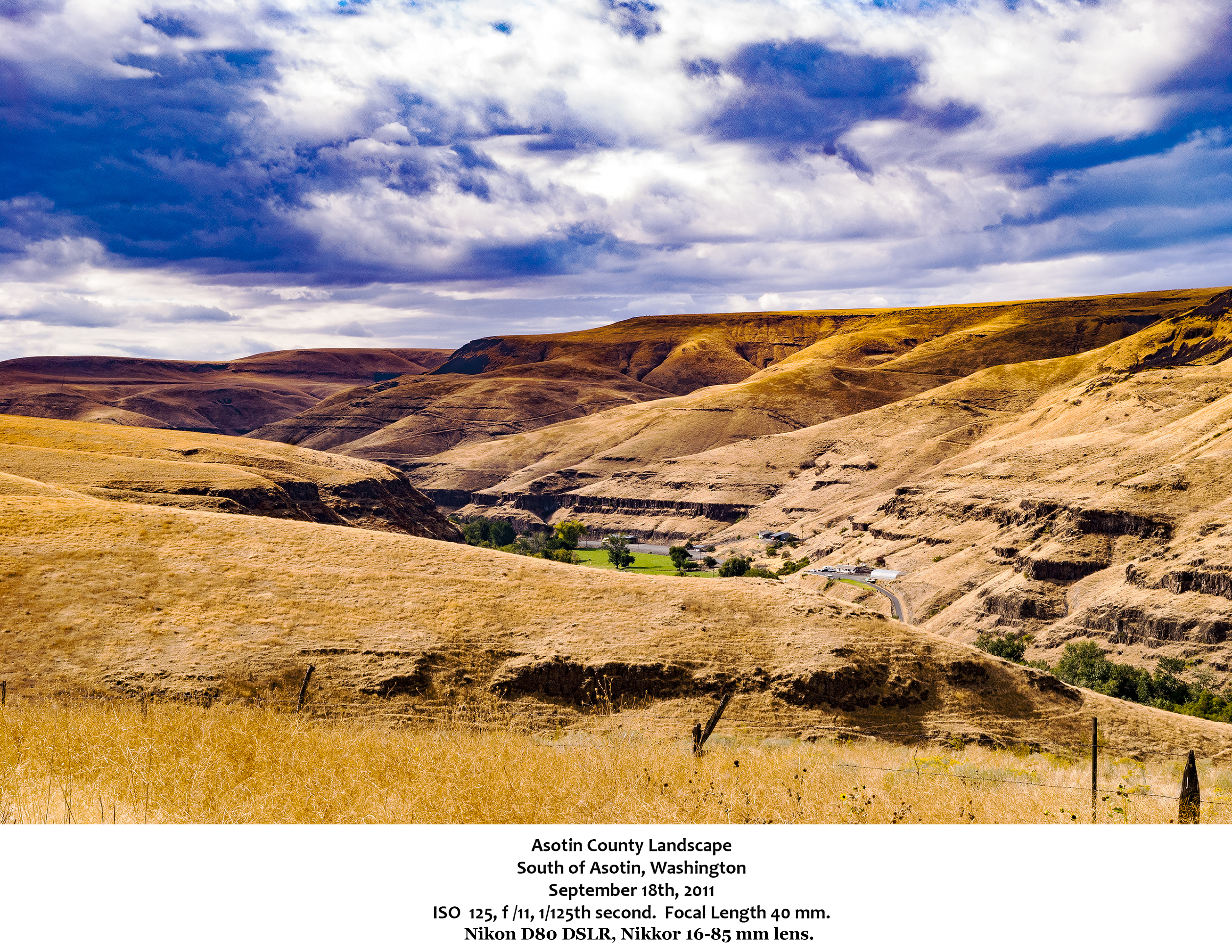
Asotin County
The southeastern-most county in Washington State, Asotin County came into being in 1883 when the eastern portion of Garfield County was partitioned. With an area of 636 square miles, the County is one of the smaller of Washington’s thirty-nine counties, but its 2010 population of 21,623 puts it closer to mid-range in the state. Most of the population lives in or around the city of Clarkston. The County Seat is the only other incorporated city in the county, the city of Asotin. The name of the County comes from the Nez Perce word for eel (or Eel Creek) as, apparently, eels were quite common in Asotin Creek. Part of the natural homeland of the Nez Perce tribe, the area was included in the original Nez Perce reservation, but when the western boundary of that reservation was moved east into Idaho, many native people remained on the Washington side of the line. According to the 2010 census, however, only 1.4% of the County’s population was Native American. Lewis and Clark came through the area, both on their way West and on their return, camping at Alpowa Creek with the Nez Perce people. Captain B.L.E. Bonneville came through in 1834, surveying the area for the U.S. Government and staying with the local Nez Perce. White settlement didn’t start until the 1860s, and didn’t pick up steam until the late 1870s.
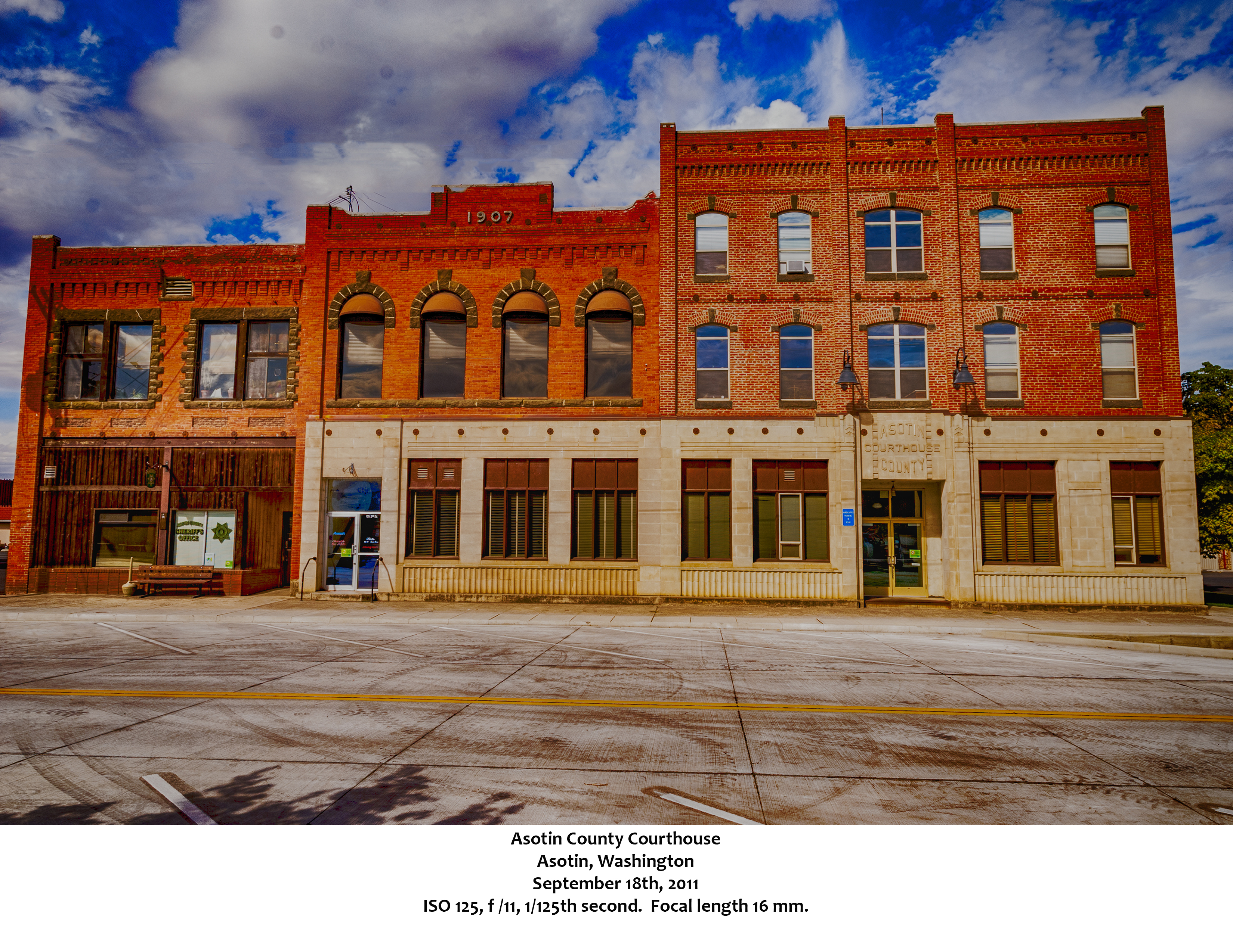
One of two incorporated cities in the County, Asotin, the County Seat, was founded in 1878 by Alexander Sumpster. The only other information Wikipedia gives about the town’s history is that a river ferry stop was established in 1881. As the town sits on the banks of the Snake River, a ferry would have come in handy. It is also somewhat telling that when Wikipedia talks about notable residents, two of the three mentioned are named as a “weird fiction fan” and an “author of weird & fantasy tales.” both of whom apparently corresponded with H.P. Lovecraft. I would hope that living in Asotin did not contribute to the weirdness. A more famous author, Washington Irving, wrote about the area in his 1837 epic The Adventures of Captain Bonneville, Bonneville being one of the many explorers who passed through the region in the early 1800s. While the area was home to the Alpowai Nez Perce, and had been for generations, the first non-Native settler was Sam Smith who in 1861 built a general store and hotel for gold seekers arriving to mine in the Orofino, Idaho area. Smith didn’t stick around, but the discovery of gold in southeastern Washington brought more prospectors, some of whom stayed as settlers. 1880 and 1881 brought two towns into existence at the confluence of Asotin Creek and the Snake River, the first, Assotin City, in 1880 when Alexander Sumpter platted the town and submitted it to Columbia County (which was the local government at the time) for recording. A year later, Columbia County surveyor Alfred T. Beall platted a somewhat larger town just south of Sumpter’s Assotin City. Beall called his town “Asotin.” With the creation of Asotin County in 1883, the town of Asotin became the County Seat. The two towns merged in 1886, choosing to use the name of the larger of the two settlements. 1889 saw a new Courthouse built in the town, a building that burned to the ground in 1936. At that point, the Ayers Hotel was converted to replace the Courthouse, and that is the building pictured above. Today, despite numerous attempts to move the County Seat to Clarkston, Asotin remains home to the County government which has grown to the point that a new Courthouse Annex has been built for the county commissioners.
The town of Asotin is not on any federal highway. That “honor” belongs to Clarkston, the largest community in the County, which is the eastern-most Washington town on U.S. Highway 12. Six miles separate the two towns, and as Clarkston continues to grow, that distance will probably shrink. The 2010 U.S. Census counted 7,229 residents in the city and an additional 8,558 in two Census Designated Places that function as suburbs of the city itself. Thus almost 16,000 of the County’s 21,623 live in or around Clarkston. The city was named for Corps of Discovery leader William Clark, just as its larger twin across the Snake, Lewiston, Idaho, was named for Meriwether Lewis. The town, originally known as Jawbone Flats, was formerly incorporated in 1902. Townfolk led several attempts to move the seat of county government to Clarkston, but each attempt was foiled by a Washington State law that mandates any such move be approved by a three-fifths majority. The last such attempt was in 1946. History Link has a spirited account of the history of the area and the battle here.
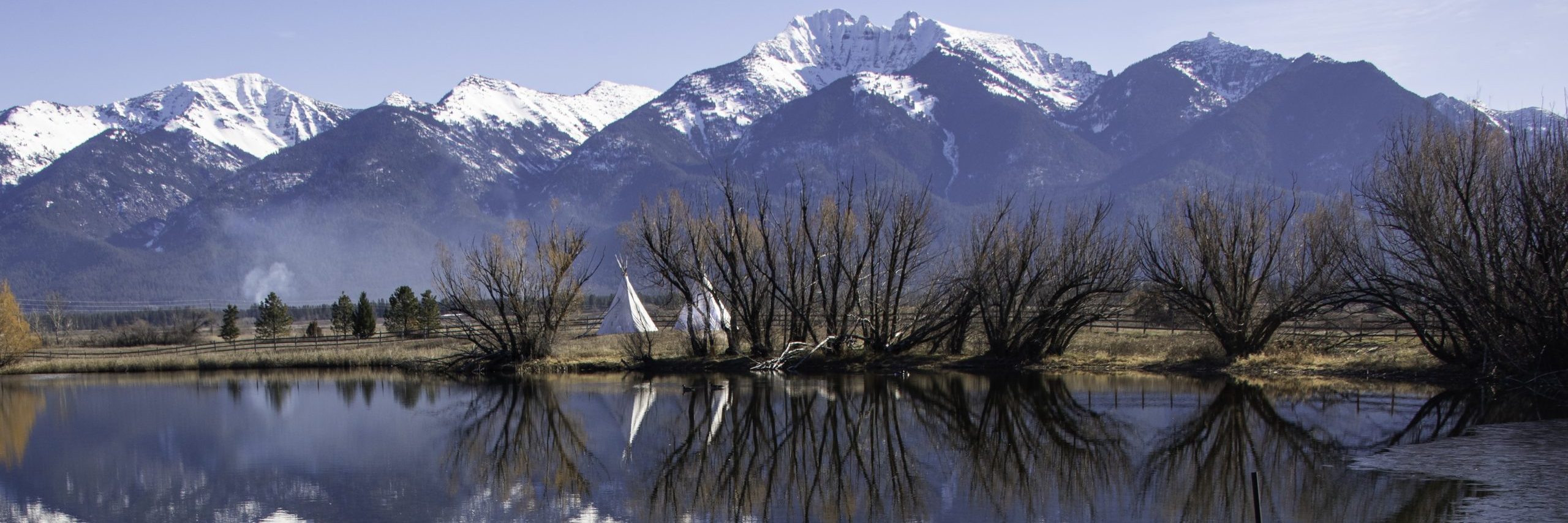
Before the farmers, before the gold seekers, before even Lewis and Clark, what is now Asotin County was home to the Nez Perce (or in their own language the Niimíipuu). The People (the English translation of Niimíipuu) were nomadic and their hunting grounds covered some 17 million acres across the four states that make up the Pacific Northwest. As a side note, just as the Flathead did not flatten the heads of their children, the Nez Perce (Pierced nose in French) did not pierce their noses or wear rings in them. When the Corps of Discovery traveled down the Snake, they stopped at Alpowa Creek and found the Niimíipuu to be very hospitable hosts. Lewis and Clark handed out metal mirrors, pointing to them and saying repeatedly “looking glass.” In one of those classic misunderstandings, the native people understood this to be a naming ceremony, and the local chief was thereafter known as Chief Looking Glass. He named his son Looking Glass, as well, the son who ended up following Chief Joseph as their band of Nez Perce followed the Niimíipuu Trail in a frustrated attempt to reach Canada and avoid reservation life. Today, the son is remembered through a Montana State Fishing Access and campground on the Bitterroot River.
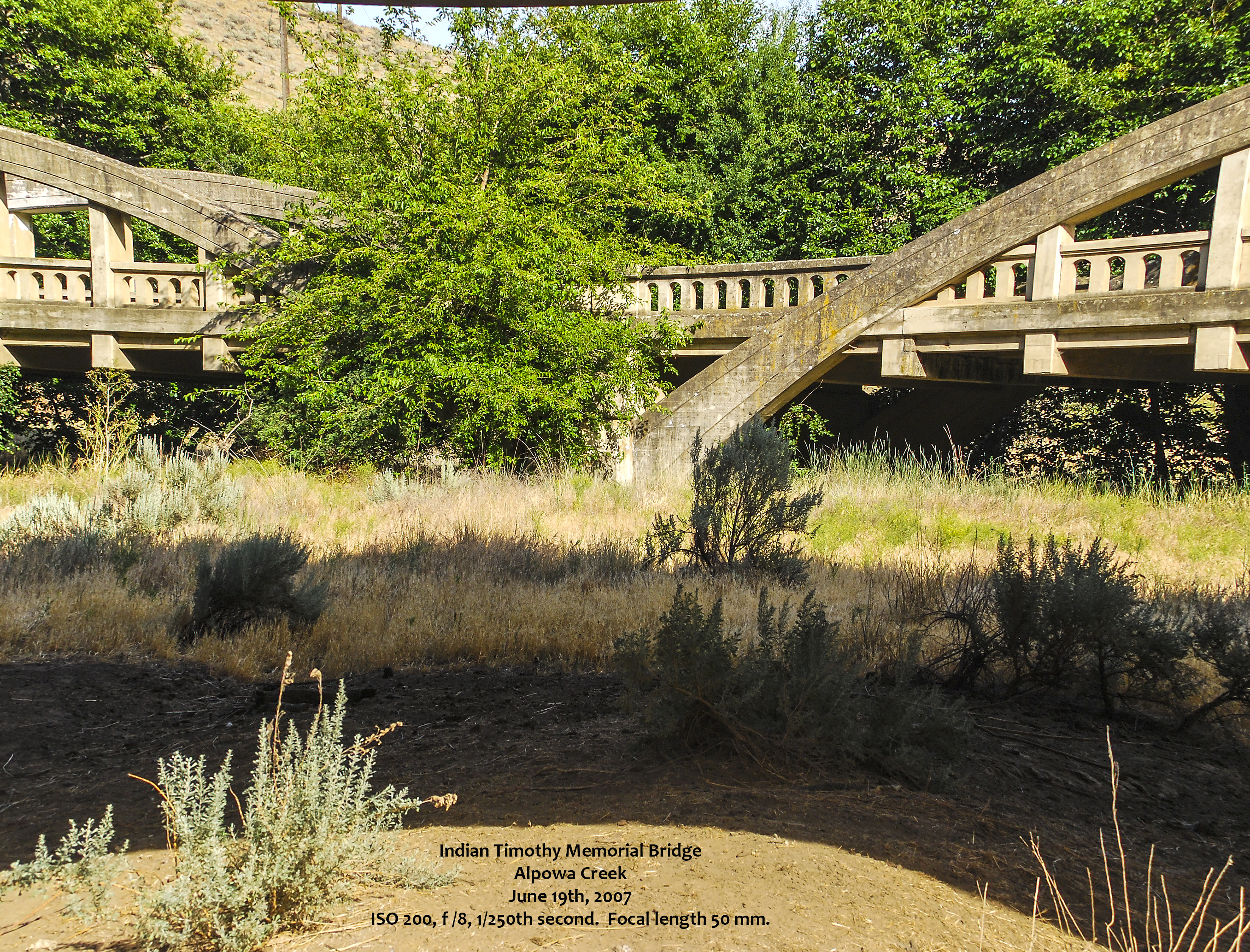
Another important name in the region is Timothy, memorialized in the bridge shown below. Bridgehunter.com has this to say about him.
Timothy, who was born Temuutsu, led the Alpowa band of Nez Perce. He was the first of his people converted to Christianity by Henry H. Spalding and is credited with the rescue of surviving cavalry troopers after the defeat of Colonel Steptoe’s detachment by a combined force of Spokane, Couer [sic] d’Alene and Palouse Indians at the battle of Rosalia in 1858. His daughter, Jane, guided a party headed by E.D. Pierce to the upper Clearwater in 1860. Their discovery, near Orofino, set off the first Idaho gold rush. Jane later married John Silcott who started a Snake River ferry at the mouth of Alpowa creek in 1861.
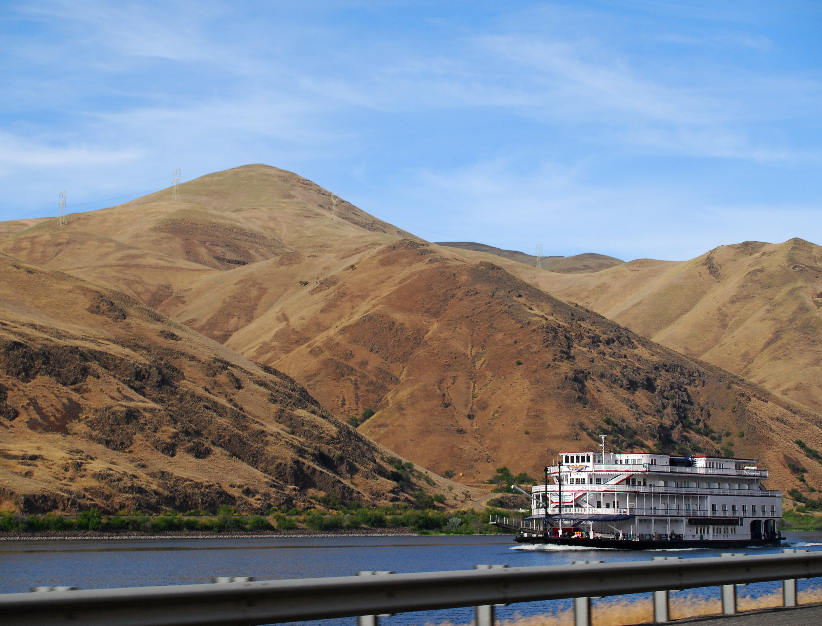
And in summation, as is the case with so much of Washington State, water is of vital importance to the state’s story, and so with Asotin County. The Snake River forms the northern and eastern border of the state, the latter being the only part of the Washington/Idaho state line that isn’t a straight line. With the opening of Lewiston, Idaho as a deep water port, transportation on the Snake has come into the modern age, even with modern replicas of classic sternwheelers taking tourists for a ride. The landscape beyond the river is neighboring Whitman County For more of my photos of Asotin County, check out my Behance.net portfolio.
![]()