Whatcom County
Introduction
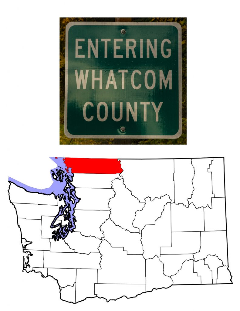
On March 9th, 1854, the one-year old Washington Territorial Legislature created two new counties. Skamania County was at the southern edge of the Territory. Whatcom County, Skamania’s twin, stretches along the northern border. For my look at Skamania County, go here. Created from Island County, Whatcom’s original borders include what is now San Juan and Skagit Counties. Even with the County’s extent over twice what it is today, few people lived in this northwestern corner of Washington. The 1860 census counted only 352 residents, and the 1870 census a mere 534. In subsequent census counts, the population has steadily grown from 3,137 in 1880 (after the creation of San Juan County). The 2018 estimate of 225,685 makes Whatcom the ninth largest county in the state. Today the County covers 2,503 square miles, of which 397 are water. It stretches from the Straights of Georgia to the crest of the Cascade Mountains. The County’s name comes from either the Lummi or the Nooksack language (both are coast Salish languages) Xwotʼqom which translates to Noisy Water.
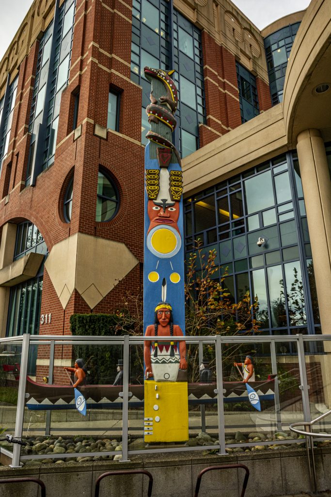
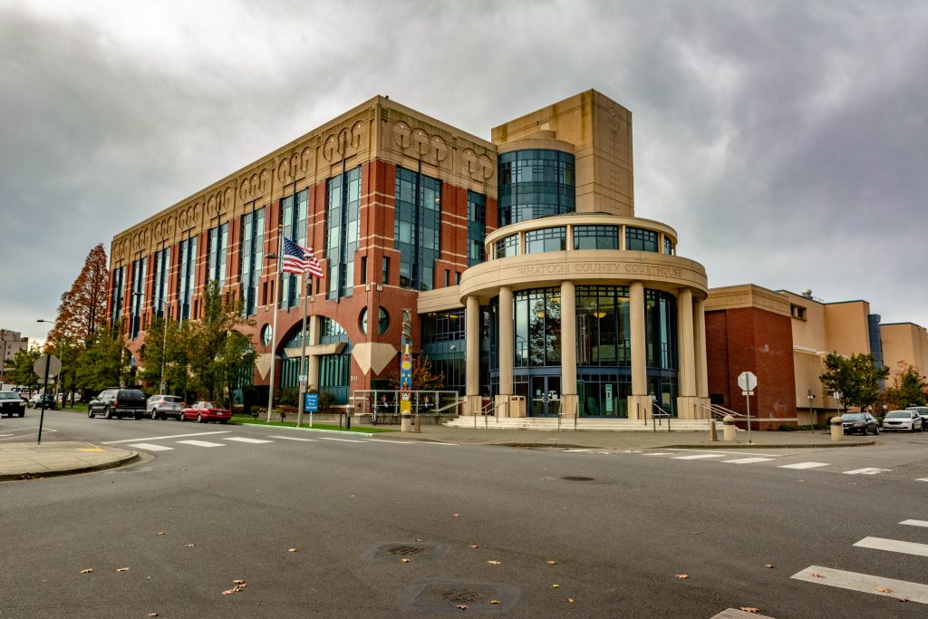
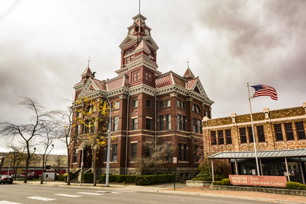
Whatcom County Courthouse
Bellingham, Washington
Whatcom County History and People
The original inhabitants of what is now Whatcom County were various tribes of North Coast Salish. These includie the Lummi (Lhaq’temish), the Nooksack (Noxws’áʔaq)and the Semiahmoo.
The Lummi
The Lummi, or the People of the Sea, relied traditionally on the salmon. Felix Solomon, a Lummi artist, spoke of the importance of that fish on the tribal website. “It’s a food that satisfies your spirit inside. It’s our identity here in Luumi—we’re salmon people.” When the Lummi signed the Treaty of Point Elliott in 1855, they relinquished much of their traditional territory, making it available for non-Native settlement. Their reservation today covers 21,000 acres on Lummi Peninsula and Portage Island at the northern end of Bellingham Bay.
With over 5,000 citizens, the Lummi are the third largest tribe in Washington State. Their reservation is home to Northwest Indian College. While the home campus is at Lummi, the school has six branch campuses around Puget Sound and as far away as northern Idaho. Begun as a school of Aquaculture, with the goal of educating Native people to work in tribal fisheries and hatcheries, in 1983 the Lummi Nation chartered Lummi Community College, which in 2008 became the only fully accredited 4-year Native institution in Washington, Oregon and Idaho. The tribe also owns the Silver Reef Hotel Casino Spa, Fisherman’s Cove Marina and the Gateway Center.
The Lummi still live by four core beliefs: Selalexw—Our strength comes from the old people. From them we receive our teachings and knowledge and the advice we need for our daily lives. Schtengexwen—We are responsible to protect our territory. This means we take care of our land and everything that is on it and in it. Xwlemichosen—Our culture is our language. We should strengthen and maintain our language. Lengesot—We take care of ourselves, watch out for ourselves, and love and take care of each other.
The Nooksack
The Nooksack lived up the Nooksack River on land that stretched from today’s British Columbia south to Skagit County, primarily in the immediate region of Mount Baker. Their name, and the name of the river, translates to “always bracken fern roots,” a place name. They relied on fishing, digging clams, hunting, and gathering roots and herbs. While subject to the Point Elliot treaty, the Nooksack were not “given” a reservation, and rejected an 1873 attempt to remove them to the Lummi Reservation. They did not receive full federal recognition until 1971 at which time one acre of land at Deming, Washington became the Nooksack Reservation. Today, the tribe has expanded its holdings to 2,500 acres. Nooksack lore tells that the tribe has lived in the river valley since time immemorial, or at least for several thousand years. Roughly 2,000 members are enrolled in the the tribe, a higher number than estimates give for 250 years ago. In addition to an extensive tribal website the Nooksack have a monthly newsletter, Snee-Nee-Chum, which is mailed directly each month to every tribal member.
The Semiahmoo
The Semiahmoo, a relatively small group living on what is now the US/Canadian border, were also fishermen noted for their use of reef nets. Their tribal name has given rise to several suggestions, including “half-moon,” “water all around,” and “hole-in-the-sky.” It could also come from the way an early U.S. Indian Agent heard what the people called themselves. Because most of the tribe moved north of the 49th parallel in the early 1850s, today’s Semiahmoo have a First Nations Reserve squeezed between the Peach Arch at Blaine and the city of White Rock, British Columbia. Unlike the Lummi and the Nooksack, the Semiahmoo have declined in number, with an enrolled tribal membership of 98 in 2015.
Early European Exploration and Settlement
The area’s European visitors include the Greek born Spanish explorer , Ἰωάννης Φωκᾶς, or as geographers know him today, Juan de Fuca. While de Fuca named many geographic features, most of his names were supplanted by Captain George Vancouver when he sailed into the area in 1792. After 1849, as San Francisco was growing rapidly, the need for timber sent men north and the first European/American settlers arrived in Whatcom County in the 1850s. Nicholas V. Scheffer, born in Indianapolis in 1825, moved first to San Francisco then north into Washington Territory in 1854. HistoryLink.org has a four-part recollection of Sheffer’s days in early Whatcom County.
For more information, visit the Whatcom County Historical Society and view this YouTube video: Building the road to Fort Bellingham
Whatcom County’s Seat, Bellingham
Bellingham, Washington
Bellingham, the northernmost U.S. city with more than 50,000 residents, came into being in 1903 when four towns on the shores of Bellingham Bay merged into one. Each of the four towns date from the mid 1850s, when European Americans first starting arriving in the area to harvest timber to build San Francisco. All four grew in the subsequent half-century, but by 1900 it became obvious that they would thrive better together than separately. One of the four already had the name Bellingham (the others were Fairhaven, Whatcom and Sehome) and because of the city’s location on the Bay, Bellingham seemed most appropriate for the newly combined city.
Captain George Vancouver was responsible for naming the bay in honor of Sir William Bellingham, the politician responsible for providing for Vancouver’s provisions. Between 1900 and 1910, the population of the city jumped 119% (from 11,000 to 24,000), and with the exception of a slight dip in 1940, it has risen ever since. The 2010 Census counted 80,885 city residents, and the 2018 estimate shows 90,665. Bellingham is home to Western Washington University and Peace Health-St. Joseph Medical Center, the two largest employers in the city. Most of the other major employers are either governmental bodies, educational institutions, or retail companies such as Haggen and Fred Mayer.
Bellingham is in the process of renewing its waterfront district, formerly home to a Georgia-Pacific pulp mill and a Chlor-Alkali plant also owned by G-P. Renewing the 74 acre area has meant cleaning up the toxic waste left behind by both plants, with plans to build a marina and condominium apartments. Housing is in short supply in Bellingham, which means that prices are high while wages are below Washington State averages.
Now part of the Whatcom Museum Complex
Bellingham, Washington
Whatcom County Communities
In addition to Bellingham, Wikipedia notes six “cities” in Whatcom County, as well as twelve “Census Designated Places” and fourteen “Unincorporated Communities. It even lists “Ghost Towns.” All the cities are within 25 miles of Bellingham. Blaine (2018 estimated population 5,436) is the main point of entry on the western US/Canada Border. The Peace Arch Park spans the border, as does the Arch itself. Blaine takes its name from Republican politician James Blaine who ran for President against (and lost to) Grover Cleveland. The town has two slogans, “The Peace Arch City” and “Where America Begins.
Some fifteen miles east of Blaine you’ll find Sumas , another border crossing city. Incorporated on June 18, 1891, Sumas takes its name from the Cowichan Indians who called the area “the land without trees.” The 2017 estimated population was 1,464 residents. Sumas is the easternmost city in Whatcom County.
Southwest of Sumas, and fifteen miles north of Bellingham you’ll find Lynden (2017 estimated population 14,259). The second (or possibly third) largest city in the County, Lynden lies on the north bank of the Nooksack River where it became the center of the dairy industry for the County. Settled mainly by Dutch immigrants, today Lynden remains proud of its Dutch heritage.
Upstream from Lynden lies Everson (2017 estimated population 2,699), and its sister Nooksack. Everson incorporated as a city in 1929, fifty-eight years after Ever Everson first settled in the area. With a 2010 population of 1,338, one would think that Nooksack should have its own Post Office. The community was incorporated on December 6th, 1912, but the Post Office closed in 1992 with the responsability being transferred to nearby Everson. Police and sewer services are also handled by Everson. The city’s website tells us “A friendly City Park in the heart of Nooksack catches the eye of most travelers. Inviting to picnickers and families from near and far, the park provides peaceful enjoyment for all.” There have been efforts in recent years to combine the two cities into one political entity.
Ferndale (2018 estimated population 14,564) grew up along a major log jam on the Nooksack River that impeded upstream travel, and indeed the community carried the name Jam for the first few years of its life. The area’s first school teacher decided that the ferns growing along the original school house made for a better name. Incorporation came in 1907. Among other reasons for being, Ferndale today acts as a bedroom community for Bellingham and may have recently passed Lynden to become the County’s second largest city.
While not a “city,” Point Roberts deserves its own mention. The 2010 Census counted 1,314 people living on the five square mile peninsula that reaches from British Columbia down below the 49th parallel. If you want to visit Point Roberts by land, be prepared to cross through Canada to get there. There is a small airstrip and a larger marina which will allow access to this part of the U.S. without leaving the country. Even the school children (from grade 4 on) must travel each day through Canada to get to their classrooms in Blaine.
Lummi Island which separates Bellingham Bay from the Strait of Georgia is an unincorporated community that has become a major arts center. A five minute ferry ride will get you across the Half Passage south of the Lummi Peninsula. Be aware that there is no fuel available on the island, so be prepared.
Whatcom County Topography
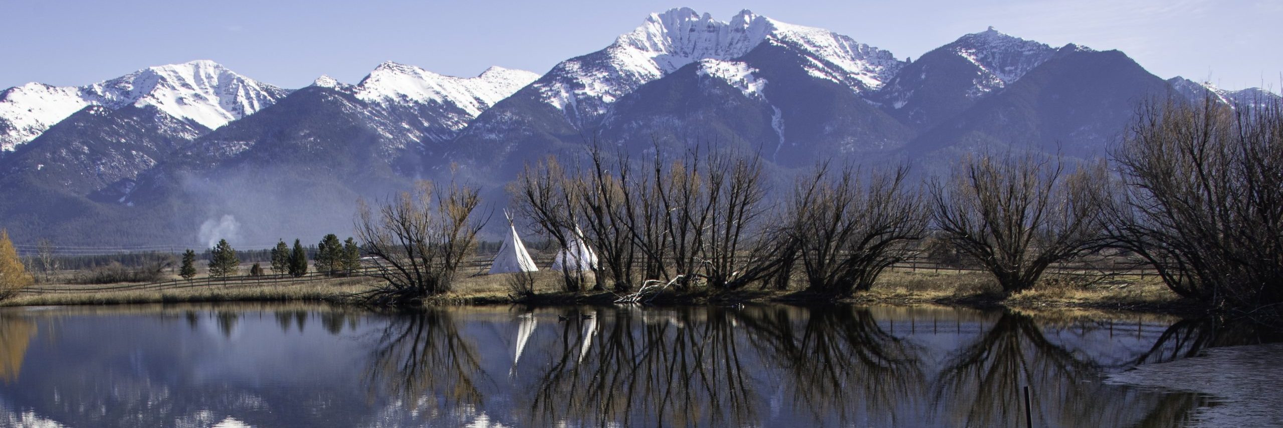
Whatcom County stretches from the Straights of Georgia to the crest of the Cascade Mountains. The Nooksack River is the major waterway inside the County. It flows roughly 75 miles from the Mount Baker Wilderness in central Whatcom County to its mouth on the north side of Bellingham Bay.
Far eastern Whatcom County is part of North Cascades National Park. Washington State Highway 20 passes through the Park, but be advised, the road is closed during the Winter due to the heavy snow that falls in the Cascades. A good bit of Highway 20 runs alongside Ross Lake, through what the National Park Foundation calls “the most accessible part of the North Cascades National Park Complex.”
West of the National Park lies Mount Baker. Rising 10,781 ft (3,286 m) above sea level, Mount Baker is visible from Seattle, and even Tacoma on a good day. The northern most volcano in the U.S. Cascades, Mount Baker is also the most active after St. Helens. The mountain is the center of the Mount Baker Wilderness.
Southeast of the mountain lies Baker Lake extending south to the Skagit County line. Baker Lake serves as a recreation magnet, attracting fishermen, campers and boaters. Originally a natural lake, Baker Lake grew considerably with the construction of Upper Baker Dam in 1959.
On the eastern edge of Bellingham lies Whatcom Lake, roughly ten miles long and one mile wide. Even though the lake is the principal water source for the city of Bellingham, there is considerable recreation on the lake. Especially important is sport fishing for the six native and three introduced fish species. An additional four species have been introduced illegally. Motorists driving on Interstate 5 can see Samish Lake in the southwestern corner of the County. Lummi Island, Portage Island, and Eliza Island, all in or bordering Bellingham Bay, are the main islands in the County.
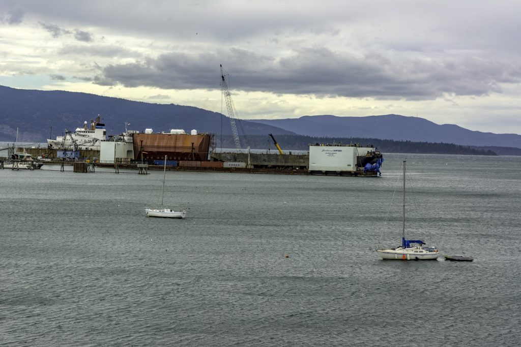
Alaska Marine Highway
Bellingham, Washington
Whatcom County Business and Industry
Logging, and perhaps surprisingly coal mining, were the initial industries in what is now Whatcom County. A fascinating video of a presentation on Bellingham’s coal mines can be found on YouTube. Today, as noted above, the principle sources of employment are health care, education, government, and retail.
![]()
A belated thank you for your kind words.