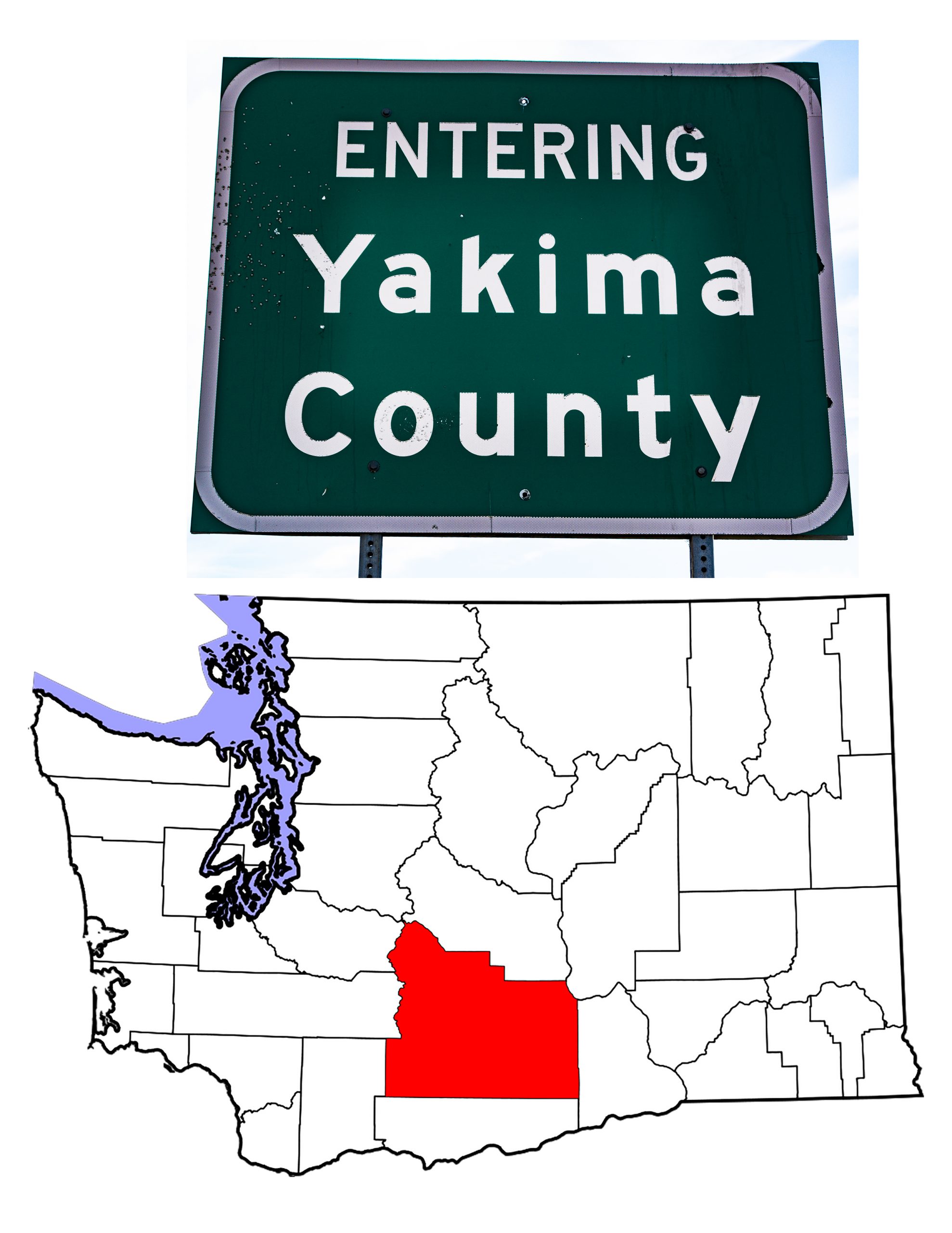
Yakima County: the Second Largest in Washington State
Introduction to Yakima County
On January 23rd, 1863, the Washington Territorial Legislature created Ferguson County. The new county, in the middle of the Territory, took its name from Skamania County legislator James Leo Ferguson. Being few in number, the area residents balked at being taxed for another level of government. Consequently, two years later, the enabling legislation was repealed. That didn’t stop the Legislature from creating Yakima County three days later on January 21st, 1865. The new county had borders roughly identical to those of the erstwhile Ferguson County. In 1883, the northern section of Yakima County became Kittitas County. In 1905, Yakima County lost more land in the creation of Benton County.
Just over one third of the County’s area makes up part of the Yakama Indian Reservation, which also covers northern Klickitat County. Today, Yakima County is Washington’s second largest in area,covering 4,296 square miles. With an estimated population (2019) of 250,873, it is Washington’s seventh most populated county.
A Brief History of Yakima County
The original inhabitants of today’s Yakima County were the various tribes that make up the Yakama Nation. Indeed, the County’s name recognizes the tribe’s importance to the area. At the invitation of tribal leaders, Roman Catholic missionaries came into the area and established missions beginning in 1848. Thanks to Isaac Stevens’ attempts to civilize and control the Native population, the Yakima Treaty of 1855 created a reservation in central Washington.
Stevens did little thereafter to protect tribal interests, and indirectly launched the Yakima Wars. The U.S. built Fort Simcoe in 1856, and by 1858 had defeated the Native people, most of whom settled on the Reservation.
Cattle drives came through the Yakima Valley beginning in 1859, and the first settlers arrived shortly thereafter, in 1861. Cattle became an important part of the area economy until the Northern Pacific Railroad started building irrigation canals. Today, the Yakima Valley has nearly 2,100 miles of canals and is an agricultural colossus. The County’s main crops include apples, wine grapes, and hops. In 2019, Yakima County accounted for 73% of all hops grown in the United States, according to the Yakima Herald-Republic newspaper.
County-wide, Yakima is a “white minority” county. As of 2019 (according to city-data.com), 47.3% of the County’s residents were “white.” Hispanics made up 56.5%, with Native Americans at 3.6%. Asians, Blacks, and Native Hawaiians together made up approximately 3%. Surprising, to this writer at least, is that since 1996, despite having a majority of non-white residents, the County has voted Republican in every Presidential election. Donald Trump took 52.7% of the vote in 2020.
The Yakama Nation
The original inhabitants of the County included many of the fourteen tribes that now make up the Yakama Nation. Those tribes come from three different language/cultural groups. The Yakama themselves (note that the tribe adopted the current spelling in 1994) were a group of Sahaptin speaking people. In addition, some Salish speaking tribes are part of the Confederation, as are some Chinookian tribes.
Yakama chief Kamiakin brought the first cattle to the area in 1840. Kamiakin was also the chief who urged his people to oppose the 1855 Treaty.
Today, according to the Yakama’s own web site, there are 6,300 tribal members. Wikipedia uses the 2000 US Census figure of 10,851. Whichever number we use, the Yakama Nation is the largest Native American group in Washington State, and their reservation the largest in the State.
Yakima: The Yakima County Seat
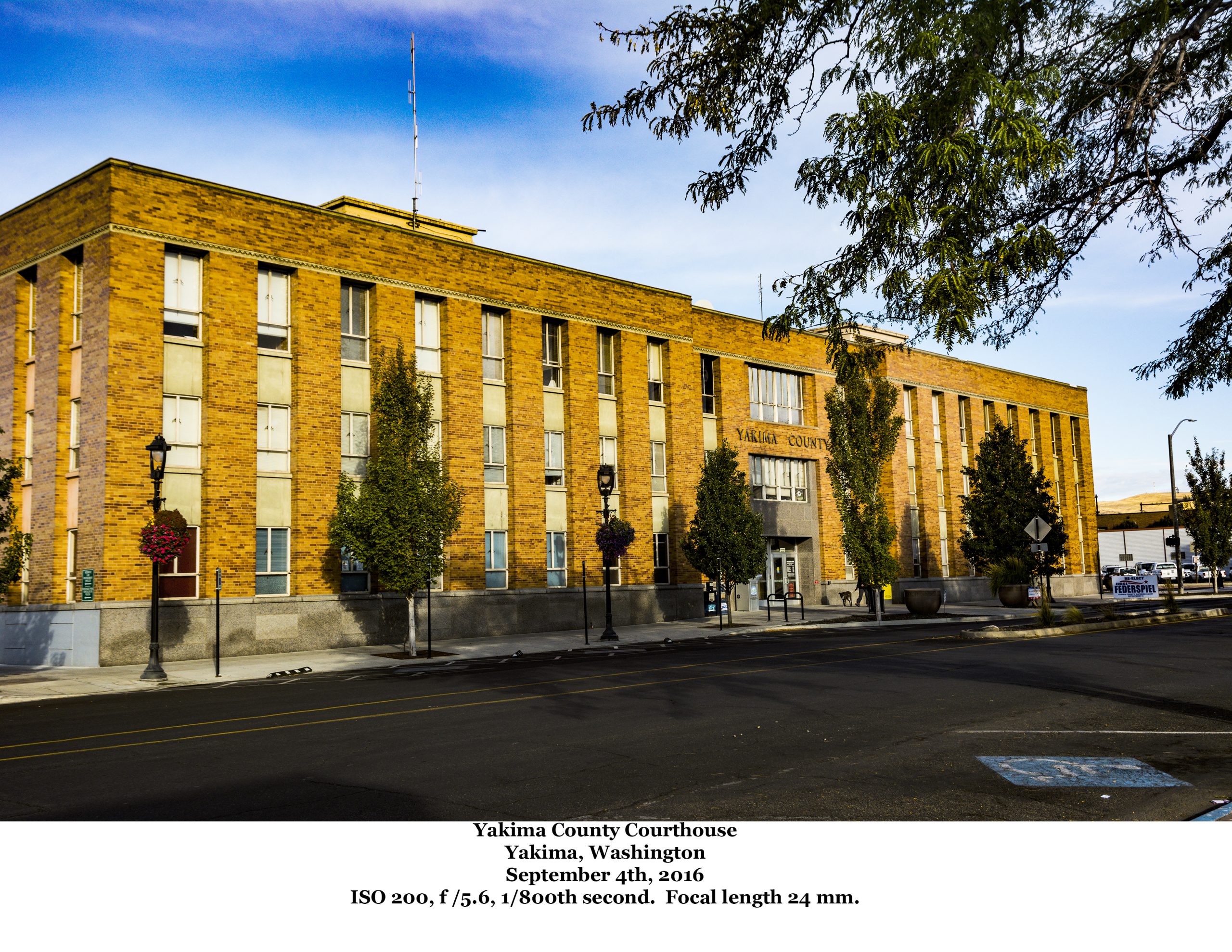
The city of Yakima traces its history back to the early 1860s, but when the Northern Pacific Railroad bypassed the community, the city fathers picked up the town and moved—literally. Using logs as rollers and horses as draft animals, they moved over 100 buildings to a new site adjacent to the railroad. This new site took the name North Yakima and under that name, the town became County Seat in 1886. Not until 1918 did the Washington Legislature acknowledge the town as Yakima (no North). The original settlement became the town of Union Gap.
With an estimated (2019) population of 93,637, From its origins, Yakima has grown into the thriving city it is today. The 1890 census, the first which included the city, counted 1,535 residents. By 1900, that number had more than doubled, and by 1910, it grew another 346.5% to 14,082. It has grown steadily since. The 2010 Census showed that people of Caucasian ancestry counted for 67.1% of the population. Surprisingly, for a community on the edge of a large Native American Reservation, only two percent of the population was Native. On the other hand, 41.3% considered themselves Hispanic.
Other Yakima County Communities
In addition to the County Seat, the County has eleven other incorporated cities, two incorporated towns, and numerous census designated places and unincorporated communities.
The second largest city, Sunnyside, lies in the eastern part of the county, not far from the Benton County line. Walter Granger, the Northern Pacific’s water/canal guy, founded the city in 1893. Residents voted to incorporate in 1902. The town grew quickly when a religious group moved to the area from South Dakota. The German Baptist Progressive Brethren, AKA the Dunkards, moved in such a number that their church was the largest church in the County in 1902. They bought the entire town site and prohibited alcohol, dancing and gambling within the town’s limits. The Dunkards no longer control the city. In fact, the 2010 census showed that 82 percent of the city’s residents were Latino.
The only other city in the county with a population over 10,000 is Grandview. Almost exactly halfway between Yakima and Kennewick, Grandview lies just west of the Benton County line. The town got its name for the fact that you can see both Mount Rainier and Mount Adams from the town. Definitely a grand view. An agricultural center, the town’s incorporation came in 1909. Like Sunnyside, the town today is almost 80% Latino.
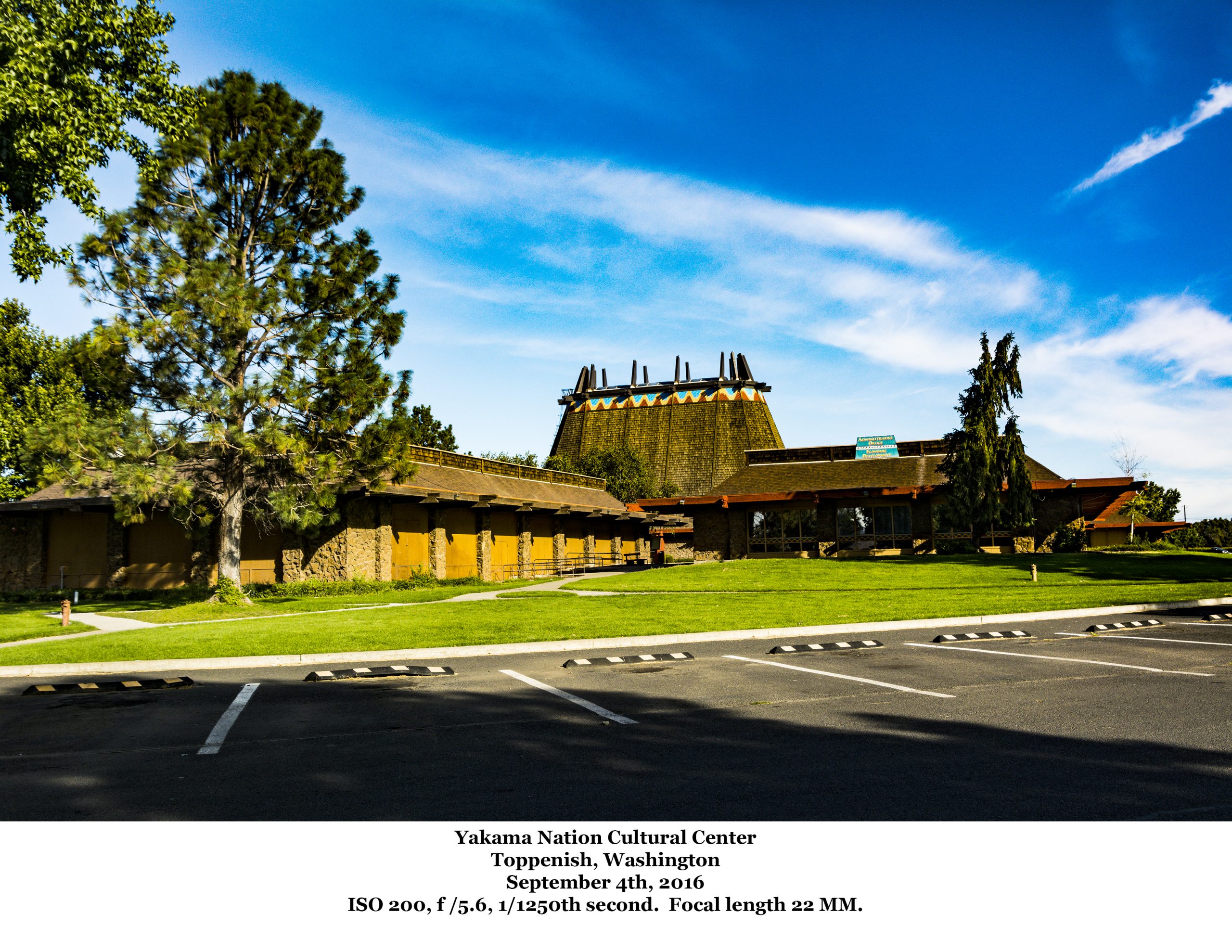
Toppenish, founded in 1884 and incorporated in 1907, today is home to the Tribal Headquarters of the Yakama Nation. The city’s name is an anglicized version of the Sahaptin word Tẋápniš. That word means “landslide.” Or possibly, not. As with many words appropriated into English, the etymology is not clear. Toppenish calls itself the city of murals as over 75 murals adorn the city’s walls. Even though the city is home to the Tribal Headquarters, Hispanics make up 82.6% of the city’s population.
Business and Industry
General Employment
Of the fourteen leading employers in Yakima, seven are entities of government, whether federal, state, county or city. Another two are medical facilities, including the largest employer– the Yakima Valley Memorial Hospital–which employs over 2,200 people. Del Monte and Tree Top are both in the list, with a combined total of over 1,700 workers processing fruit. Another 850 process beef for AB Foods.
The Washington State Employment Security Department’s Yakima County Profile shows that as of 2019, the top five industry sectors (in terms of employment) were: 1) agriculture, foresty and fishing; 2) health services; 3) local government; 4) retail trade; and 5) manufacturing. The first three account for more than 70% of all jobs in the County. Agriculture accounts for more than the next two sectors combined.
Agriculture
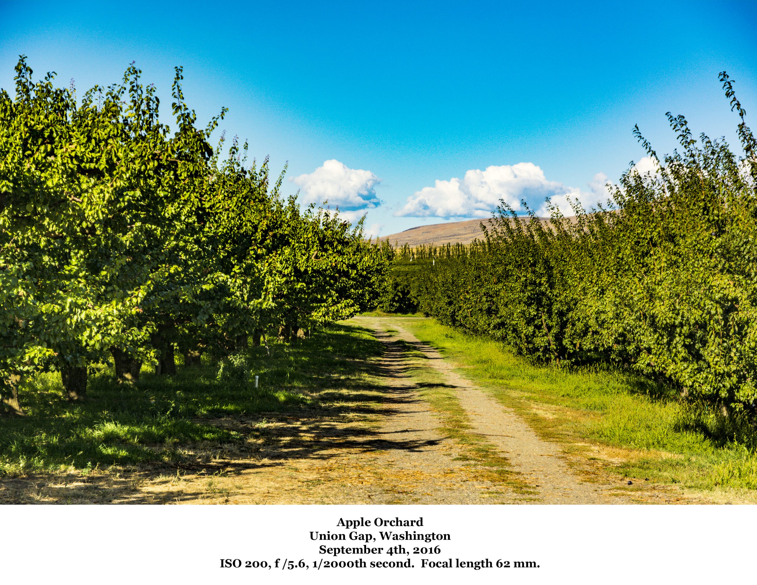
County-wide, agriculture is king. As noted above, nearly three-quarters of all of the US hops crop comes from the County. 1970s comedian Pat Paulsen used to joke about Washington State being stuck in the depression—still selling apples to the country. But apples are an important crop in the County. According to the 2017 Census of Agriculture, apple orchards covered 58,670 acres, ranking first in Washington State. The County also ranked first in silage corn (37,545 acres) and second in grapes (19,421 acres in 2012). In fact the County was first in the state for sales of Fruits, tree nuts and berries. First in the category Other Crops and Hay. First in Milk from Cows, and first in Sheep, goats, wool, mohair, and milk.
But in addition to food stuffs, the County ranked first in Washington State in the inventory of Cattle and Calves. Also first for Sheep and lambs, and second for bee colonies (2012). (Note: the 2012 Census of Agriculture does not align perfectly with that for 2017. For example, the category for bee colonies does not show up on the 2017 Census.)
Topography
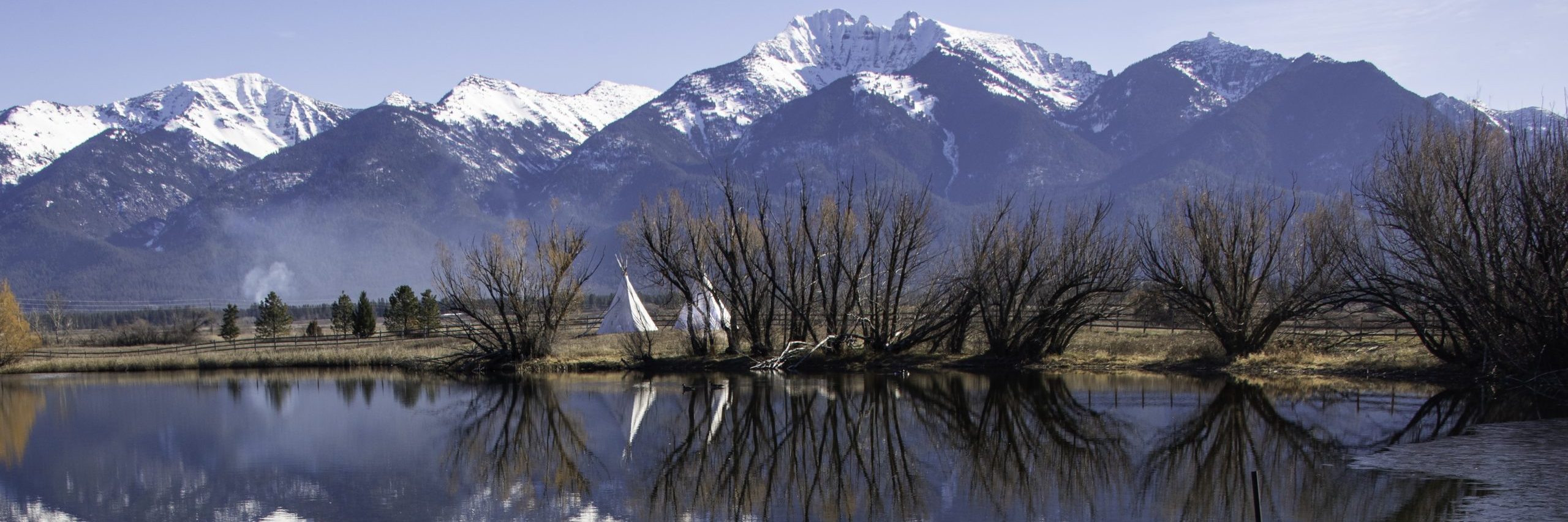
Yakima County has a widely varied topography. The County’s western line follows the crest of the Cascade Mountains from north of Mount Rainier (which is in Pierce County) south to the Township 10.5 North line, then west to the Skamania County line, and due south from that point on to Klickitat County. In practical terms, this means that western part of the County is the east slope of the Cascades. Mount Adams is within the County.
The Yakima River cuts a valley through the County, and most of the County’s population lives in this river valley. Several ridge lines cross the County east to west on both sides of the river. This is arid, semi-desert land made fit for agriculture only through a vast array of irrigation canals.
Within the western mountainous region are numerous lakes which provide recreational oppportunities: fishing, boating, camping. Rimrock Lake, Bumping Lake and Two Lakes are all popular sites.
My Travels Through Yakima County
Three main highways cross Yakima County. US Highway 97 runs north/south across the County, connecting Yakima with the Columbia River to the South and to Ellensburg and Wenatchee to the north. US Highway 12 crosses the County east to west and runs parallel to (and in some cases using the same roadbed as) Interstate 82. 82 connects Ellensburg to the Tri-Cities, ultimately ending in northern Oregon. US 12 heads west from the city of Yakima, crossing the Cascades and skirting Mount Rainier National Park.
I have driven all these roads from border to border in the County. My favorite drive is that portion of Highway 12 through the Cascades, but note, this is not a road for people who don’t like mountain driving. It’s an older two-lane highway, and while very scenic, it can be slow going because of trucks lumbering up the mountains.
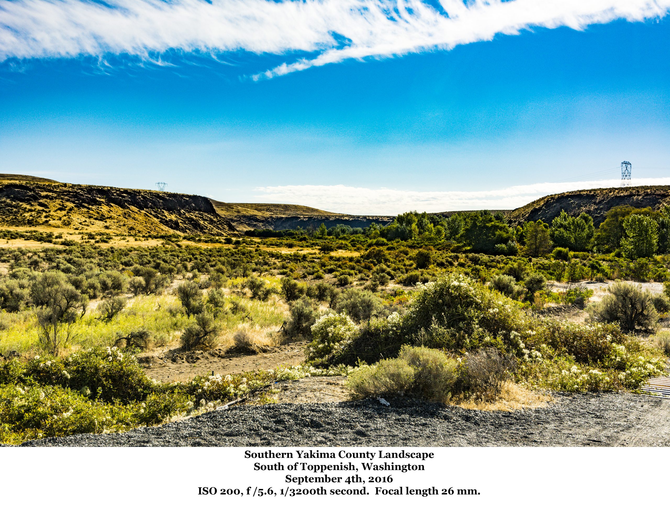
US 97 south from Toppanish to Maryhill and the Columbia is also a two-lane mountain road, but in my opinion, not as scenic as US 12. I took the photo at the head of the Topography section parked alongside US 97.
If you want to cross the County quickly, then take I-82. What can I say? It’s a four-lane divided road that will speed you across the irrigated desert that makes up most of central Yakima County. Enjoy the drive.
On my next visit, I want to visit some of the vineyards that are so important to the County’s economy. I also want to get off the highway and camp at those Cascade Mountains lakes. I’ll have a grand time, I can assure you of that.
![]()